
|
For the North Atlantic...Caribbean Sea and the Gulf of Mexico: 1. Satellite-derived wind data indicate that a sharp surface trough of low pressure lies over the southwestern Atlantic Ocean, with an associated area of disorganized showers and thunderstorms extending from Puerto Rico northward to near Bermuda. Although tropical cyclone development is becoming less likely due to strong upper- level winds, this disturbance is forecast to merge with a cold front over the western Atlantic by tonight, and a non-tropical area of low pressure is expected to develop along the front and move toward the north Atlantic during the next few days. * Formation chance through 48 hours...low...20 percent. * Formation chance through 5 days...low...20 percent. 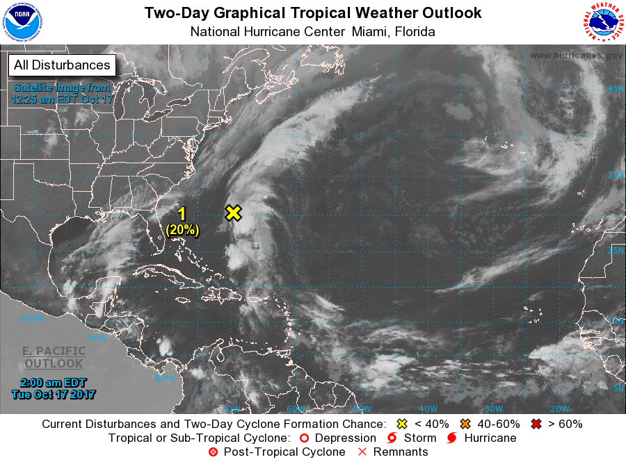 |
Archives
October 2018
Categories |
 RSS Feed
