
|
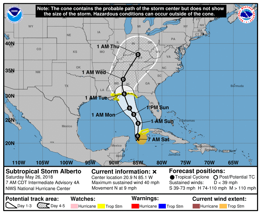
Alberto continues to move northward through the gulf as a subtropical cyclone this morning with a disorganized structure and loss of thunderstorm activity overnight. Maximum sustained winds continues to remain at 40 mph. 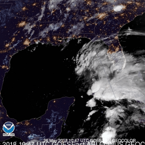 WHAT YOU NEED TO KNOW:
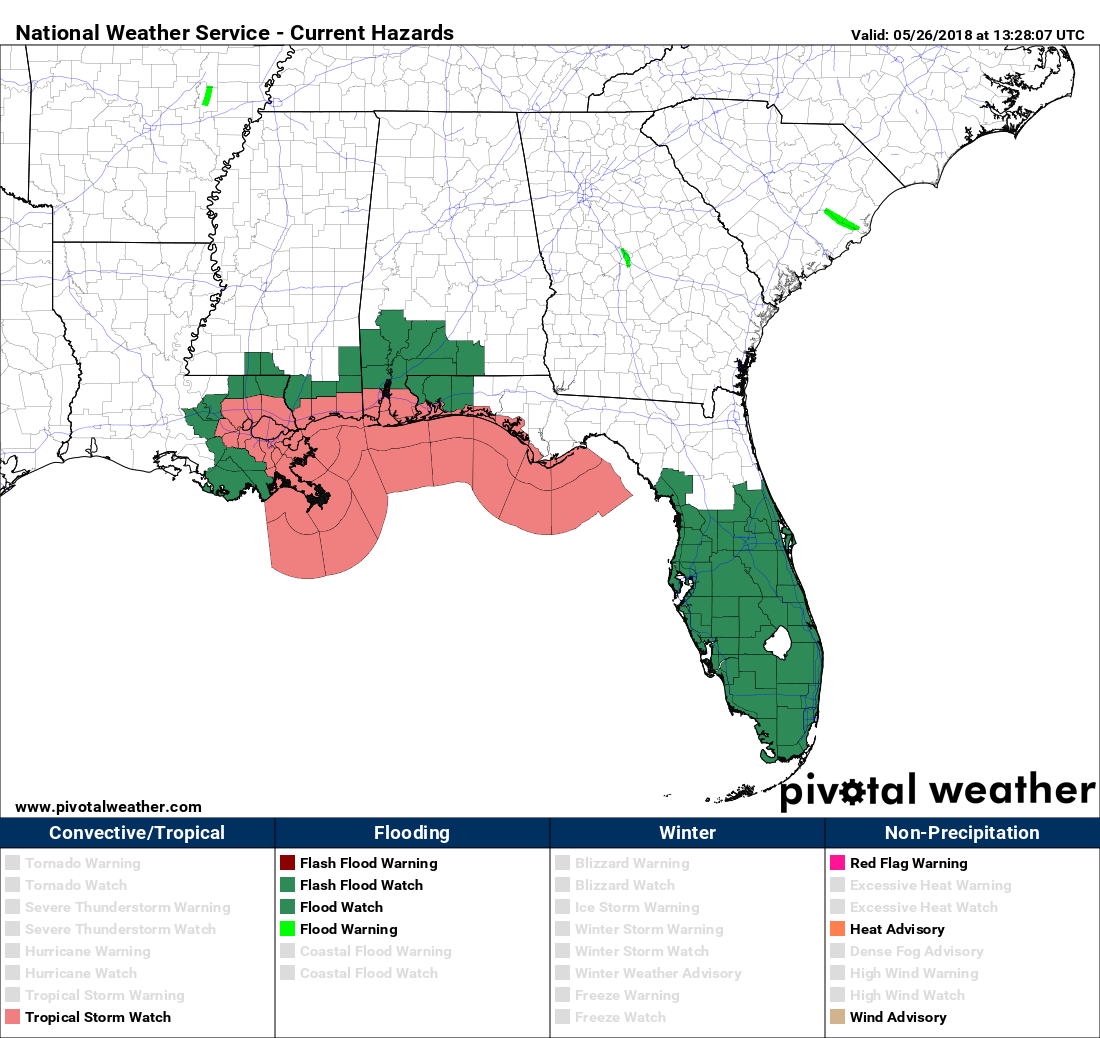 Flash flood watches cover much of Southern Florida through the coast of Louisiana, Mississippi, Alabama, and Florida. The flood threat will be maximized for areas closer to the coast where 6 to 12 inches of rainfall is expected. Areas more inland could still experience 3 to 6 inches. 
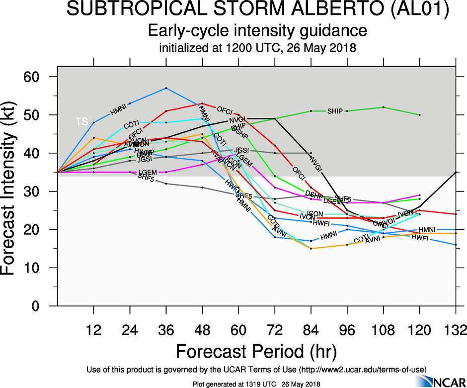
As we get closer to the landfall of Alberto, just make sure that you are consistently working with fresh information. As I always say, if you are looking at a forecast that is more than six hours old, you are looking at bad information. |
Archives
October 2018
Categories |
 RSS Feed
