
|
Sunshine, sunshine, and more sunshine (some clouds) - We are in the midst of summer, the time where forecasts don't change that much; if you don't have isolated showers, you have hot and humid conditions with highs in the mid to upper 90s. And if you get rain, it will probably not last as long as you think. We will see this this summer-like weather today through Friday. Weekend - As I have mentioned before, the risk for scattered showers and storms will increase throughout the weekend. With a surface front coming towards us from the north, and the upper level high moves back to the west, that will create a north flow aloft that will allow multiple rounds of showers and thunderstorms to move through here throughout the weekend. The chance of one spot getting wet will be in the 20-30 percent category throughout the weekend and Monday. Otherwise, expect mostly sunny conditions with clouds out at times, highs in the mid to upper 90s. Next Week - Not much change will occur. After Monday, we should continue to stay in summer-like conditions; mostly sunny, with highs in the mid to upper 90s. Keep in mind that the peak of summer-like weather is usually in late July/August. Please see the Texas Weather Outlook video for more details. 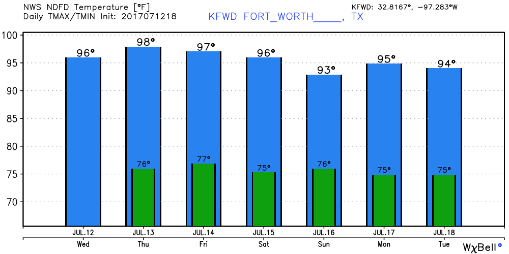 Tropical Talk - The Atlantic should stay dry for the next five days with no tropical cyclone activity expected. 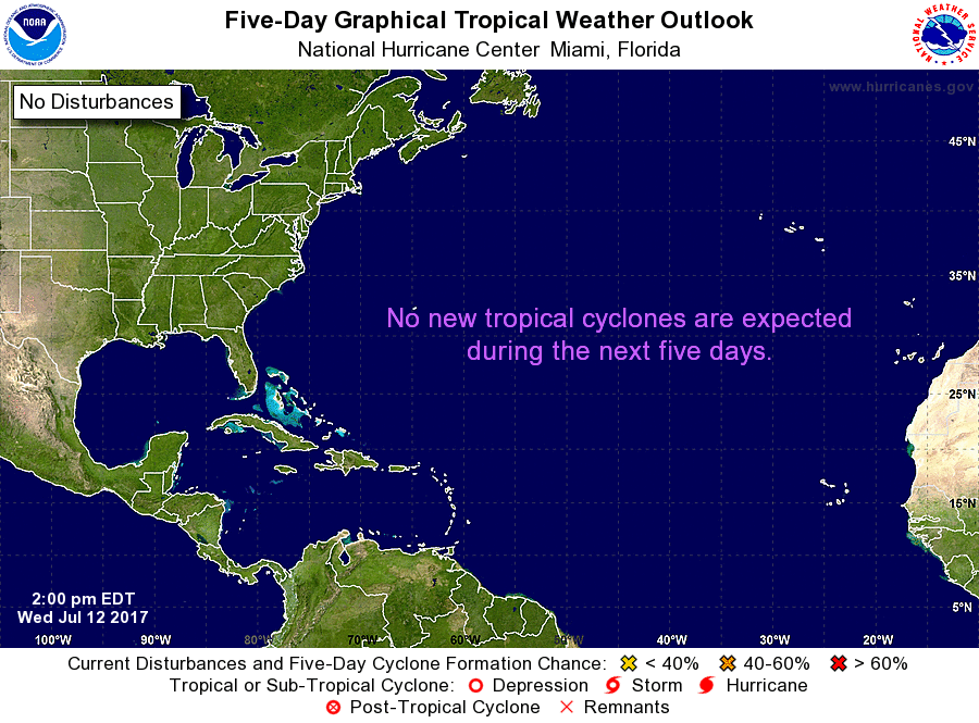 Thank you and have a great rest of the day.
Donovan Neal |
Archives
March 2023
Categories |
 RSS Feed
