
|
Radar Check - While moderate snow is continuing to fall to the east of Dallas, a few flurries remain possible in the DFW metro area... 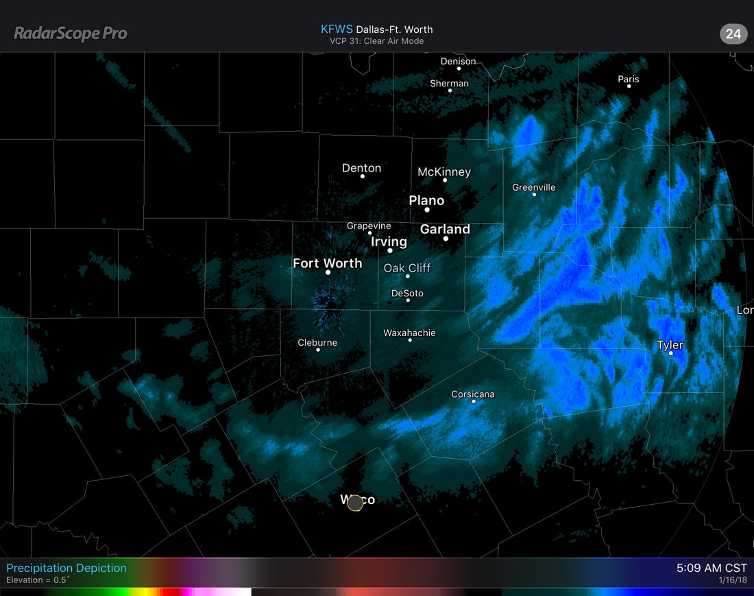 Anything that falls in DFW from here on out should not have a significant impact with travel. The precipitation should be completely out of North Texas by the afternoon. One thing to take note on this morning is the icy roads and cold temperatures. Please make sure you are exercising caution when traveling to work and school this morning. Thin ice may still be possible on bridges and some roads and could easily make you lose traction and spin off somewhere. Drive slow. Additionally, do bundle up for the rest of the day as it will be this cold going forward. The flu-season is out in full force, and the last thing we want is exposure to frigid temperatures to make the chance of catching it increase. 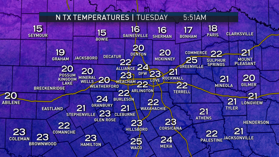 The high will only be in the upper 20s today with sunshine breaking out by the afternoon, which may help in melting some ice on roads. We trend even colder tonight, with widespread teens and single digits likely through the morning hours. Prepare your pipes, plants, pets, and people. Prolonged exposure to low temperatures outside will lead to hypothermia and frostbite in under 30 minutes. We will still be in the freezer for tomorrow with highs reaching the mid 30s. Some spots will stay below freezing for 48-60 consecutive hours. Thursday should be a little warmer with highs in the low 40s across North Texas. Any lingering ice around that time will melt. Friday and the Weekend - Friday should be another mostly sunny day with highs in the mid 50s. We warm even further on Saturday with highs reaching the mid 60s. A few spotty showers during the day can't be ruled out. And by Sunday, a surface front develops, which could bring the chance for rain and thunderstorms during the late morning hours. It remains known whether or not we see severe weather, but a storm or two could turn marginally severe. Next Week - We generally stay dry early next week, with potential for a potent storm system developing during the latter half of the week, which could bring out our next significant rain chances. See the Texas Weather Discussion Video for more details. 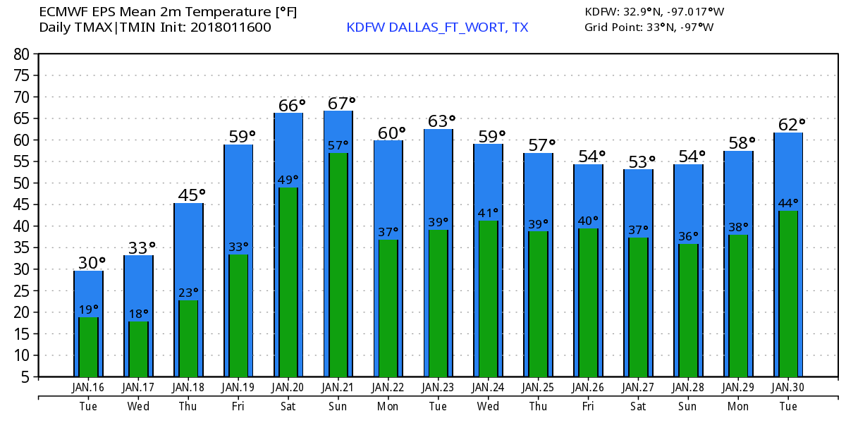 |
Archives
March 2023
Categories |
 RSS Feed
