
|
RAINY DAYS - Moisture from Gordon will continue to linger around Texas today through the weekend along with a surface front coming through the region slowly. This will create our best chance of widespread showers and thunderstorms this week. The sky will be mostly cloudy today, and showers and thunderstorms are expected during the afternoon and evening hours. The chance of any one spot getting wet is 70/80 percent today. Scattered showers and thunderstorms will continue Saturday on the back side of the surface front as it slowly drifts to the east. It is safe to say that tomorrow will be more like today in terms of the expected coverage of rain and cloud cover. The high today and Saturday will only be in the middle 80s due to rain-cooled air. Rain tapers off to the east on Sunday, and we go back to a mix of sun and clouds with highs still in the 80s. FOOTBALL WEATHER - For the high school football games tonight, scattered showers and thunderstorms will still be in the area tonight. Due to the scattered/widespread coverage of the storms. It will be hard to predict who exactly gets wet this evening. But for those of you traveling to see the games, expect rain delays or even cancellations in some places. Temperatures will be in the low 80s by kickoff, falling into the mid 70s by the end of the first quarter. If you somehow remain dry this evening, it will definitely feel good outside. NEXT WEEK - We stay dry for most of next week with a mixture of sun and clouds each day. Highs will remain in the upper 80s to low 90s for most days. See the Texas Weather Discussion Video for more details. 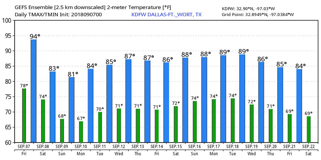 TROPICS - The Atlantic Basin is quite active this morning. Florence weakened to a tropical storm yesterday evening and is now packing maximum sustained winds of 65 mph. However, conditions will favor intensification within the next several days, and will regain hurricane status over the weekend. It will become a Major Hurricane again next week to the southeast of Bermuda Islands. 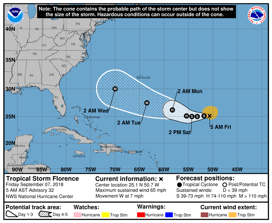 It could get extremely close to the U.S. East Coast during the later half of next week by sideswiping the coast, making landfall, or recurve just offshore - we don't know yet. There is no skill in a specific forecast track this far out, and it is impossible right now to forecast the exact impacts of Florence to the U.S. East Coast. The bottom line is, everyone on the U.S. East Coastal States should keep a very watchful eye on this system over the next several days. Back in the middle of nowhere, we have two well organized disturbances emerging off of the African Coast. They are expected to become Tropical Storms Helene and Isaac this weekend. There is absolutely no way in telling whether or not this will impact any land at this present time. 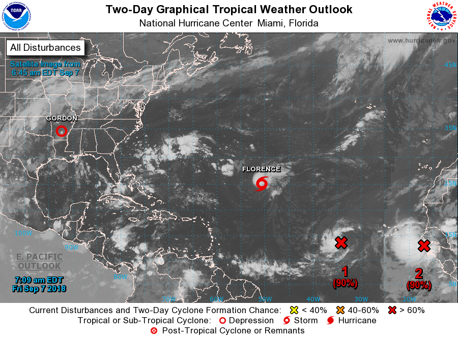 |
Archives
March 2023
Categories |
 RSS Feed
