
|
MILD START - Temperatures are in the mid 50 to low 60 degree range for much of the region this morning. Don’t expect much sun this week, our current upper air pattern shows a trough pushing down to the south near California, advecting moisture to the north, which will spark our rain and storm chances. We will reach the low 80s today with mostly cloudy sky and breezy conditions. We will mention the chance of a few showers during the day, but nothing widespread. Tonight will be generally overcast with lows in the mid 60s. THE REST OF THE WEEK - A trough in the southwestern states and a deep surface low in Colorado will spark our first major severe weather chances of the season. For now, we will mention cloudy days and mostly overcast nights with highs in the low to mid 80s each day. We will mention the risk of a few showers and thunderstorms each day, but our main event won’t come until Thursday, despite a major severe weather threat in place for the nation’s heartland on Wednesday. 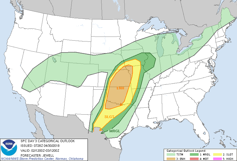 We will mention the chance for scattered showers and storms during the day on Wednesday, but I don’t anticipate any major severe weather issues for North Texas. Our main threat of rain starts Thursday during the pre-dawn hours and lasts through most of the day, according to the GFS. Once that activity moves off to the east on Friday, we should be dry with clouds still in place. Again, we will still continue to mention rain at times. THE WEEKEND - We will continue to mention the risk for occasional showers with a few clouds in place. The weekend looks generally dry with highs in the mid 80s. NEXT WEEK - Next week looks mostly sunny and dry with highs in the mid 80s.... see the Texas Weather Discussion Video for more details. 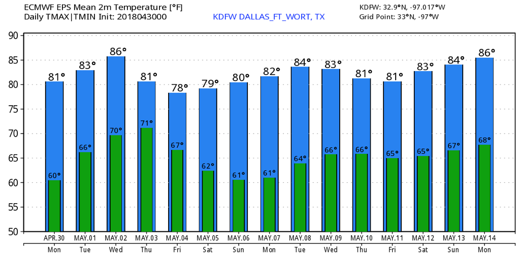 |
Archives
March 2023
Categories |
 RSS Feed
