
|
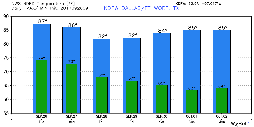
More Dry Days Than Wet - With the cold front coming through our area, some of the public may be thinking the thoughts of "going to rain all week" or "heavy downpours", which is not the case. While some may be disappointed about this, all you need to do is travel to west Texas, where numerous showers and storms have been occurring there since yesterday. Still Summer-Like - We forecast highs close or at 90 degrees for today, but, a great deal of cloud coverage is expected throughout the day. The best chance of any showers occurring around here will be to the west of DFW. But, we can't rule out a shower or two during the late morning hours. Cooler Days - A trough in the western part of the country will help break down the upper ridge, which will bring in a cold front later today that will trend us towards cooler temperatures later this week. Tomorrow we fall to the mid 80s, and by Thursday we fall to potentially the upper 70s for high temperatures. The Weekend - Very pleasant weather is in the forecast for both days - highs 83-87, lows 62-66 with lots of sun. Definitely not sweater weather, but temperatures should be just at or below average for closing September and beginning October. Next Week - Dry, pleasant weather will persistent for most of next week with more sun than this week. We note that the GFS and ECMWF models start to hint towards a surface low forming in the Gulf of Mexico in the next 6-10 days. We will have to keep an eye on any signs of tropical mischief. Tropics - Hurricane Lee, which is in the Central Atlantic, will kick out into the Northern Atlantic in the next few days, posing no threat to land. Closer, Maria is expected to weaken to a tropical storm later today, passing to the east of the North Carolina Outer Banks, where a tropical storm warning is in effect there. This storm should kick out to sea later this week. The rest of the Atlantic, is quiet. See the Texas Weather Discussion Video for more details. 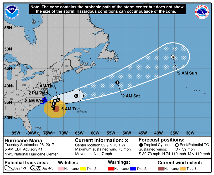 |
Archives
March 2023
Categories |
 RSS Feed
