
|
As expected, most locations in north Texas are starting the day in the upper 70s to low 80s as the upper ridge continues to hold. As a result, we should warm to the mid to upper 90s today, with heat index values in the triple digits in some spots again today. Tomorrow Though the Weekend - As the upper ridge holds in north Texas, we should expect partly sunny days, fair nights, with highs remaining in the low to mid 90s, which is about 8 to 10 degrees above average. We should also mention that this weekend will be the first weekend of fall; the autumnal equinox will begin at 3:05 PM on Friday. Football Weather - For the Friday night high school football games, it should start in the low 90s in most places at kickoff, with temperatures falling into the low 80s by the final whistle. This week, Mansfield Summit High School will take on Waxahachie tomorrow night (kick off at 7:30 PM). As the sunset, temperatures should be in the low 90s, before cooling off into the mid to low 80s by the fourth quarter. Next Week - We embark on a cooling trend. As the late September cold front arrives early next week, we should notice a significant change. A cold front arrives early next week, which will leave behind significantly cooler temperatures along with a chance of scattered showers and storms for multiple days. Additionally, the global forecast models (GFS/ECMWF) is suggesting a major pattern change by the end of September which will bring refreshing air into the south as October begins. 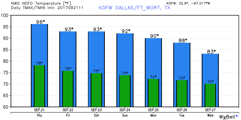 Maria - Maria is now a category three hurricane with maximum sustained winds of 115 mph. The eye of the storm has emerged from Puerto Rico, and is back into open water. This should gain latitude and move to the north, staying well to the east of the Bahamas. 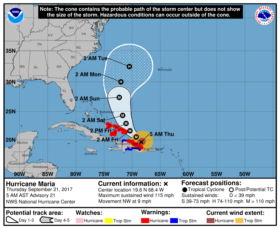 Confidence is increasing that this storm will NOT affect the East Coast thanks to a sub-tropical ridge left by Tropical Storm Jose, which is still spinning in New England. See the Texas Weather Discussion Video for more details.
|
Archives
March 2023
Categories |
 RSS Feed
