
|
RADAR CHECK - We have a good patch of rain for areas to the southeast of Dallas, generally to the south of I-20. Temperatures are above freezing with no issues with ice at all. Today will be cloudy with a good, soaking rain likely. Where rain falls, temperatures will not get out of the mid 40s. More rain is expected for areas to the southeast of DFW. The good news is no severe weather expected, just an all-day type of event. Rain amounts over North Texas will average at around 1-3 inches. No major flooding issues is expected for North Texas at this time. THE WEEKEND - We see rain persist through Saturday afternoon as the storm system exits the area. For now, periods of rain is still likely for North Texas, but the overall threat of significant winter weather issues has diminished greatly over the past 24 hours. However, some snowflakes/light snow is possible for some of our northern counties, but no significant travel issues are expected at this present time. At this point, it is looking more and more likely that temperatures will be above freezing by the time the wrap around arrives, and if this happens, no impact is expected. The high will be in the mid 40s falling during the day. The storm system quickly moves out by Sunday, and we begin to mention drier weather with highs still holding in the mid 50s. NEXT WEEK - A disturbance develops in the South-Central Plains, and I would not be surprised if that squeezed out a few showers at times on Wednesday. Otherwise, expect a mostly dry week with increasing moderation. See the Texas Weather Discussion Video for more details. 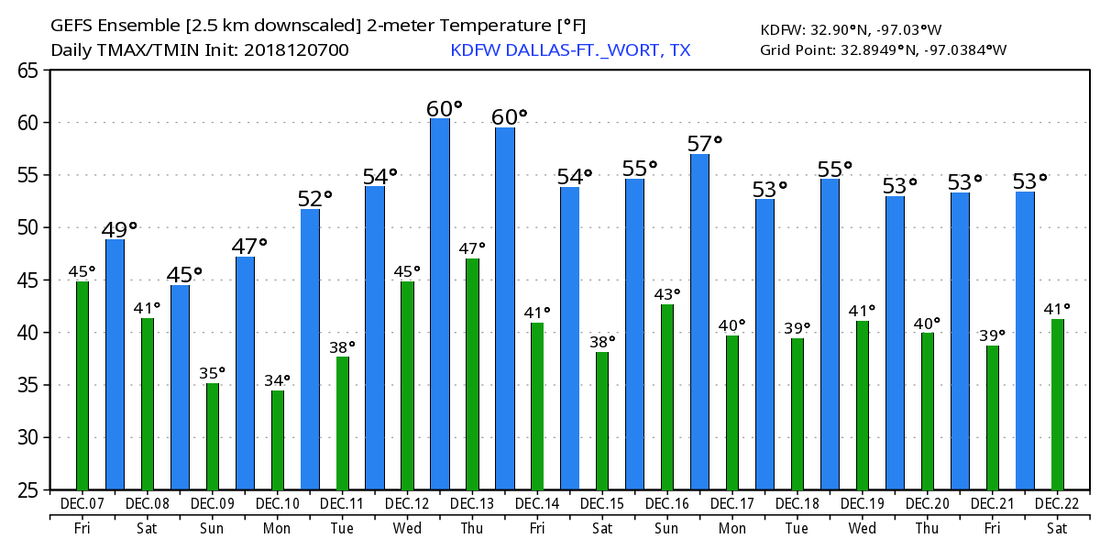 |
Archives
March 2023
Categories |
 RSS Feed
