
|
Radar Check - Showers and thunderstorms continues to move to the northeast this morning, making for a very wet commute in most places... 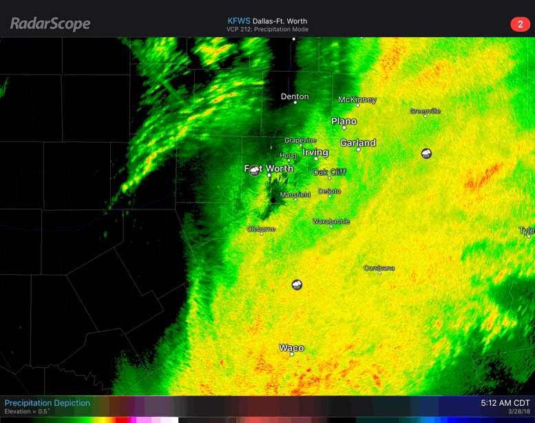 An additional 1/2 to one inch of rain can be expected from this morning activity. While some places in north Texas are under a marginal risk for severe storms, we do not anticipate any big severe weather today. After this morning batch of showers and thunderstorms clear the area, we should be dry during the afternoon and evening with highs in the mid 60s. The sky will be mostly cloudy through most of the day, though some sun could break out in some spots. The upper low pushes off to the east tomorrow, and the sky will feature a mostly sunny sky with afternoon highs in the mid 70s for Ranger's Opening Day. FRIDAY THROUGH THE WEEKEND - Dry air continues to return to the region on Friday, making for mostly sunny skies. Saturday should be a pleasant day with abundant sunshine along with highs in the mid 70s. On Easter Sunday, the sky turns partly cloudy with highs in the low to mid 70s. We will mention the chance of a couple of showers as a weak surface front approaches from the north, but most places stay dry. NEXT WEEK - The first week of April should remain mostly dry with highs in the low 70s. Though we will continue to mention a chance of spotty showers every other day, but will be widespread and most places stay dry. See the Texas Weather Discussion Video for more details. 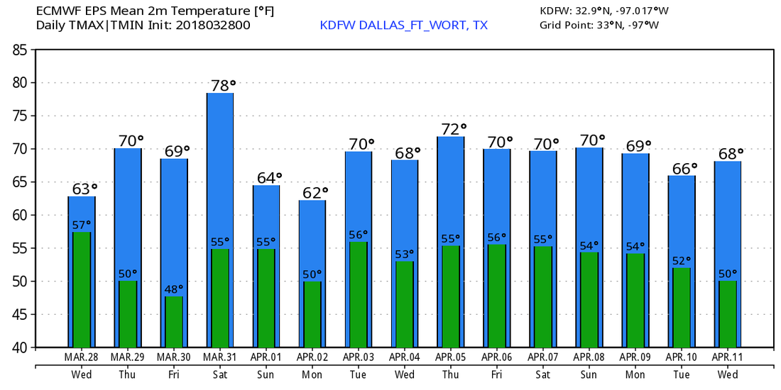 ON THIS DAY IN 2007 - A significant tornado outbreak took place extending from the Texas Panhandle all the way to South Dakota. This was part of a multi-day severe weather event, but this day produced the most tornadoes of the event. A total of 19 tornadoes touched down in Texas alone; Three were rated EF3. This was the second most significant outbreak of 2007.
|
Archives
March 2023
Categories |
 RSS Feed
