
|
VERY HOT AND HUMID DAY: A heat advisory is in effect for much of North and East Texas today where highs will be in the upper 90s and humidity values will make it feel like 105-110 degrees. However, whether in the heat advisory or not, everyone will be hot and humid with highs in the upper 90s. A few spotty storms could form this afternoon, but they should be fairly isolated. REST OF THE WEEK: The heat advisory will last into tomorrow afternoon with highs still in the upper 90s. A surface front will drop from the north, enhancing our chances of isolated showers and storms on Thursday. We will still stay mostly dry on both days with highs in the upper 90s. THE WEEKEND: This weekend's weather will be largely dependent on how a developing tropical system in the Florida Panhandle behaves. This is what we know about Invest 92L. *A tropical depression or storm is expected to develop in the Gulf of Mexico by Friday. If it becomes a tropical storm, its name will be "Barry". *It is highly unlikely that the system reaches hurricane strength. The main impact will be heavy rain inland, followed by rough rip currents towards the coast. The SPC has a "marginal risk" (1/5) for severe storms defined for the coasts of Mississippi, Alabama, and the western Florida Panhandle to address the possibility of an isolated tornado or waterspout Thursday. *Once it gets into the water, the system will begin to drift southwestward, with most models having it somewhere around Lake Charles and the Texas border by Saturday evening. However, heavy rain will extend to the north and east by a couple hundred miles. 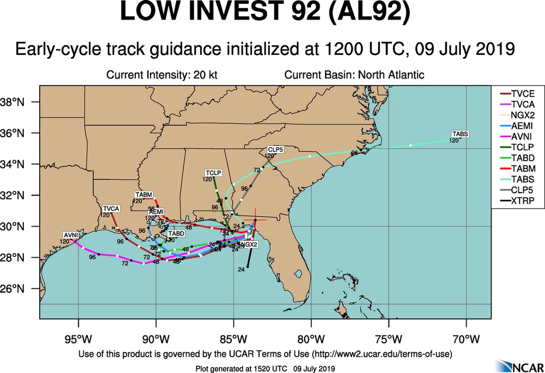 The Weather Prediction Center has the heaviest rain from the Mississippi Coast, mainly impacting North Charles, to southeast Texas. Lighter amounts are forecast to the east and northeast of the center. 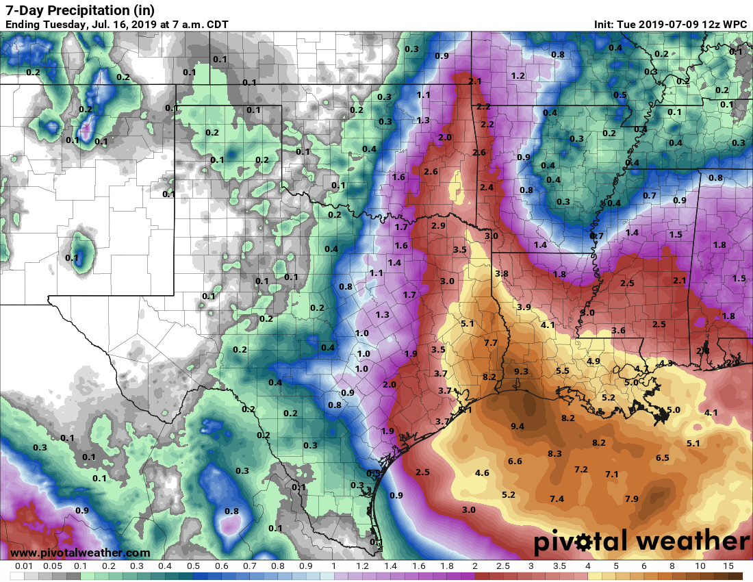 Please be advised that this map right now is very very arbitrary. Confidence is very low in forecasting the area of heavy rain until this system develops. In other words, the forecast will change in the next few days.
*For North Texas, I will continue to keep a dry forecast for the weekend through early parts of next week. However, if we see a notable shift to the west, that can change, so stay tuned NEXT WEEK: Expect routine July weather across Texas with the usual daily chance of "isolated, mostly afternoon and evening showers and storms". Highs will be in the low to mid 90s. See the Texas Weather Discussion Video for more details. ON THIS DAY IN 1979: Hurricane Bob formed in the Gulf of Mexico, becoming the first Atlantic Hurricane to receive a male name. |
Archives
March 2023
Categories |
 RSS Feed
