
|
*I am currently leading in a camp in Denton, so no Texas Weather Discussion Video today* MILD MORNING - As expected, temperatures are currently in the mid 70s across the region this morning, with some of the urban areas already seeing 80° at 5:25. Expect sun in full force today with very little clouds in place. After combining the elements of summer and spring time weather yesterday, we will turn very hot and humid this afternoon with highs in the mid to upper 90s today, about five or so degrees above our average high of 92° for June 20. However, it will feel much warmer than 97° due to heat indices around 105-107° for most communities. To address this risk, National Weather Service has issued a Heat Advisory for the greater DFW Metroplex, excluding the the northern counties. 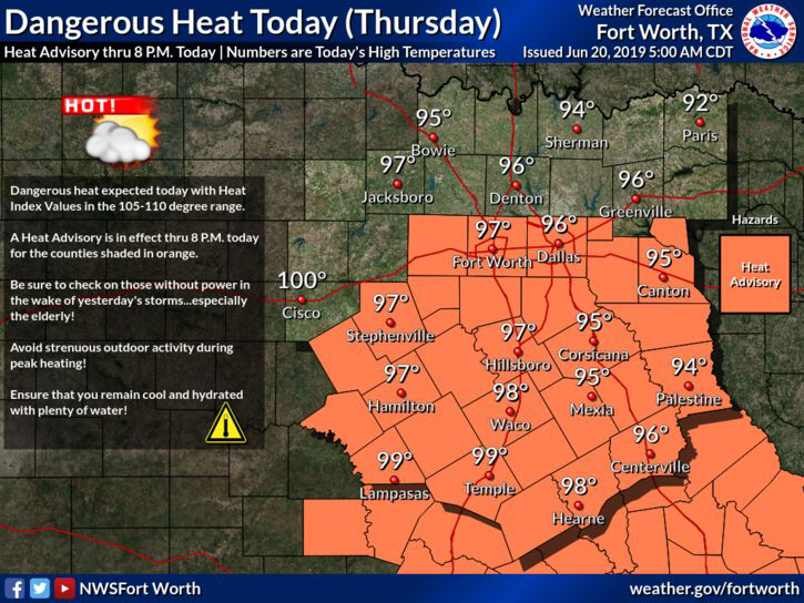 It will be slightly cooler and breezy tomorrow, but highs will still be in the mid 90s with mostly sunny skies. Overnight lows will be in the low 70s. THE WEEKEND: Only slightly cooler conditions are forecast for the weekend, so we will maintain highs in the low 90s. We will bring back the early season daily chances of “isolated, mostly morning/afternoon showers and storms”. Widespread chances of rain looks low, but a microburst and some gusty wind is possible with some storms. NEXT WEEK: A relatively moist airmass will still be over North Texas for at least the beginning of the week, which means we will have the daily chances of “isolated, mostly morning to afternoon showers and storms”. Odds of any one spot getting wet is in the 20-30 percent range. We do turn dry by the latter half of the week featuring a mix of sun and clouds. Highs will be in the low 90s each day. 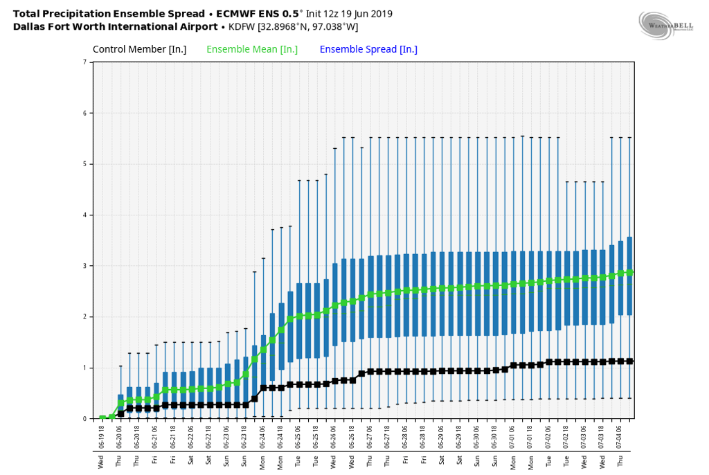 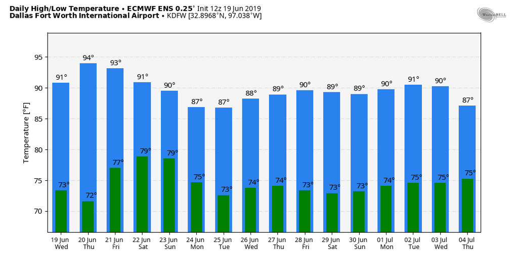 TROPICS: All is quiet in the Atlantic Basin, and tropical cyclone development is not expected for the next week.
|
Archives
March 2023
Categories |
 RSS Feed
