
|
RIGHT NOW - If you step outside this afternoon, it is just downright hot and sticky... Dewpoints are currently in the low to mid 70s which is pretty humid for North Texas. We are seeing sunshine in full force with temperatures mostly in the mid to upper 90s with a few triple digit readings. 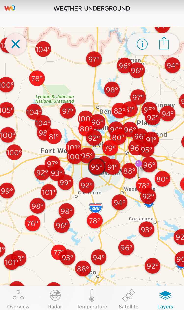 The radar right now looks quiet across the North Texas region this afternoon.  However, we are keeping a close eye on the development of strong to severe storms over the lower Mississippi Valley along a cold front. The cold front will continue to track to the southeast this afternoon and evening, and convection initiation is possible as far south as Central Texas. 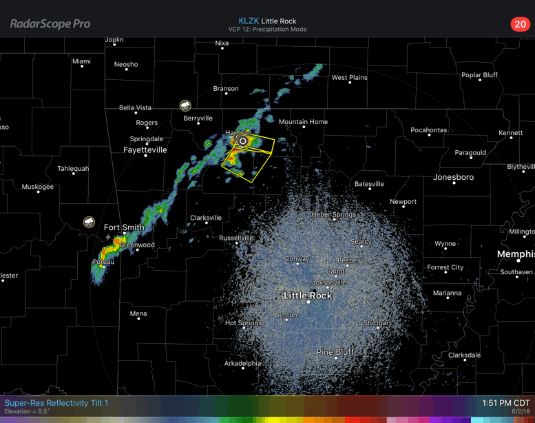 We do note that the SPC has a “marginal risk” of severe storms (1/5) in place for the northeastern portions of the metro (McKinney, Garland, Sulphur Springs, Tyler, and Canton). As the storm initiation occurs as the cold front approaches from the northwest, storms should approach the area during the evening hours and could produce gusty winds and hail at times. 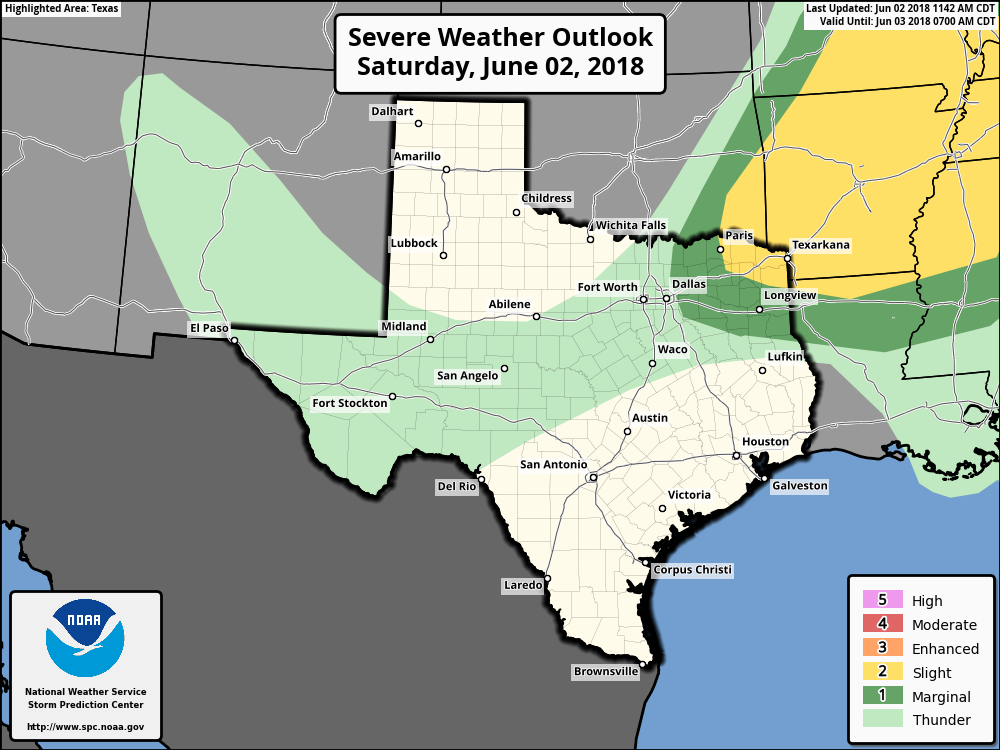 Isolated strong storms will still be possible in the metro with the best coverage in Arkansas and the Lower Mississippi Valley as indicated by our severe weather/probability of highest storm coverage map. 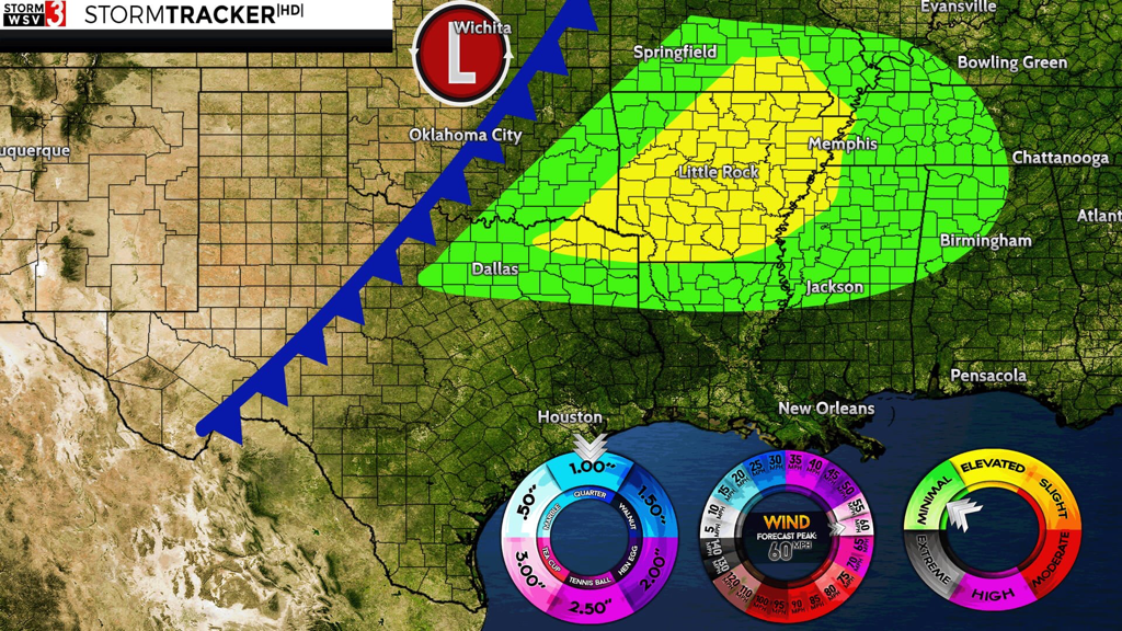 gc: Jonathan Williams FOR TOMORROW - The batch of showers and thunderstorms will weaken during the morning hours as they progress to the southeast. Most of the metro will stay dry for Sunday. We will see a wind shift to the north followed by cooler temperatures as the cold front moves through. The day tomorrow looks mostly dry with sunshine still in full force with drier air moving into the region due to lowering dewpoints and humidity levels. Highs will be in the low to mid 90s.
|
Archives
March 2023
Categories |
 RSS Feed
