
|
RAIN POSSIBILITIES TODAY THROUGH THE WEEKEND: An increasingly moist, unstable airmass will be in place today, setting the stage for occasional showers and thunderstorms this late afternoon through Saturday. It certainly won't rain all day today or tomorrow, or over the weekend, but there is a good chance of some beneficial rains for a good part of North Texas. Most of the rain will come from 7PM this evening through 7AM tomorrow morning, but showers during the day tomorrow cannot be ruled out. Heat levels will come down due to cloud cover and limited amounts of sun. Highs will be in the 94-98° range. NEXT WEEK: We go back to heat advisory conditions for a brief period Monday afternoon, then a surface front bringing another chance of showers and storms moves through here late Tuesday afternoon. The latter half of the week will trend drier and cooler as a long wave upper trough evolves over the eastern third of the US. There is a chance we see drier, continental air during the latter half of the week with lower humidity and cooler nights. See the Texas Weather Discussion Video for more details. 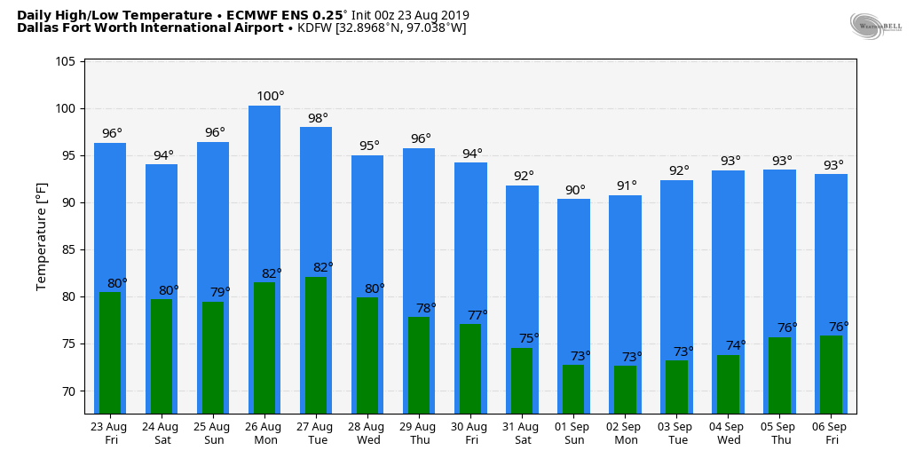 DROUGHT MONITOR: The new drought monitor released yesterday morning shows most of the state in some kind of drought conditions, concentrated over parts of South Texas, expanding rapidly into west Texas. Places like Abilene have gone a full month without receiving measurable rainfall. 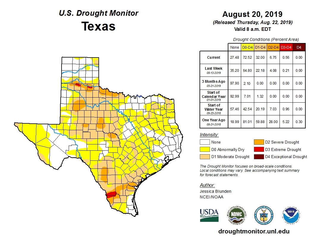 TROPICS: Tropical Depression Chantal is expected to dissipate over the Northern Atlantic within the next 24 hours. A tropical wave over the Bahamas now has a 50% chance of becoming a tropical depression or storm over the next five days; it will move north, then northeast just off the Southeast US coast. No threat to the Gulf of Mexico. 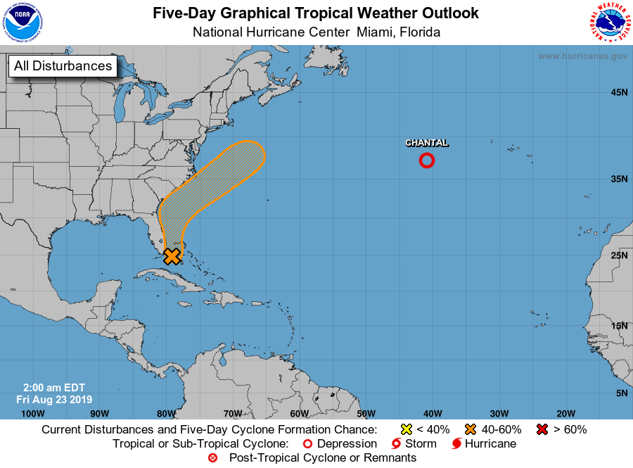 |
Archives
March 2023
Categories |
 RSS Feed
