
|
RAINFALL TOTALS: As of 7AM this morning, here are the rainfall totals over the past 24 hours... Arlington 0.46 Corsicana 0.01 Dallas Love Field 0.51 DFW Airport 0.91 Denton 1.95 Fort Worth Alliance 1.44 Fort Worth Meacham 1.46 Longview 0.04 Lufkin T McKinney T Mineral Wells 0.01 Paris 1.10 Terrell 0.07 Wichita Falls Municipal: 2.45 So far, showers and thunderstorms are not materializing as of late afternoon, but that could change within an hour or so. A few isolated supercells could develop along a residual outflow boundary, capable of hail and strong straight-line winds. After midnight, a complex of severe thunderstorms capable of large hail and damaging winds may impact the region after midnight. Heavy rain is also possible. SPC maintains the standard "slight" risk (level 2/5) of severe storms for much of the metroplex through 7AM tomorrow. 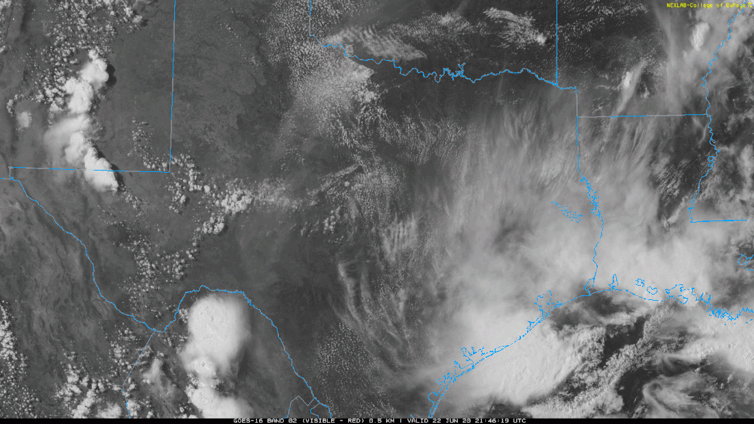 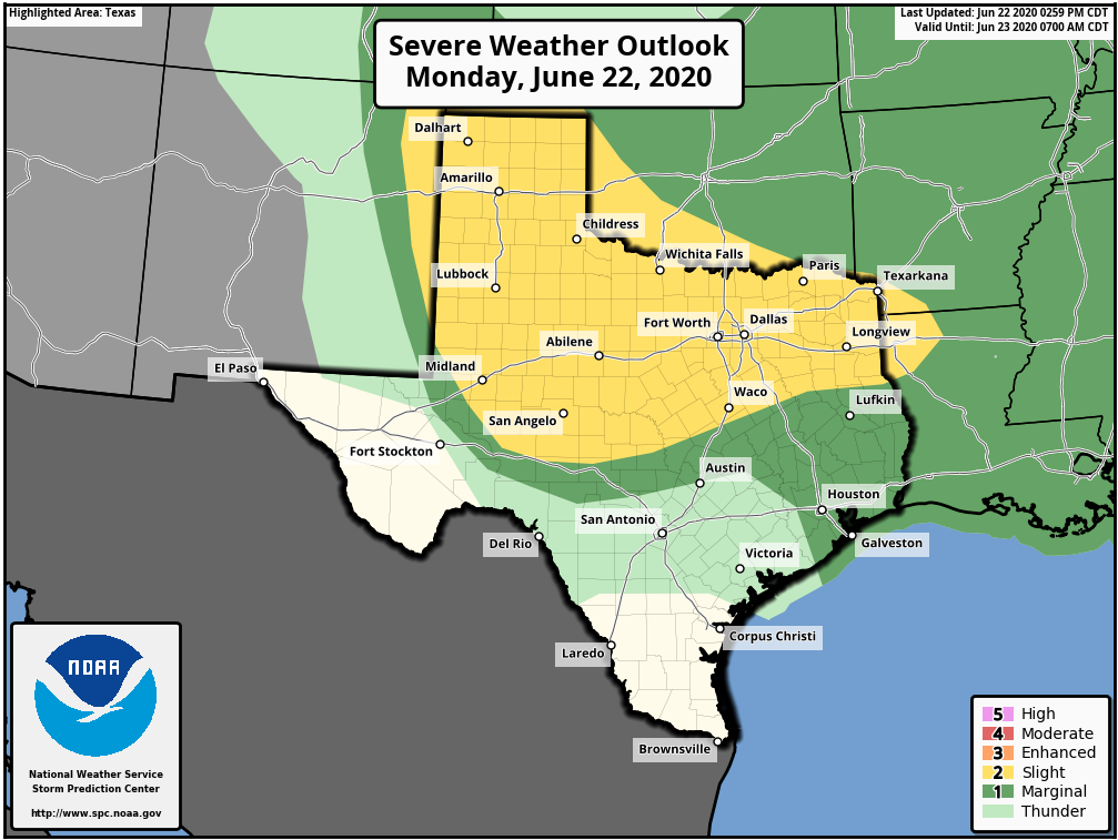 REST OF THE WEEK: An upper trough, combined with deep layer moisture, will keep our weather pattern unsettled through most of the week. Look for more chances of isolated to scattered showers and thunderstorms, mostly in the afternoon to overnight hours. Like tonight, severe storms are possible with wind and hail possible. The sky will be partly to mostly sunny with highs in the upper 80s to low 90s. Showers will be possible Thursday and Wednesday afternoon, but, they will be fewer in number.
THE WEEKEND: Look for a mostly sunny sky with the chance of an isolated shower and storm or two. Highs will stay close to 90° over the weekend. NEXT WEEK: We will stick with the classic summer forecast for much of the week; mostly sunny skies, highs in the 93-95° range. TROPICS: Shower and thunderstorm activity associated with a well-defined low pressure system located about 350 miles southeast of Cape Cod, Massachusetts, has continued to get better organized today, and a subtropical depression has formed this afternoon. The system is expected to move to the east/northeast, staying away from the US at this time. The rest of the Atlantic Basin is quiet. AFRICAN DUST: The SAL (Saharan Air Layer), with origins over the deserts of Africa, is pushing through the Caribbean this morning, and should reach parts of the southern U.S. later this week. This dry, dusty air is transported in high levels of the atmosphere, generally between 5,000 and 20,000 feet, and the main effect is creating very vivid sky scenes at sunrise and sunset due to the scattering of sunlight. The dry air also mitigates any tropical storm formation. There can be a reduction in air quality, but most of the dust is several thousand feet off the ground and is not an issue for most people. And, this is NOT unusual in summer. ON THIS DAY IN 2007: The first officially documented F5 tornado in Canada struck the town of Elie, Manitoba population 500 people. Video of the storm showed a heavy van being whirled through the air. The storm also tossed an almost entire house several hundred yards through the air before it disintegrated. The tornado traveled across the landscape for about 35 minutes covering 3.4 miles and leaving a damage path 984 feet wide. Wind speeds in the tornado were later estimated at 260-316 mph. Fortunately, no fatalities or serious injuries were reported. |
Archives
March 2023
Categories |
 RSS Feed
