
|
SOME RELIEF: Temperatures are mostly in the mid to upper 70s this morning. Arlington has already reported a temperature of 80 degrees this morning. We will see a bit of relief today and through the weekend, as slightly lower temperatures and humidity values are expected. We will still be in the mid 90s today with mostly sunny skies. THE WEEKEND: Not much change. Most of the region stays dry with mostly a mixture of sun and clouds. Highs will be in the low 90s with overnight lows in the low to mid 70s. NEXT WEEK: As we enter the "dog days" of summer, expect an increase of temperatures and humidity values next week with highs mostly in the upper 90s. DFW might record their first 100° day by Wednesday of next week. Our average first 100° day is July 1st, we will be over two weeks late. 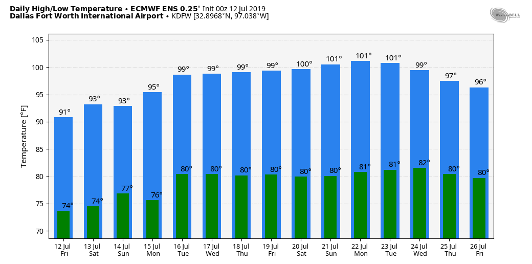 TROPICAL STORM BARRY UPDATES: The system nearing the Louisiana coast was upgraded to a Tropical Storm yesterday morning. It is still a middle-end tropical storm with sustained winds of only 50 mph as it is fighting northerly shear and dry air around the circulation. However, some slight strengthening is possible today as it moves to Louisiana coast tonight or early tomorrow morning. This storm will likely maintain tropical storm status . Barry will weaken as it moves northward near the Mississippi River Valley this weekend. 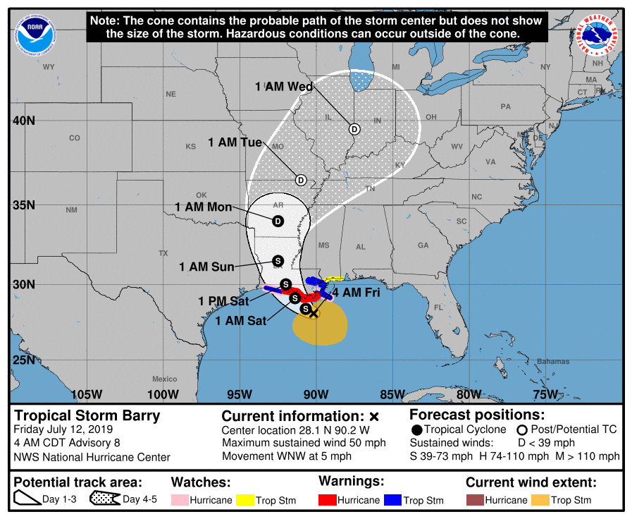 *A Tropical Storm Warning is in effect for the Mouth of the Pearl River to Grand Isle, Lake Pontchartrain and Lake Maurepas including New Orleans, and Intracoastal City to Cameron. *A Storm Surge Warning is in effect for Intracoastal City to Shell Beach *A Storm Surge Watch is in effect for Shell Beach to Mississippi/Alabama Border and Lake Pontchartrain *A Tropical Storm Watch is in effect for East of the Mouth of the Pearl River to the Mississippi/Alabama Border. *For the coastal areas, understand that it will mostly rain at times and will not be continuous. However, dangerous rip currents are likely along the coastline, and double red flags are flying in many places, which means the water is closed, but the beaches are open. *A Flash Flood Watch is in effect for parts of Southern Louisiana, Mississippi, Alabama, and the Florida Panhandle. Anywhere from 1-2 feet of rain is expected for areas surrounding Baton Rouge and New Orleans with a high risk of flash flooding tomorrow and Saturday. Life-threatening flooding is expected Saturday for New Orleans and Baton Rouge.  Elsewhere, expect anywhere from 4-10 inches of rain for areas along and each of the Mississippi River Delta.
*The weather will improve along the Gulf Coast early next week as Barry weakens to a remnant low and moves away from the coastline. See the Texas Weather Discussion Video for more details. ON THIS DAY IN 1936: From the 5th to the 17th of July, temperatures exceeding 111° ended the lives of 1,180 people, most of which were the elderly and infants, during the most prolonged, deadliest heat wave on record. 400 of the deaths were caused by people drowning attempting to seek refuge from the heat. The heat was so intense that steel rain lines and bridge girders twisted, sidewalks buckled, crops wilted and fruit baked on trees. Some of the temperatures include 112° at St. Albans and Emerson, Manitoba, 111° at Brandon, Manitoba, and 108° at Atikoban, Ontario and Winnipeg, Manitoba. |
Archives
March 2023
Categories |
 RSS Feed
