
|
*no Texas Weather Discussion Video this morning* RADAR CHECK - The radar only shows a small cluster of showers and thunderstorms that is located just to the north of Eastland and Ranger, moving southeast. They should continue to move to the southeast with time, but, we will need to keep a watchful eye of new development of showers and thunderstorms this morning, but nothing widespread. Today will feature typical mid to late August weather - hot with a mix of clouds and sun. Afternoon highs will be in the mid 90s today. REST OF THE WEEK - The surface low well to the north along with the cold front will continue to move east throughout the week. We will have another one of those weeks where the weather will not change much. Each day will feature a mostly sunny sky with a few clouds with highs in the low 90s/mid 90s range. We can't rule out the possibility of an isolated shower or two during the day. THE WEEKEND - The overall pattern really does not change much. We continue to stay relatively dry for the weekend with highs in the mid 90s and morning lows in the upper 70s again, very average for late August. NEXT WEEK - The early part of next week will continue to be dry as well as the overall synoptic scale does not change at all. Similar to this week, each day will feature a mix of sun and clouds with afternoon highs in the middle 90s with morning lows in the mid 70s, which isn't too far from seasonal averages here in North Texas. 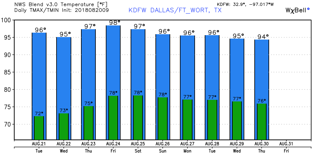 TROPICS - Following Tropical Storm Ernesto, which became post tropical two days ago, the rest of the Atlantic Basin continues to remain quiet for the next 48 hours to five days, which is very good considering how August and September are usually the peak months of hurricane season. 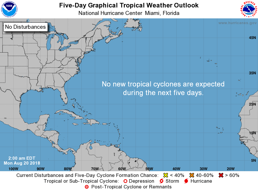 |
Archives
March 2023
Categories |
 RSS Feed
