
|
After a nice Saturday, a continued nice day is expected today with highs in the lower 80s expected with abundant sunshine. A few more clouds will be possible later this afternoon, but dry weather is expected. Tomorrow overall will remain fairly uneventful, but a decaying area of showers and storms will dive out of Oklahoma early tomorrow afternoon and may set up an outflow boundary somewhere in North Texas. This may allow for a very low storm chance, however no severe weather is expected. Skies will be partly cloudy with highs in the low to mid 80s. A few storms may develop N/W of the region tomorrow evening, and could make a run at our western/northern zones tomorrow night. At this time, severe weather is not expected as weakening is likely. Lows will remain in the upper 60s. Tuesday is shaping up to be an active severe weather day across parts of the state. While most of the day will be dry, a dryline will sharpen out to the west and will be the focus (along with a cold front in Oklahoma) for thunderstorm development. There are uncertainties about a capping inversion aloft preventing storm initiation, however some models (incl. Euro) have shown rather explosive supercellular development just west of I/35 late afternoon on Tuesday and moving eastward into our area during the early evening hours. 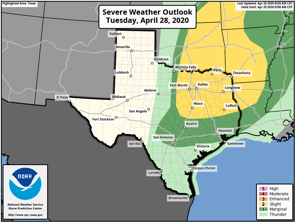 The Storm Prediction Center has already outlined much of the area in a "Slight Risk" for severe weather on Tuesday for storms capable of very large hail, damaging winds, and a few tornadoes. Remember, the initial threat of severe weather is conditional, but if storms develop they could be rather intense. 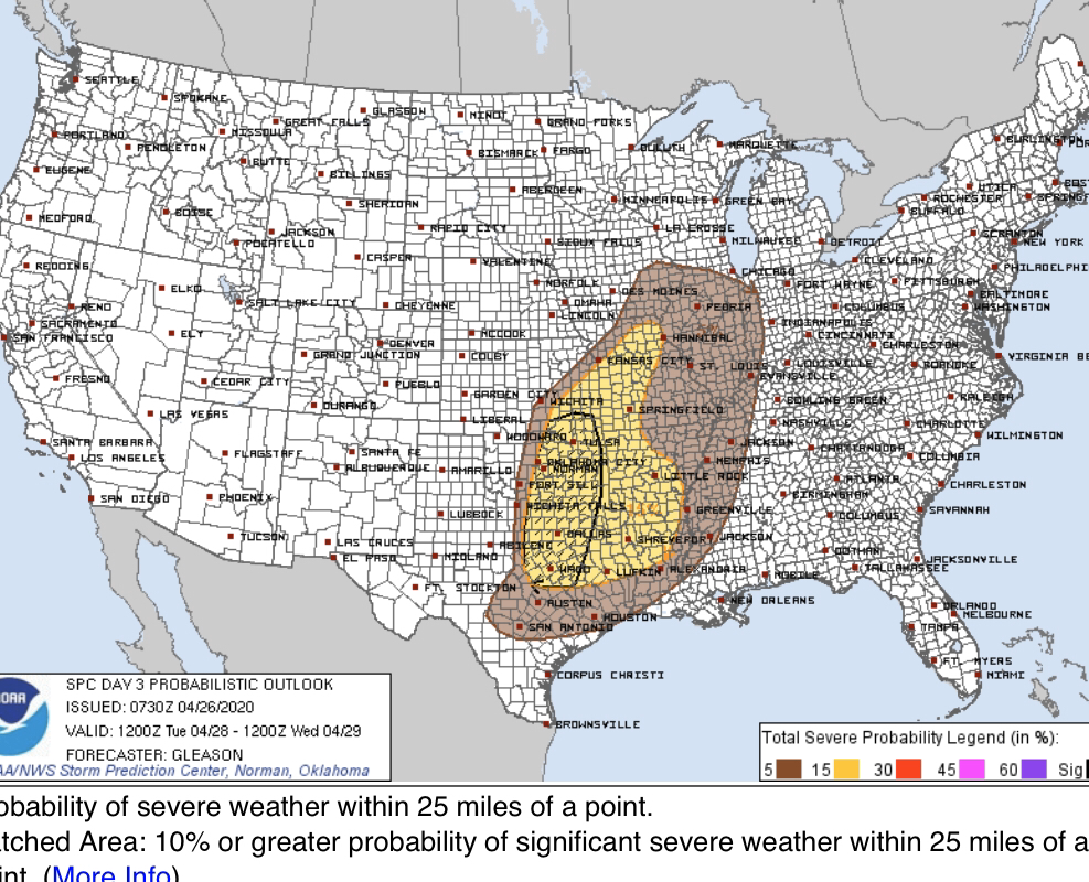 Notice the area inside the black circle (includes much of North Texas, including DFW) where the SPC has concerns for significant severe weather. (hatched risk) We are closely monitoring this.
Tuesday afternoon and evening isn't our only risk of storms. As a cold front slides in during the early overnight hours, an additional area of storms could develop. The best chance will be along and east of I/35 where better bouyancy and moisture remains. These storms could also be severe, primarily with damaging winds and a low tornado threat. Large hail still isn't ruled out with these storms. The rest of the week will be much calmer but remaining warm with highs in the 80s. Our next storm system will approach by next Sunday, and increasing southerly flow could shoot temperatures into the 90s with storm chances increasing, especially into early next week. Given the climatology, severe weather would certainly be in the realm of possibility. However, this is a week out and too many of uncertainties exist to get into any sort of detail. Have a great Sunday! Logan Shipley |
Archives
March 2023
Categories |
 RSS Feed
