
|
*No Texas Weather Discussion Video due to break week* It wasn't particularly active on Sunday across North Texas with only a few scattered showers and thunderstorms about for the region. However, the radar this morning shows scattered showers about in North Texas, clustering near Hillsboro. 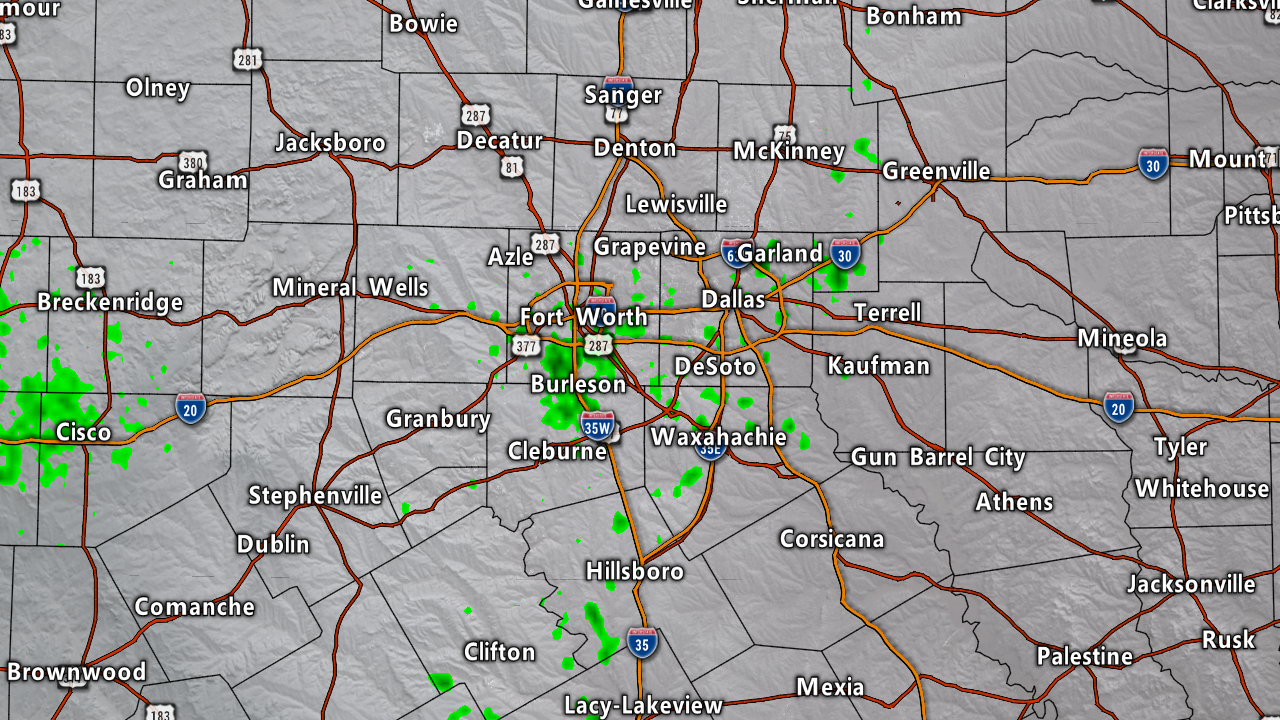 It is also noted that there is a field of widespread cumulus clouds across much of the Lone Star state as a result of the tropical moisture associated with Invest 91L. The sun will still be out at times, but expect clouds to accompany the sunny weather. Random, scattered showers will be possible throughout the day, especially during the afternoon and evening hours. Temperatures are in the upper 70s to low 80s across the region. Expect afternoon highs in the low 90s today. With the storm track and the main mid-latitude westerlies to the north of us, the SPC has a slight risk of severe thunderstorms over the northeast states, including parts of Nebraska, Colorado, and Iowa. For tomorrow, the SPC has a large area of marginal risk of severe storms from the Texas Panhandle through most of the Central Plains, extending into much of Virginia. On Wednesday, an area of upper low pressure will develop in Nebraska with a cold front extending through the Texas Panhandle. A marginal risk is maintained from Northwest Texas through Central Iowa. Looking out in the tropics, the Atlantic Basin remains very quiet with the exception of one area of disturbed weather in the northern Gulf. At this type, this system is not expect to develop into a tropical cyclone, but it will serve as a moisture pump for Texas. Rain amounts of about a foot or more can be expected from this system through this week. 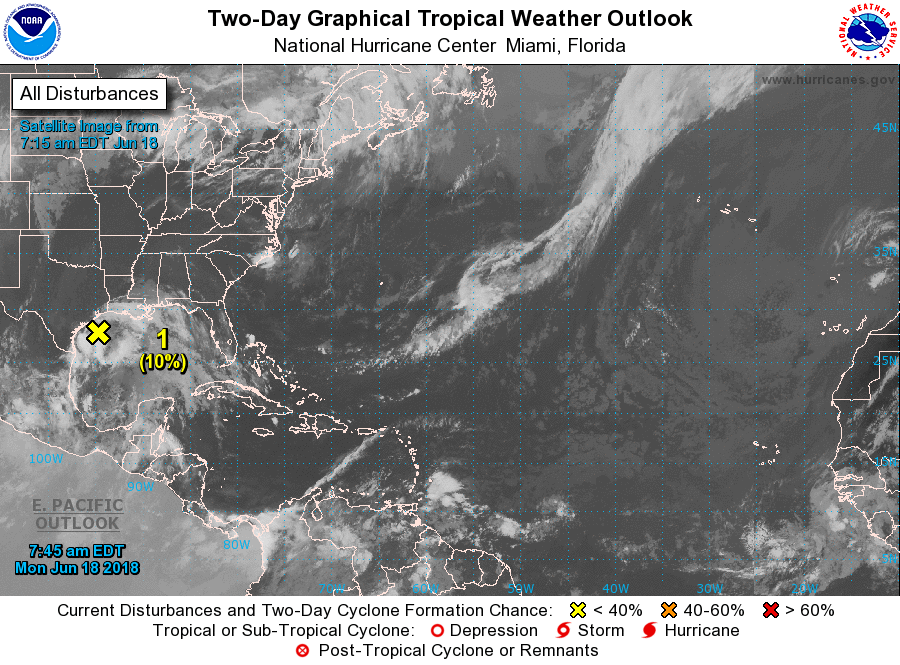 Taking a quick height analysis real quick, we have broad ridging in place for much of the southeastern U.S with a trough approaching from the southwest. That trough will weaken the ridge to the east by Wednesday, which will open the door for a cold front to come through during the latter half of the week. Precipitable water values should stay in the 1.5 - 1.9 range today, so we will only see a few scattered showers and thunderstorms during the afternoon and evening hours with highs in the low 90s. However, as we head into tomorrow, PWAT values climb to 2.0 for much of the region as well as 2.0-3.0 for the following days. Showers and thunderstorms should become more numerous Tuesday, with more coming Wednesday as well. Rain-cooled air as well as widespread clouds for much of the region should do a good job in keeping us in the 80s for Tuesday and Wednesday. With the cold front coming through, we will start to dry out a little, but with the front, we will need to continue with a chance of at least isolated showers and thunderstorms for Thursday and Friday. We start to warm up on Friday with afternoon highs in the mid 90s. The surface front really doesn't go anywhere during the weekend, so we will also mention the chance of isolated showers and thunderstorms during the weekend. The sun starts to come out more often, and afternoon highs will be in the mid 90s with morning lows in the mid 70s.' Looking at the Quantitative Precipitation Forecast for the next week, obviously the heavier totals will remain concentrated in near the Texas coast where a foot of rain or more can be expected. For North Texas, amounts of up to two inches can be expected with locally heavier totals. 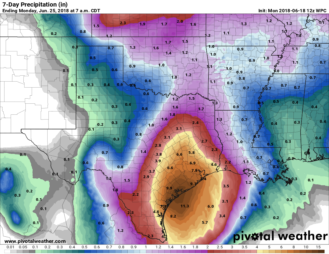 Looking out into the early parts of next week, we revert back into the classic late June pattern to close out the month. Highs will be in the mid to upper 90s with mostly sunny skies.
Look for the next blog update tomorrow by noon! Donovan Neal. |
Archives
March 2023
Categories |
 RSS Feed
