
|
**No morning Texas Weather Discussion Video today. Weather permitting, we will try to do one this afternoon** Warm Morning - Temperatures are in the 64-70 degree range across the north Texas region with clouds out. The sky will remain mostly cloudy through most of the day with brisk northwest winds with highs in the low 80s. STRONG STORMS THIS AFTERNOON/EVENING - A line of strong to severe thunderstorms will develop in North Texas this afternoon. The SPC maintains a marginal risk of severe storms to the east of Dallas; a line from San Antonio to the east of Paris. 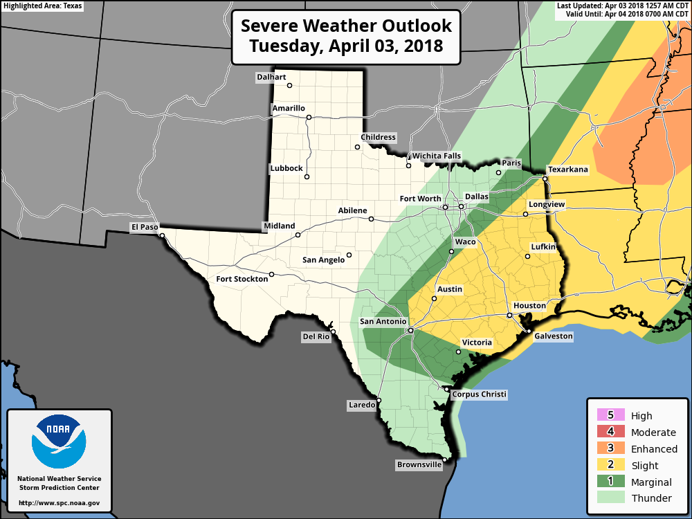 TIMING - The greatest risk of thunderstorms developing will come at around 1pm to 3pm. Based on relevant data, most of these storms will develop to the east of the metro and move towards east Texas, where their core threat is from around 4PM to 8PM. THREATS - In DFW, we are in the thunder zone, which means no organized severe weather is expected for the time being. Although if something does try to show up, the main issue will be strong straight-line winds and large hail at times. The risk of one or two isolated, brief tornadoes can't be ruled out in East Texas, especially in the "slight" risk area. RAIN AMOUNTS - Rain amounts for most will be in under a tenth of an inch. No flooding issues are expected. WEDNESDAY THROUGH FRIDAY - The sun comes back in full force on Wednesday, and will also be cool and comfortable with highs in the mid 60s. We warm substantially again on Thursday, this time with highs in the mid to upper 70s. Moisture returns on Friday, and we will introduce the risk for scattered showers and thunderstorms. It is also important to note that the SPC has outlined a risk for severe weather for Day 4 (Friday).  The Weekend - A few showers will stick around Saturday morning, then the rest of the weekend will be dry with a mix of sun and clouds. Highs will be in the low 70s on Saturday, and low 80s on Sunday. NEXT WEEK - Next week looks generally dry and sunny with afternoon highs in the 70 degree range. Rain could return during the latter half of the week. 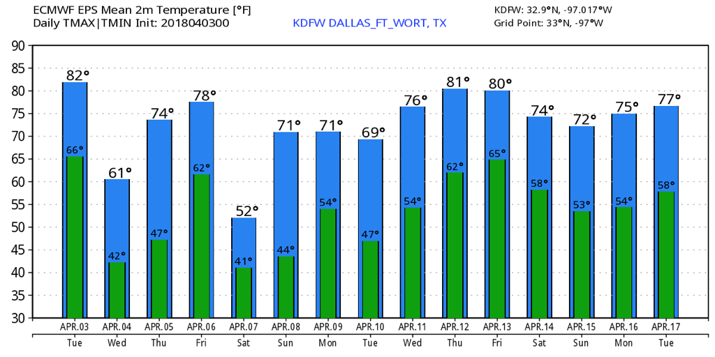 ON THIS DAY IN 2012 - A slight risk of severe storms was issued for mainly the DFW Metroplex. A severe thunderstorm watch was issued at around 9, but was upgraded to a tornado watch later in the morning. Past noon, two supercells developed and moved north. One moved through Lancaster and East Dallas, producing a tornado that would cause EF-2 damage, and another moved through Kennedale and parts of Arlington, producing a tornado that would also cause EF-2 damage. More storms formed that day, including the supercell that would produce EF-3 tornado damage in the Forney area. Fortunately, no one was killed from this localized tornado outbreak. Comment if you remember being in school in shelter in place when this happened!!
|
Archives
March 2023
Categories |
 RSS Feed
