
|
*Texas Weather Discussion Video will come this afternoon, I promise ):* WARM MORNING - It is a warm morning across North Texas; DFW Airport reports 63 degrees; Graham and Possum Kingdom Lake are at 64. The day will be sunny with highs in the mid 80s. STRONG STORMS POSSIBLE FRIDAY - Confidence has been pretty good that rain and thunderstorms will impact the North Texas area tomorrow, but it has been difficult to resolve the details because of model discrepancies. The SPC has taken DFW out of any severe weather risk for Friday, while they maintain the 'marginal' risk for areas immediately to the east of Dallas. The standard 'slight' risk includes areas to the north of Houston and through Paris while the 'enhanced' risk of severe storms extends from Lufkin through western Kansas. 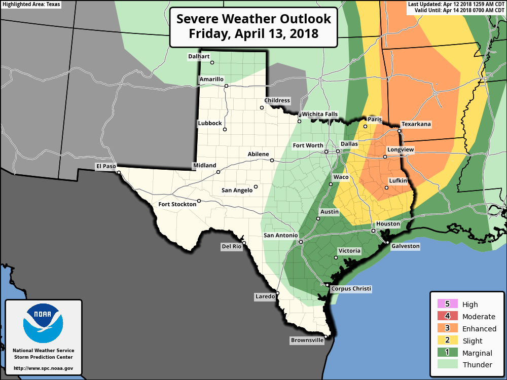 For the most populated part of North Texas, looks like we will see the potential for a few thunderstorms in some spots tomorrow morning, but organized severe thunderstorms do not appear to be an issue at this time. TIMING - Some scattered thunderstorms will start to affect North Texas during the morning commute, mostly in the form of rain and lightning. As we get closer towards the afternoon, storms will progress to the east, posing a threat for severe weather in the slight and enhanced risk areas. THREATS - Mainly in the slight and enhanced risk areas, given the high instability but sparse storm coverage, all modes of severe weather will be possible. Very large hail events appear likely, along with the risk for damaging winds and a few tornadoes, a couple of which could be strong in the enhanced risk area. That zone is being monitored for a potential upgrade to Moderate risk in later outlooks. Be sure to stay in touch with the blog for the latest details. THE WEEKEND - After the cold front comes through on Friday, cold air advection will follow the next day, and we fall back to the low 40s for lows during the weekend. Highs will be in the low to mid 60s with a sunny sky. NEXT WEEK - For now, most of next week looks dry and pleasant with afternoon highs in the upper 70s/low 80s. We will need to monitor the potential for more rain during the latter half of the week. 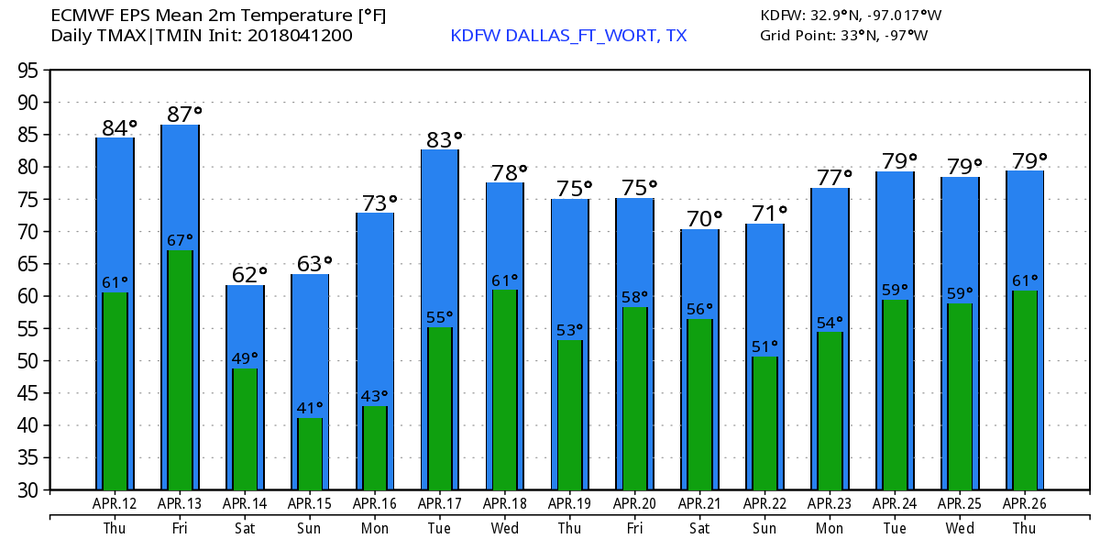 |
Archives
March 2023
Categories |
 RSS Feed
