
|
Radar Check - A few rain showers have developed around and just to the west of the DFW Metro, but we expect them to push off to the north, and thunder is not expected this morning. 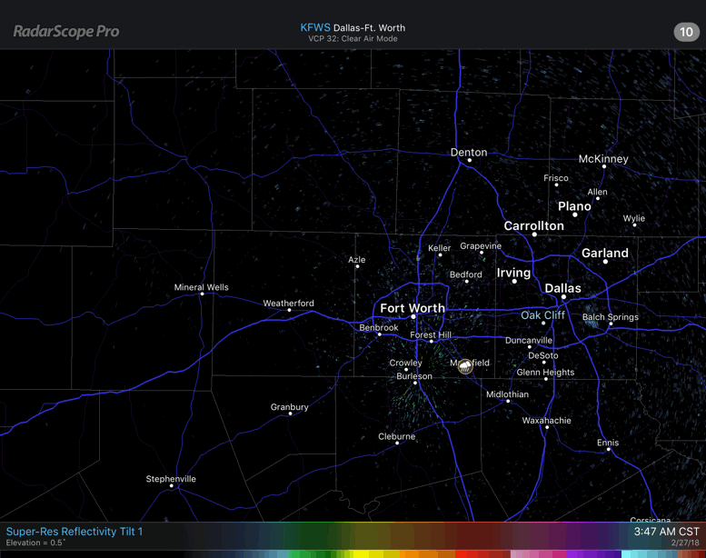 However, it will remain cloudy, and we do expect to see thunderstorm activity develop during the afternoon. Some of the storms could turn marginally severe, posing a threat for mainly large hail and heavy rain at times during the afternoon hours. We do note that the SPC continues with a 'marginal' risk for severe storms for much of North Texas... 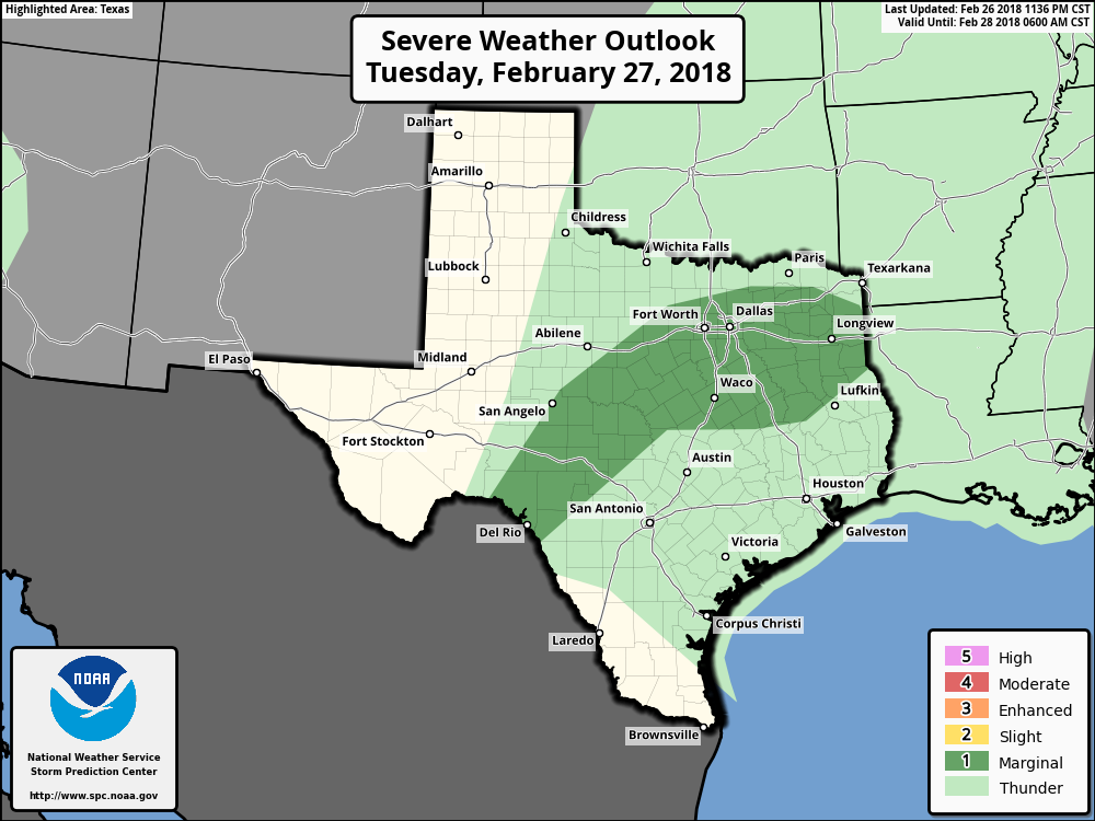 Rain amounts could reach 1/2" in most spots today, but flash flooding should not be a concern. We should see most of the activity taper off during the late evening. Midweek - On Wednesday, we will mention the chance for rain throughout the day. It shouldn't rain all day, but rain at times. Once again, some of the strongest cells could turn severe, especially where the SPC denotes a risk of severe weather once again. 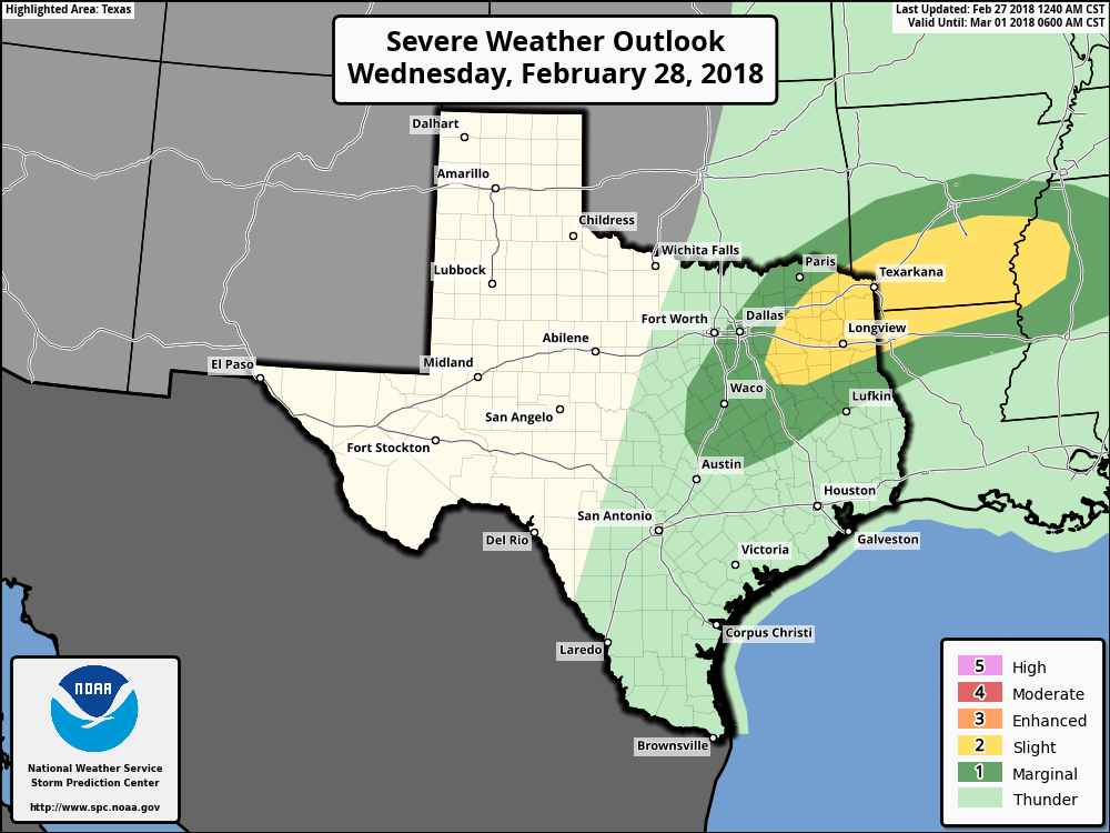 Most of the severe activity won't come until the late evening hours, and even then, the strongest storms should stay to the east. Though we could see some hail-producers creep into North Texas. Highs should be in the low to mid 70s. Then on Thursday, we begin Meteorological Spring and the Spring tornado season. A cold front comes through in dry fashion during the morning hours, but we should warm nicely with highs in the mid 60s. Friday and the Weekend - Friday and Saturday should be dry, pleasant days with lots of sunshine and highs in the mid to upper 60s. Rain could return to the region with another front on Sunday, which would bring the chance for thunderstorms during the afternoon and evening hours. Sunday's high should be in the mid 70s. Next Week - Some rain could return during the latter half of the week, but early next week looks dry with highs in the mid 60s, right at averages for early March. See the Texas Weather Discussion Video for more details. 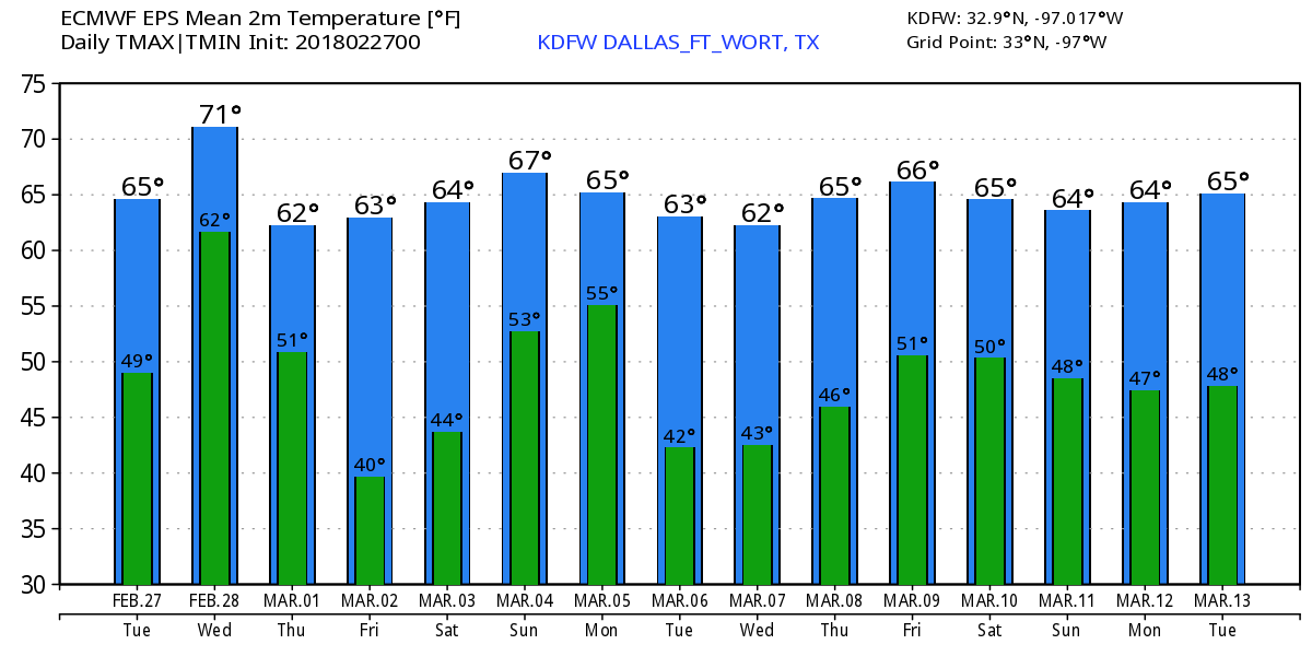 |
Archives
March 2023
Categories |
 RSS Feed
