
|
MILD START - Despite some morning drizzle out on the radar, temperatures are well into the low 70s this morning as anticipated. The average high for May 2 is 81 degrees in Dallas. Highs will be well into the mid 80s again today with cloudy skies. Scattered showers and thunderstorms could develop during the afternoon and evening hours. An upper trough in the western side of the country will bring the chance of widespread severe storms with very large hail, damaging winds, and a few tornadoes, some of which could be on the strong side from Texas through parts of the Midwest. The highest tornado probabilities are maximized over portions of Western Oklahoma and Kansas this time. 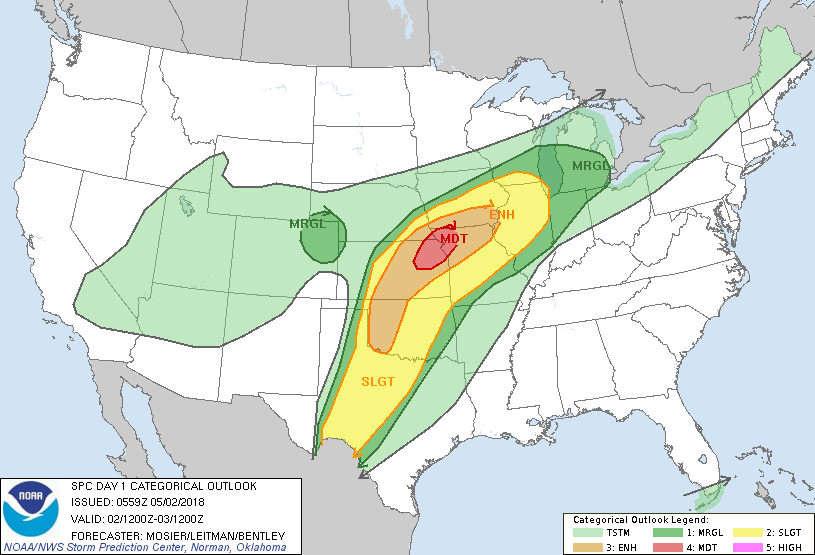 For North Texas, we might see some random showers and thunderstorms that could turn marginally severe, but that's really about it. Our main focus for severe weather will be Thursday as the cold front moves to the east. We do note that the SPC has all of North Texas under the standard “slight” risk for severe storms tomorrow. 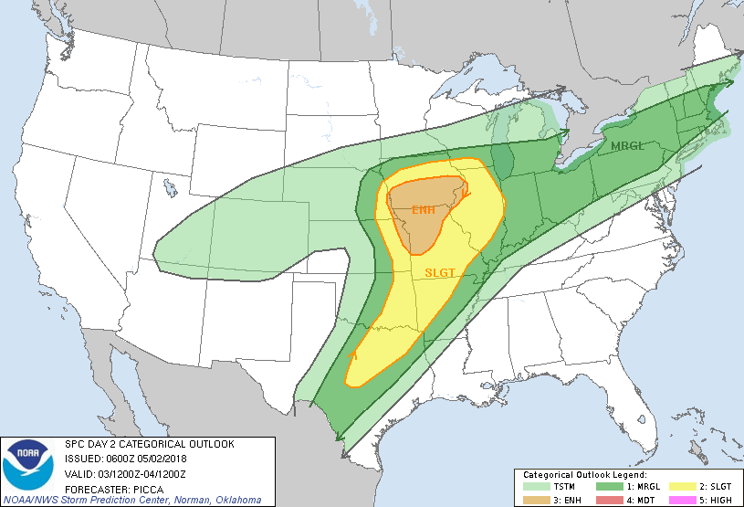 A batch of showers and thunderstorms will be possible during the pre-dawn hours before a cluster of strong to severe thunderstorms move in during the afternoon. These storms could produce large hail and damaging winds, maybe even a couple of weak tornadoes given a few strong hodographs. If you don’t see anything, tomorrow will be mostly cloudy with highs in the low 80s. FRIDAY AND THE WEEKEND - We will still continue to mention the chance of rain and thunderstorms during the day, but severe weather will not be an issue. Rain amounts should be in the one and a half inch range by Friday. Highs will only reach the upper 70s due to cold air advection from the cold front. We will warm up through the weekend with a mix of sun and clouds, and highs should be in the 80-85 degree range. NEXT WEEK - After an active week of severe weather, next week should be mostly dry and sunny with afternoon highs in the mid 80s. See the Texas Weather Discussion Video for more details. 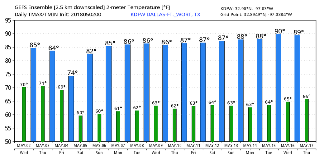 |
Archives
March 2023
Categories |
 RSS Feed
