
|
VERY CHILLY - Temperatures are mostly in the mid to upper 30s across the North Texas region this morning, which is actually above our average high of 35°. We won't warm much today, and afternoon highs will only reach the mid 40s with more clouds than sun, so be sure to dress appropriately for today. REST OF THE WEEK - The good news is, temperatures will slowly moderate throughout the workweek. We will start most days in the 40s, but we will end up in the mid 50s on Tuesday, followed by mid to upper 60s by Wednesday and Thursday. Then, we should peak in warmth by Friday, with highs very close to 70°. Each day will feature a mix of sun and clouds. THE WEEKEND - An arctic outbreak is becoming increasingly likely across the Continental US starting this weekend. An upper high in the Central Plains will allow for an intrusion of cold air to filter into North Texas this weekend. At this point, we are only expecting highs in the low 30s for much of the weekend. Morning lows are expected to be in the low 30s for Saturday, followed by the mid to upper teens by Sunday. However, the wind chill will make forecast temperatures feel like the single digits in most spots. This brutally cold air mass will also feature a mix of sun and clouds throughout each day. Rain is possible early Saturday morning, but the best chance of any one spot getting wet is only in the 10-20 percent range for now. NEXT WEEK - After a brutally cold weekend, we become a bit more average with highs in the low 40s with a mix of sun and clouds for at least the beginning of next week. See the Texas Weather Discussion Video for more details. 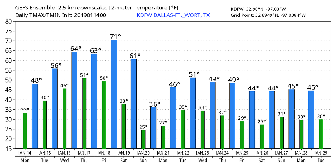 |
Archives
March 2023
Categories |
 RSS Feed
