
|
Radar Update - As expected, showers and storms are currently ongoing along a surface front, making for a wet commute for some traveling to work and school. 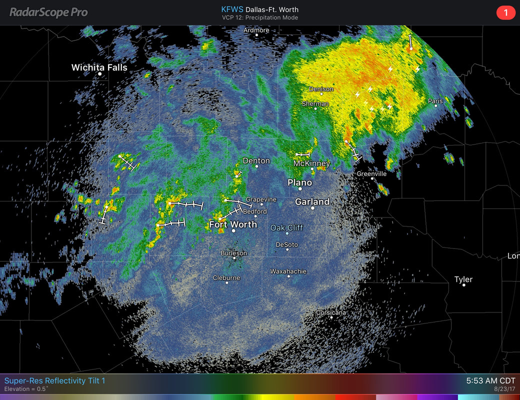 These storms are moving to the east and are not severe, but may produce heavy rainfall and some lightning with the strongest storms. Radar suggests that over 1-2 inches of rain has already fallen between Bowie and Sunset. Aside from the rain, most in DFW are starting the day quiet with highs in the mid to upper 70s. As the surface front gets closer to us, the coverage of rain should be greater by this late morning. Most of us will be cloudy today with highs only in the low 90s. A few scattered showers and storms by the afternoon can't be ruled out. Thursday and Friday - Very subtle differences. On Thursday, we start the day with clouds and cool temperatures. Some cooler places could start their morning with upper 60s for some time. Showers and storms will still be possible on both days, before ultimately tapering off by the end of the day on Friday. The Weekend - Moisture returns, and the chances of showers and storms increase again. We should be accustomed to seeing clouds with highs dropping to the mid 80s. The amount of rain that we see this weekend will be dependent on Harvey, which is a tropical system that is expected to regenerate in the southern Gulf of Mexico in the next 48 hours. Unless we have a definite low-level center, it may be pretty hard to determine where this system may go and which location gets the most rainfall, but things look pretty muggy for this weekend. 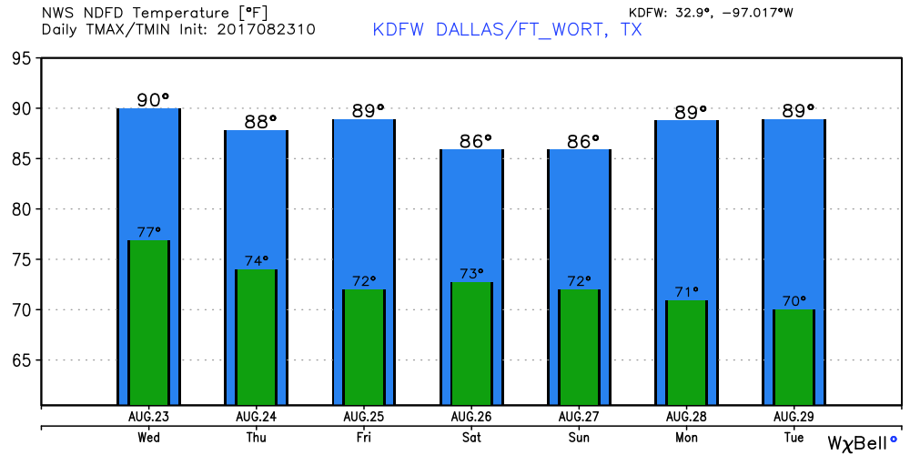 Harvey's Back - As you may know, Tropical Storm Harvey dissipated into an open wave while in the Caribbean Sea this weekend, but is expected to intensify tomorrow or Friday. Models suggest that Harvey will move into southwest Texas as a high-end tropical storm/category one hurricane. The main threat to southwest Texas will come from mainly heavy rain and flooding. Models suggest that recurving is likely once it reaches inland, and some parts of southwest Texas, including Houston, could wind up with over two feet of rain during the next several days, which will make for a widespread flooding event. 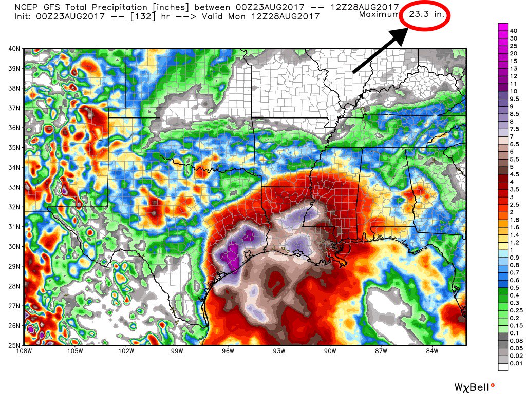 Invest 92L - A broad tropical low is located on the East Coast of Florida, and should lurk there for a few days, and could develop as the environment becomes more favorable and it tracks out into the Atlantic. If this becomes a tropical storm, it's name will be "Irma". See the Texas Weather Discussion Video for more details.
|
Archives
March 2023
Categories |
 RSS Feed
