
|
Radar Update - As expected, showers and storms are traveling ahead of a cold front, moving mainly to the east, which may make for another wet commute for DFW. As I am writing this, a Flash Flood Warning is in effect for parts of Denton county until 8:00 AM. 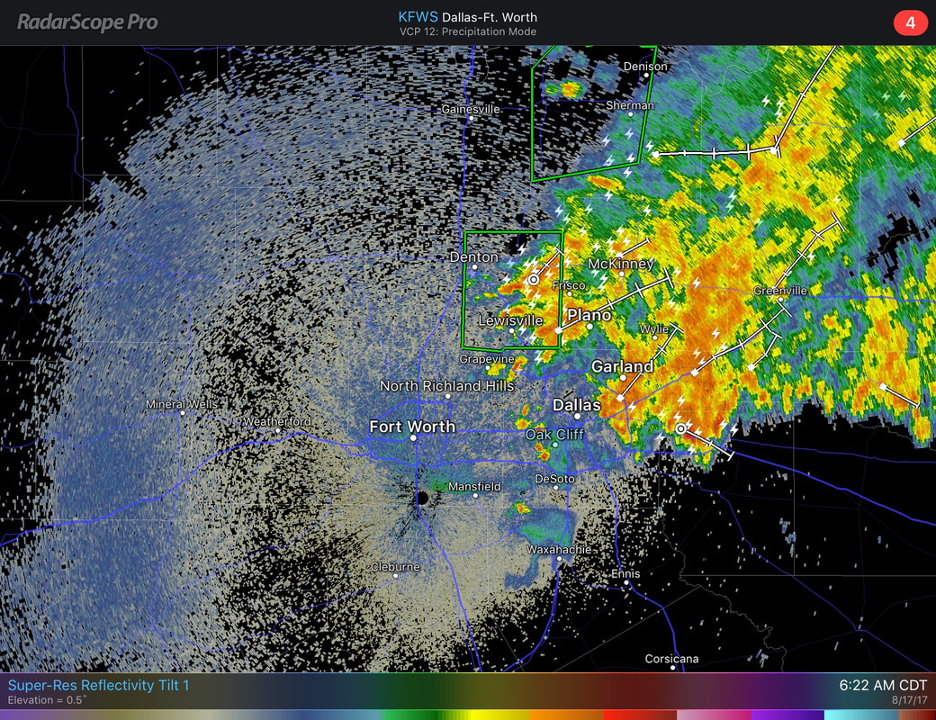 These storms may produce heavy rain, frequent lightning, and maybe some gusty winds. The chance of any one spot getting wet is in the 50 percent range. We will continue to stick with the typical summer forecast with plenty of sunshine with clouds out at times, which a chance of an isolated storm or two during the afternoon/evening hours. We continue with highs in the middle to upper 90s, just what we would expect for the middle of August. The Weekend - Not much change. The cold front is completely out of North Texas, and drier air will take over, leaving a good dose of sunshine with any isolated storms being very limited. Highs will be mostly in the upper 90s to near 100 degrees as the drier air raises the heat levels. Solar Eclipse Information - This Monday, August 21, all of the U.S. will be treated to an eclipse of the sun. Anyone in that is in the path of 'totality' will be able to view one of mother nature's most awe-inspiring looks, a total solar eclipse. This path, where the moon will completely cover the sun and the sun’s tenuous atmosphere – the corona – can be seen, will stretch from Lincoln Beach, Oregon to Charleston, South Carolina. Observers outside this path here in Texas will still see a partial solar eclipse where the moon covers part of the sun’s disk. The eclipse will begin at 11:39, peaking at 1:09, before ending at 2:39 for Arlington. But, what is the weather going to look like for this area? The weather looks like a typical summer day with plenty of sunshine with some clouds out at times, but this does not mean a widespread overcast, which is a good thing. 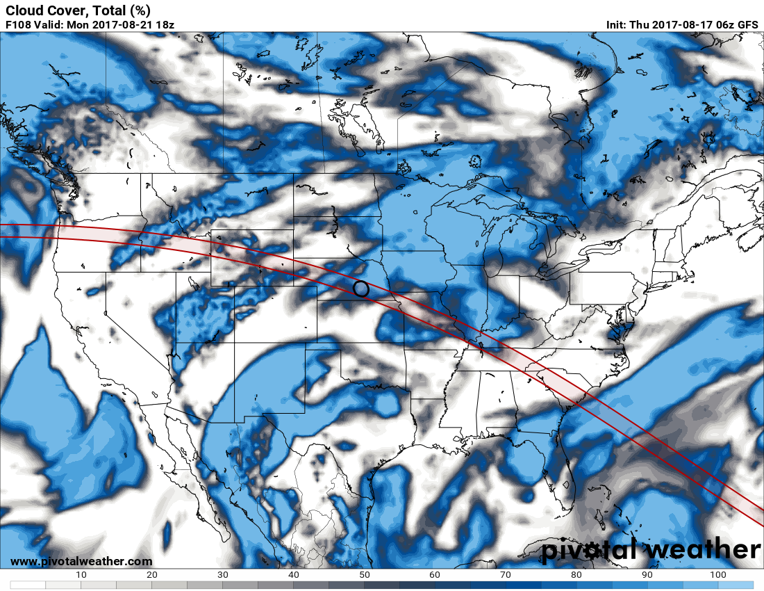 Please be mindful that it is imperative that you are wearing the right eyewear to view this eclipse. More information on that can be found here. Tropical Weather - Gert is now a Category Two hurricane with maximum sustained winds of 100 mph, well to the east of the United States. This is expected to continue churning northeastward in the Atlantic, before becoming post-tropical cyclone this weekend. There are three waves in the African Coast/Cabo Verde Islands region... The first one, Invest 91L, is expected to move towards the Caribbean and Central America, and Harvey would be the name if this were to develop into a tropical storm, quite possibly a hurricane. The second one, Invest 92L, is trying to track into the Bahamas. We currently do not know if this will threaten Florida, the U.S. East Coast, go into the Gulf of Mexico, or recurve into the Atlantic. This will be in a challenging environment, but a tropical storm is still possible. The third one, which is just off of the African Coast, will most likely be tagged "Invest 93L". See the Texas Weather Discussion Video for more details. 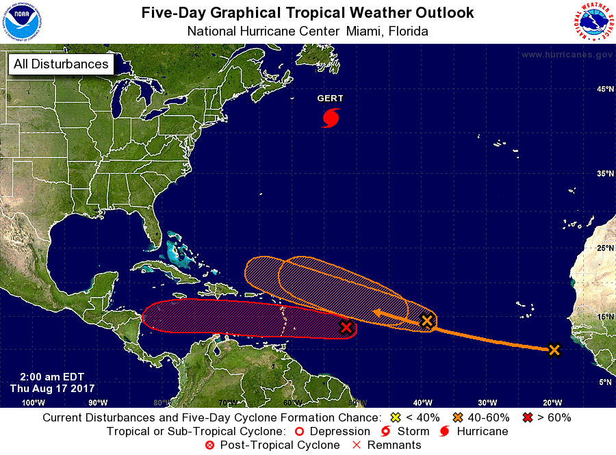 |
Archives
March 2023
Categories |
 RSS Feed
