
|
RADAR CHECK - As you head out this morning, you might want to pack an umbrella. Showers and storms are moving ESE across North Texas, with stronger cells along and south of I-20 and well to the east of I-35. 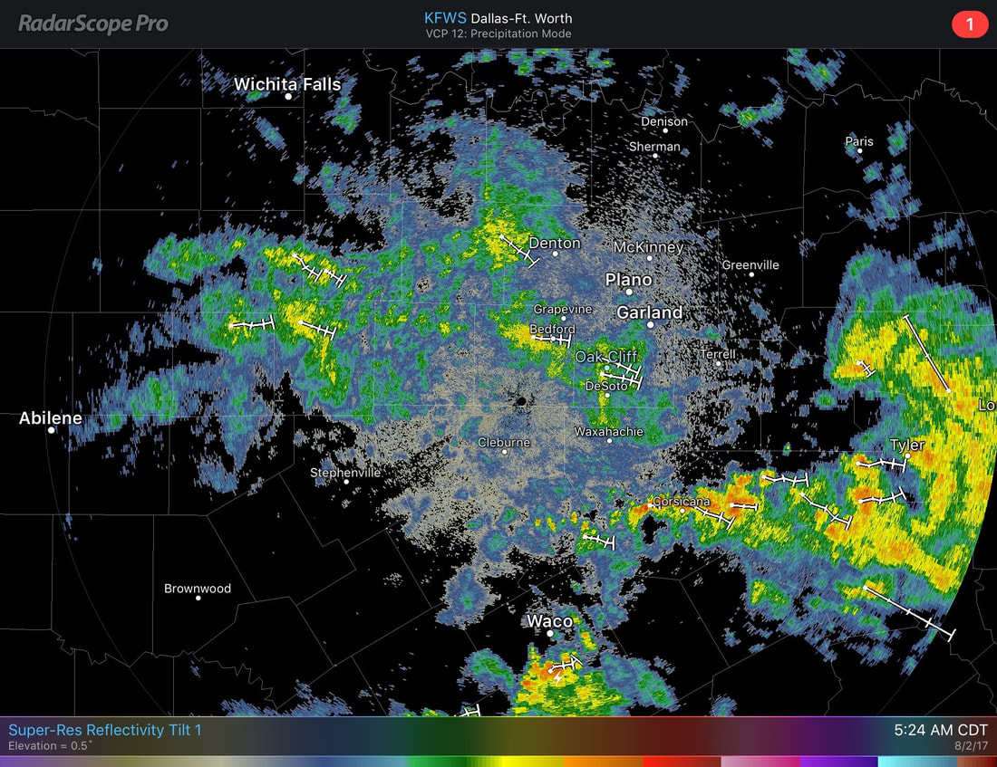 They are expected to continue moving slowly to the east, bringing downpours in some locations. Severe weather is not expected, but some stronger cells may produce frequent lightning or gusty winds. Rain should end by the afternoon/evening hours. Scattered to numerous showers and storms are expected across North Texas for much of this morning before clearing in the afternoon. It should be cloudy for most of the day, with highs only in the upper 80s due to cloud coverage. The chance of one spot getting wet this morning is in the 60-70 percent range. Tomorrow should stay mostly rain-free with highs in the low 90s with clouds out at times. But, you can never rule out the chance of an isolated storm or two during the afternoon hours. Friday and the Weekend - Same, consistent forecast will stick with us during the weekend. Cloudy, with at least SOME chance of showers and storms each day with highs in the low 90s. Not everyone will see rain. The best chance of one spot getting anything is in the 20 percent range Friday and Saturday. Sunday, scattered showers and storms will be more likely along a cold front coming from the north, and that should raise storm chance by 20 percent. Next Week - As we start of the early week, the cold front should still stick along a cold front, mainly on Monday where the chance for rain will be the highest next week. Mostly cloudy, with chances for scattered to numerous showers and storms. Just like today, highs should only stay in the upper 80s due to the cloud coverage. During the latter half of the week, storm chances should slowly start to come down with highs in the low 90s. I don't say that too often during the hottest part of the summer. See the Texas Weather Outlook for more details. 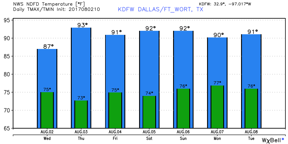 |
Archives
March 2023
Categories |
 RSS Feed
