
|
After yesterday's severe storms, it was a much nicer and calmer day in North Texas. However, our severe weather risks ramp back up in the next 24-48 hours. More details below... FIRST OFF: A couple thunderstorms will develop late tonight near I/20, however the extent, if the lift is even enough for development, and intensity of these is uncertain. If storms develop, they will tap in to some elevated instability and strong deep layer shear. These storms could produce quarter to half dollar size hail and gusty winds. The overall severe risk is low. The SPC has outlined portions North Texas in a level 1 "Marginal Risk" for severe weather tonight. 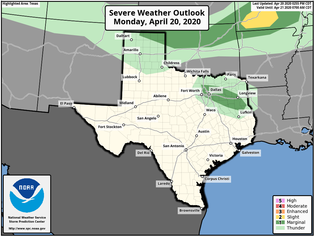 These will clear out late tonight and we will be left with a partly to mostly cloudy day tomorrow. A few storms will be possible as a warm front lifts northward through the area dependent on a capping inversion. Strong low level instability and deep layer shear will favor a risk of supercellular structure in any storm that develops with UH near 250 m2/s2. The main risks will be large hail and damaging winds and will favor areas north/west of DFW. 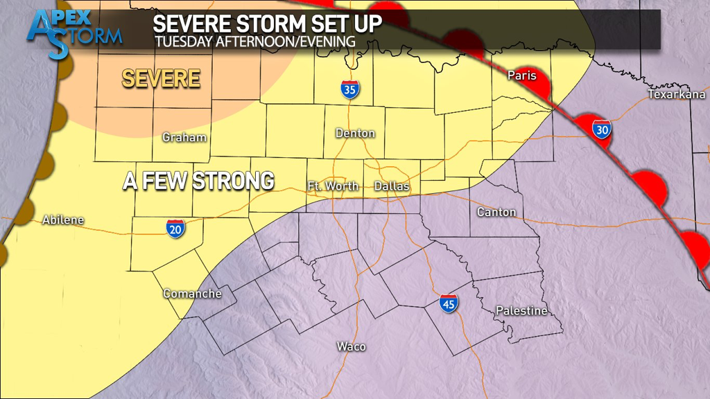 We will watch as they attempt to make a run at North Texas during the evening hours. Whether or not these make the trip (nonetheless even materialize) is very uncertain at this time. Below is a more aggressive solution from the TTU-WRF. 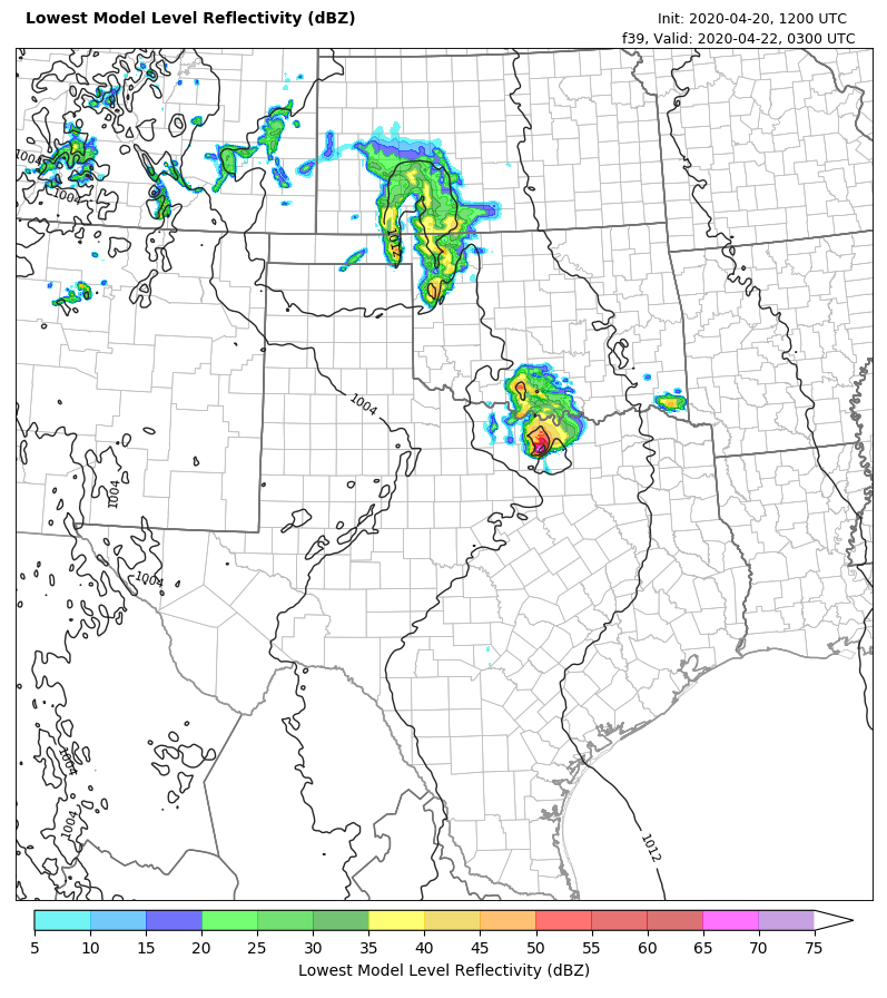 Meanwhile, the NAM 3km favors a dry forecast with any storms well northwest of our area. 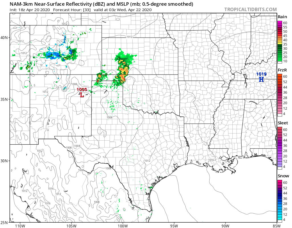 These storms will clear out of North Texas either way by early to mid morning on Wednesday, leaving us wide open in the warm sector with rapid destabilization expected. By late morning into early afternoon, we could see some development that will remain more elevated and will favor areas east of I/35 capable of large hail. However, by 3-5pm the dryline will be mixing west as our boundary layer mixes out and surface air parcels find the unstable and bouyant airmass set up east of the dryline. This will be the area to watch for initial supercellular development (near I/35) capable of initially very large hail and a tornado or two. The Storm Prediction Center has outlined a good portion of the area in the "Slight Risk" of severe weather with a hatched large hail risk. (--- meaning greater potential of 2" hail or larger---) Due to increasing LI's, storms will begin to cluster as they move into East Texas favoring a risk of heavy rain and damaging winds, and with increasing LLJ a QLCS-based tornado risk may evolve during the overnight hours in East TX into LA. 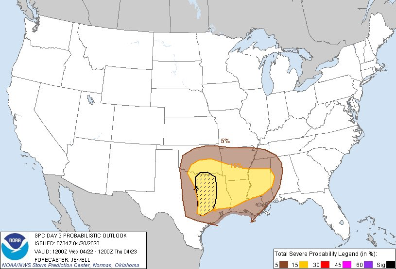 A cold front will follow the dryline and usher in drier air for Thursday, with temperatures in the 70s and pleasant temperatures. A quick return in moisture will occur Friday afternoon into the overnight, and a few storms may develop along a boundary that could pose a severe risk mainly east of DFW. A quiet weekend is expected, but storm chances will return early next week as the next shortwave approaches and a NW flow aloft begins to settle in.
Logan Shipley |
Archives
March 2023
Categories |
 RSS Feed
