
|
Mild Morning - Temperatures in North Texas are currently in the mid to upper 60s this morning, very mild and above seasonal averages for this time of the year. The average low for DFW on February 28 is 44 degrees. If you still haven't guessed it, today will be a pretty mild day with highs in the mid to upper 70s in most spots. I wouldn't be surprised if a location or two touched 80 this afternoon. However, do pack an umbrella as you head out this morning. Rain will return later this morning with a chance of an isolated storm turning marginally severe. The main threat is large hail, but we could see some gusty winds as well. There is a marginal risk for severe storms outlined for some parts of North Texas... 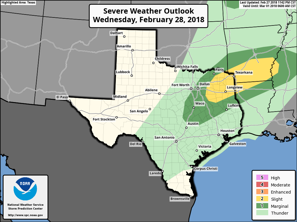 Then during the afternoon hours, storms become more isolated in nature, which means that they could be more intense. Again, the main threat is large hail and damaging winds, but the tornado risk is very low, but not zero. Activity should taper off during the late evening hours and we should be dry during the overnight hours. Rest of the Week - Both days look like perfect starts to March and Meteorological Spring. We will see abundant sunshine on both days with highs in the mid to upper 60s - very comfortable beginning to the new month. Lows on both days will be in the low to mid 40s. We will be down in the low 40s on Friday, and some places could touch the upper 30s, but we don't expect a freeze anywhere. We will remain dry on both days. The Weekend - Saturday is another perfect start with afternoon highs in the upper 60s, with some places touching 70. We will see plentiful sunshine, but we could see a few showers return on Sunday, but that doesn't look like a severe weather risk or a widespread heavy rain event. We should be in the 70s on Saturday. Next Week - After clouds and a few showers clear on Monday, most of next week looks pretty dry with abundant sunshine with highs in the low to mid 60s and lows in the mid 40s. No signs of any terribly hot weather or freezes anytime soon. See the Texas Weather Discussion Video for more details. 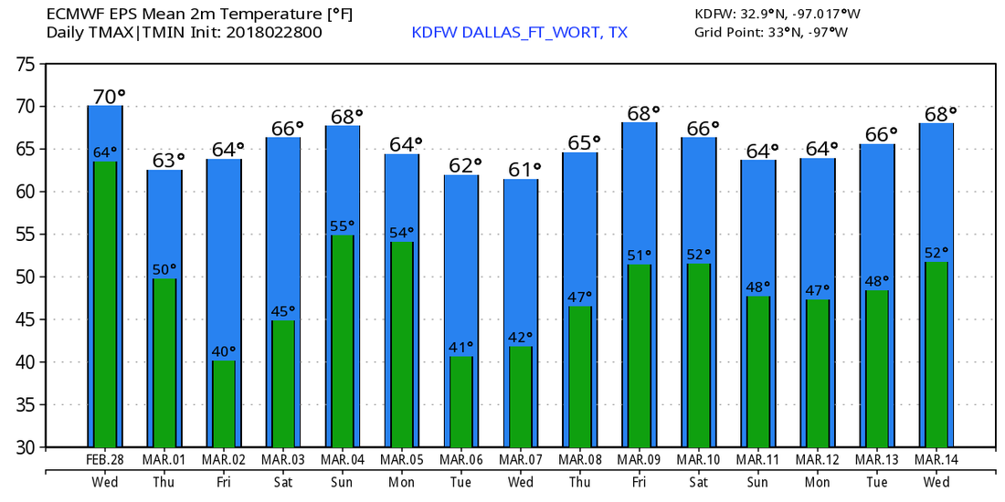 |
Archives
March 2023
Categories |
 RSS Feed
