
|
RADAR CHECK - Scattered showers and thunderstorms continue to move to the northeast this morning, affecting mostly the northern portions of the DFW metro... 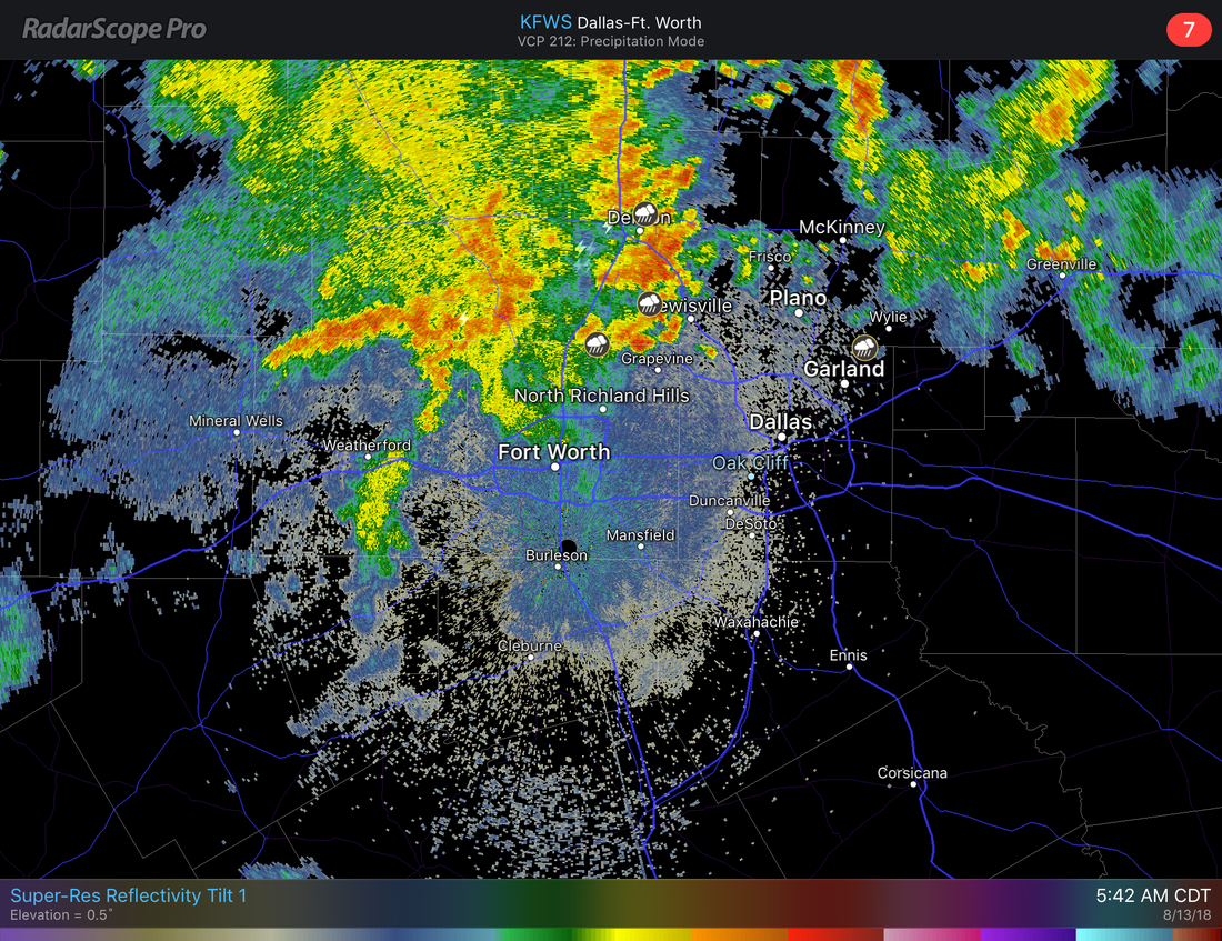 The good news about these storms is that they are moving northeast at around 25 MPH, so we don't have to worry about flash flooding too much this morning. But flooding in low-lying areas is definitely not out of the question so take it slow on the roads heading to work and school this morning. Redevelopment of showers and thunderstorms is likely after 1PM, the best chance of any one spot getting wet today will be in the 70/80 percent bracket. We will stay cloudy for much of day with afternoon highs in the mid 80s, about ten degrees below average for mid August. TUESDAY - We will see a cluster of showers and thunderstorms develop during the morning hours, but nothing widespread like what we have seen this weekend. The majority of North Texas will stay dry Tuesday with mostly cloudy skies. Highs will be in the upper 80s to low 90s, still way below the average high for mid August. WEDNESDAY THROUGH FRIDAY - We dry out during the latter half of this week as the stalled upper low finally moves northeast. There will still be some clouds lying around, but we should see more sun than clouds during the day. Highs will be in the low to mid 90s in the afternoon, back to seasonal averages for this time of the year. Better than 100° heat. THE WEEKEND - Not much change. We will stick with a dry forecast for the weekend with a mix of sun and clouds during the afternoon with highs in the mid 90s during the peak of the day. We might see a shower or two but that's really about it. NEXT WEEK - Another surface front may edge some parts of North Texas by early next week, but won't be enough for widespread showers and thunderstorms. So we will continue to forecast a mix of sun and clouds with occasional isolated showers and storms during the afternoon. Highs will be in the low 90s as we get closer and closer to September, the first month of Meteorological Fall. See the Texas Weather Discussion Video for more details. 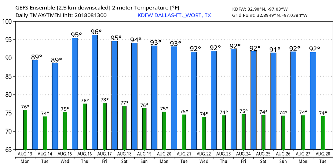 TROPIX - There is a wave located in the Northern Atlantic that is barely generating showers and thunderstorms. The NHC gives it a 10 percent chance of development within the next 48 hours to five days, but more than likely it just stays an open wave. The rest of the Atlantic Basin remains very quiet for this time of the year. 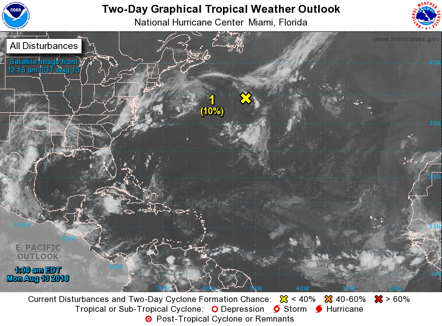 |
Archives
March 2023
Categories |
 RSS Feed
