
|
MORE SHOWER/STORMS TODAY - A shortwave trough is moving to the west from the east, which means we will see an enhancement of showers and thunderstorms this afternoon during the peak of the daytime heating process. Most of the showers will not develop until after 12 PM, and the best chance of any one spot getting wet is in the 40/50 percent range for today, falling to 20/30 percent tomorrow. However, we can't rule out the potential for any overnight/early morning showers and storms tonight, given the type of atmosphere we are in. Afternoon highs will be in the mid 90s today and tomorrow. THE WEEKEND - We clear out for the weekend, going back to our routine summer weather pattern for mostly sunny skies in humid conditions with most highs in the triple digits. NEXT WEEK - Not much change in the weather pattern for next week. We continue to forecast mostly sunny skies in a humid airmass with highs in the triple digits for most spots. The GFS indicates the idea of a trough in the Midwest near the Ohio Valley, and a 594 millibar heat ridge extending into Texas from the Western U.S. The GFS wants to bring a cold front with scattered showers and thunderstorms in the mix, but is unlikely because fronts usually don't make it this down south this time of the year. See the Texas Weather Discussion Video for more details. 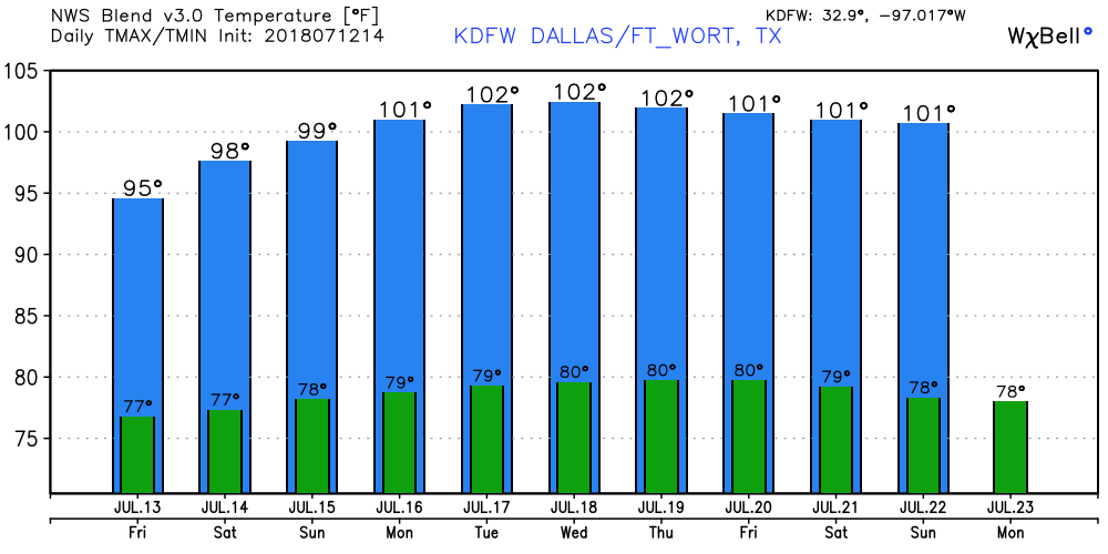 TROPIX - Formally Tropical Storm Chris has become Post Tropical Cyclone in the Northern Atlantic this morning. It will continue to move to the northeast, away from the U.S. The Ghost of Beryl is just to the north of the Bahamas. The NHC still has a 50/50 chance of regeneration. One way or another, it will follow the same path as Chris, moving to the northeast, away from the U.S. The deep Atlantic Basin remains quiet, with no tropical development expected in the Gulf of Mexico anytime soon. 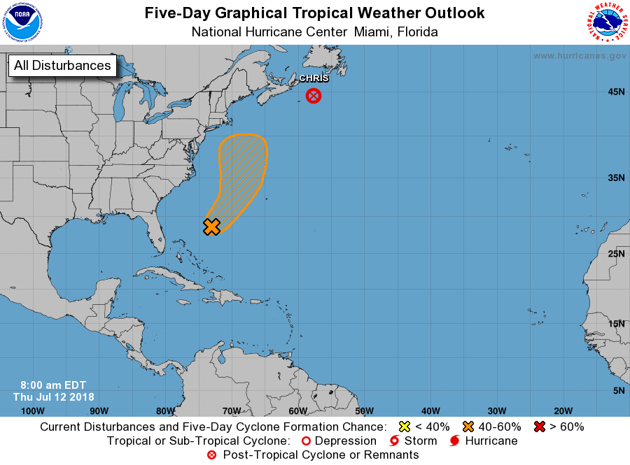 |
Archives
March 2023
Categories |
 RSS Feed
