
|
FAIRLY QUIET MORNING - Most communities are quiet this morning with temperatures in the low to mid 80s today, but a couple of showers and thunderstorms are already starting to develop near Parker and Palo Pinto counties. We will see better coverage of scattered showers and thunderstorms later today with a tropical airmass still in place. As noted in the Precipitable Water values, the better coverage of showers and thunderstorms will be from a line near Henrietta to Brownwood and points to the east. Today's high will be in the low to mid 90s for most communities. MIDWEEK - Widely scattered showers and thunderstorms will remain possible tomorrow and Thursday, but the better coverage of scattered nature will be Thursday as moisture levels increase for the day. The best chance of any one spot getting wet will be in the 50/50 range on Thursday with highs in the low to mid 90s. The best coverage of the rain will come from 12:00 to 9:00 PM each day. THE WEEKEND - We go back to fairly routine summer time weather sunshine in full force. Highs will warm back up in the upper 90s to the low 100s. NEXT WEEK - Consistent summer time weather will be in the forecast for much of next week with abundant sunshine with highs in the upper 90s to the low 100s. 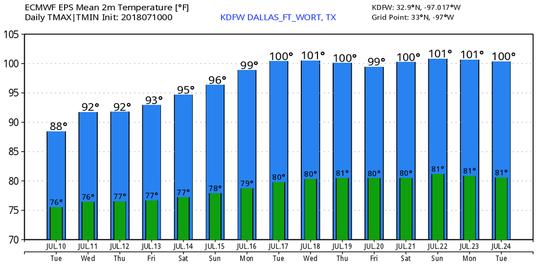 TROPICS - Chris is a high-end tropical storm in the Atlantic with pressure down to 996 millibars with maximum sustained winds at 70 mph. It is expected to become a hurricane later today. The storm has already began movement to the northeast at 9 mph. It will continue to move to the northeast through the course of this week, becoming post-tropical cyclone by this weekend. It will have indirect impacts to the Eastern U.S. Coast, such as rough surf and rip currents. 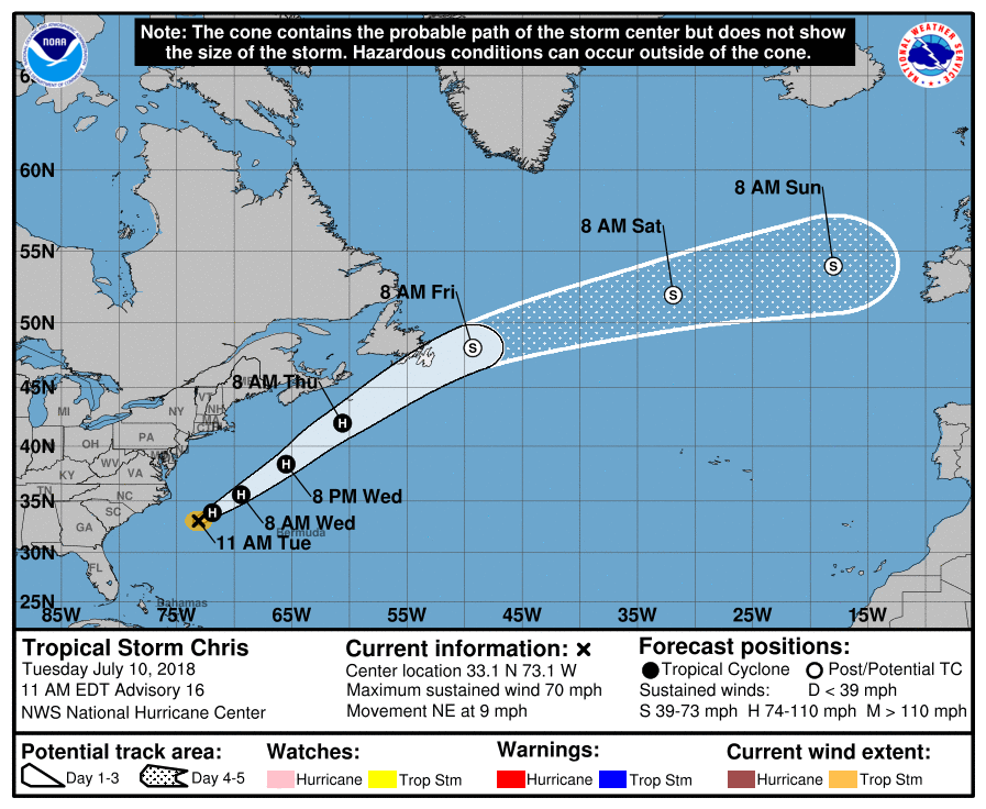 BERYL - The remnants of Beryl is currently located near Hispaniola this morning. The National Hurricane Center gives it a 50/50 chance of it regenerating into a tropical cyclone within the next 5 days. One way or another, it will turn to the northeast, away from the US.
|
Archives
March 2023
Categories |
 RSS Feed
