
|
RADAR CHECK - Showers continue to move to the north from the metroplex. This should be something we should be accustomed to allday; cloudy with showers at times. A Dense Fog Advisory is in effect for most counties across North Texas. Visibilities are down to one quarter of a mile to even less at times. We will remain mostly cloudy throughout the afternoon with highs in the lower 60s. TUESDAY THROUGH THURSDAY - Expect a gradual warm up in temperatures up to Thursday. We turn mostly sunny Tuesday and Wednesday, followed by a few clouds by Thursday. Highs will be in the upper 50s tomorrow, followed by the mid 60s on Wednesday. We will reach the mid 70s by Thursday. FRIDAY AND THE WEEKEND - A cold front comes through early Friday morning, which will cause a wind shift from the northeast to the southwest, which will make for a very windy day. We turn sunnier by the afternoon with highs only in the mid 50s, which is actually a couple degrees below our average for mid February. Winds die down by the weekend, and Saturday will stay mostly sunny with highs in the mid 50s. Another cold front moves through during the overnight hours, and temperatures will be in the upper 40s by Sunday with a mix of sun and clouds. NEXT WEEK - Overall colder week. Showers at times will be possible at times during select afternoon. Mostly a mix of sun and clouds for the week. See the Texas Weather Discussion Video for more details. 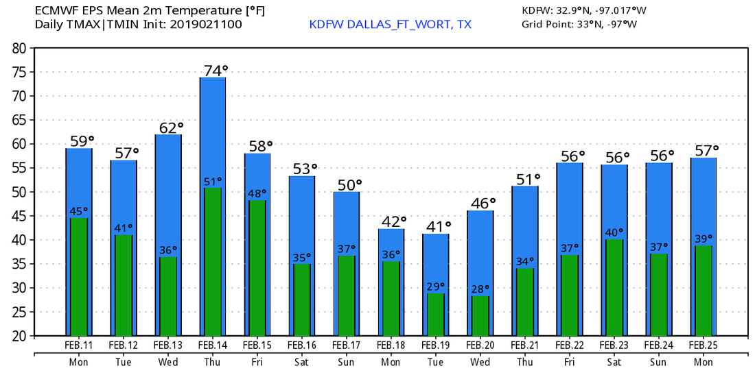 |
Archives
March 2023
Categories |
 RSS Feed
