
|
RECORD COLD MORNING - For many communities outside of the metroplex, temperatures are a touch below freezing, leading to a rare mid-spring freeze across parts of the NTX region and much of the midwest. Here are some of the observed temperatures early this morning... DENTON 33 DFW AIRPORT 40 ARLINGTON 36 GAINSVILLE 32 SHERMAN 32 JACKSBORO 29 MINERAL WELLS 31 GREENWILLE 33 ROCKWALL 36 HILLSBORO 34 To put things in perspective, our average last freeze date is March 12, and our latest last freeze on record is April 13, 1957. We didn't break that record in the metroplex, but we did get really close. We did break our old record low of 39° in the metroplex this morning for April 21. The good news is that we should warm up very nicely this afternoon with a mostly sunny sky with high clouds increasing late in the day. Highs will maintain in the low to mid 60s, just like yesterday. Clouds will stick around for the day tomorrow with some sprinkles at times. Highs will stay in the mid 60s due to cloud cover. SEVERE WEATHER POSSIBLE FRIDAY - A dynamic weather system will bring the possibility of severe storms for much of the south-central Plains and much of the North-Central Texas region Friday afternoon and evening. The Storm Prediction Center continues a large standard "slight" (2/5) risk of severe storms for all of North and Central Texas throughout much of Central Oklahoma. 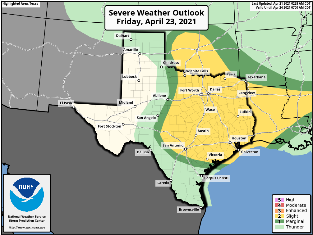 All modes of severe weather appear possible, including the threat for very large hail up to the size of baseballs, in addition to isolated tornadoes. Once we get within 60 hours of the event (that will be later this afternoon and evening) we will get within range of the convection allowing models, and will have a much better idea of the timing and magnitude of the threat. Just know that Friday will be a day where it is imperative that you are weather aware. Dry air returns Saturday morning, and the weekend should be quiet and dry with highs in the upper 70s on Saturday, followed by the low 80s on Friday. NEXT WEEK - Our weather will be very warm and dry on Tuesday... the high Monday will be in the low to mid 80s by the afternoon. A dynamic weather system will spark another chance of severe weather on Tuesday for North-Central Texas through Central Oklahoma. At this time, it appears that all modes of severe weather are possible once again. The SPC has introduced a standard "slight risk" zone for the aforementioned areas, but greater probabilities may be needed if trends continue. See the Texas Weather Discussion Video for more details. 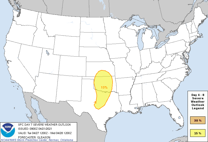 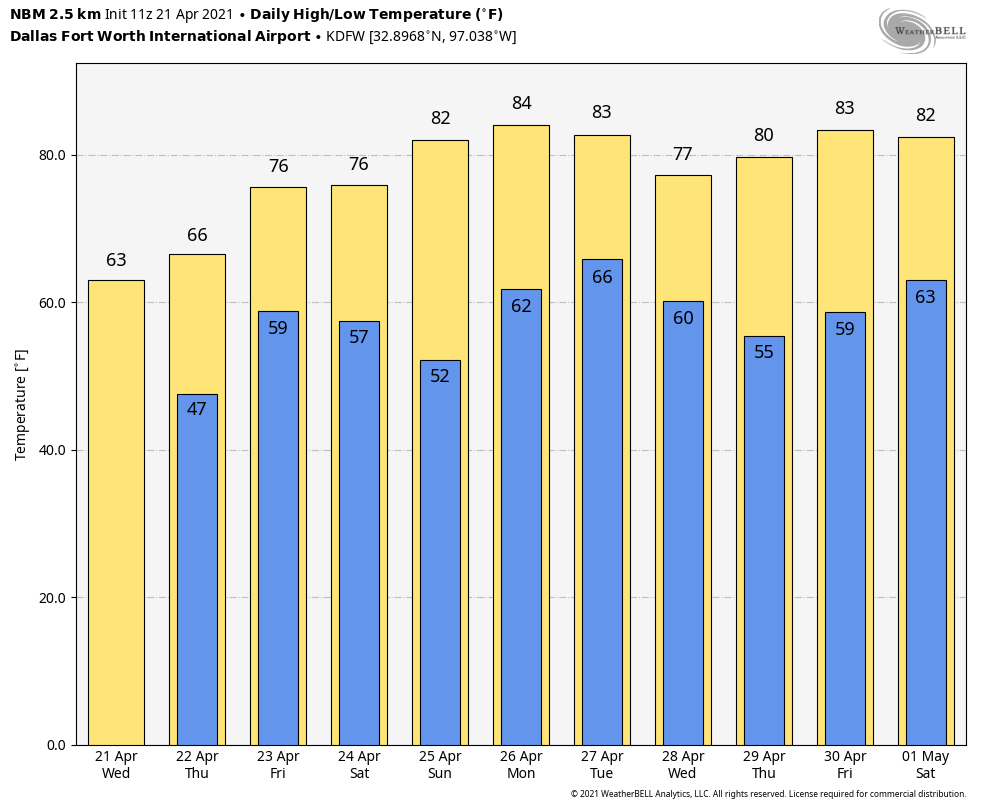 ON THIS DATE IN 1967 - Severe thunderstorms spawned 48 tornadoes in the Upper Midwest. Hardest hit was northern Illinois where sixteen tornadoes touched down during the afternoon and evening hours causing fifty million dollars damage. On that Friday afternoon, tornadoes struck Belvidere IL and the Chicago suburb of Oak Lawn, killing 58 persons.
|
Archives
March 2023
Categories |
 RSS Feed
