
|
RADAR CHECK: A complex of showers and thunderstorms are moving to the southeast across North Texas this morning. This is just a period of light to moderate rain with no severe and probably very little thunder. These storms should clear by the afternoon, and we should be in the mid 80s for the rest of the day with a mix of sun and clouds. Not much change for the weekend; each day will feature a mix of sun and clouds with a chance of either widely scattered showers and storms or a complex of storms in the morning/early afternoon. Highs each day will be in the 87-91 degree range. NEXT WEEK AND BEYOND: Relatively dry weather will continue for most of the week, but each day will feature at least some chance of showers and storms during the morning/afternoon hours. Afternoon highs for much of the week will be in the upper 80s to low 90s; around seasonal averages for this time of the year. Global model data suggests we will continue to see the opportunity of widely scattered showers and storms through mid-June. See the Texas Weather Discussion Video for more details. 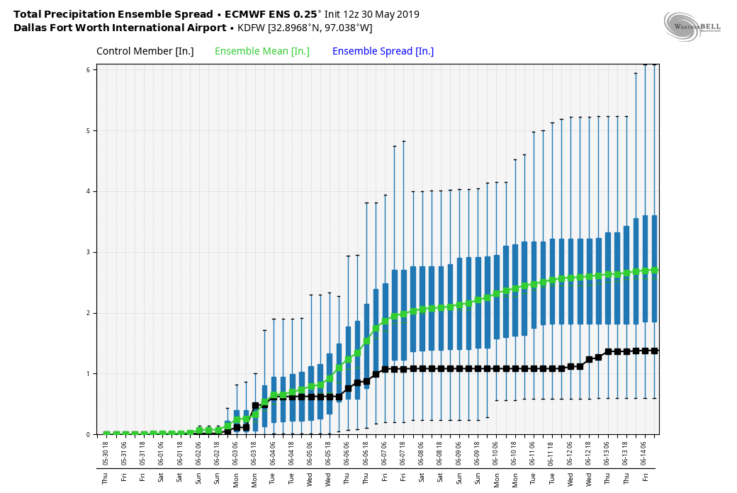 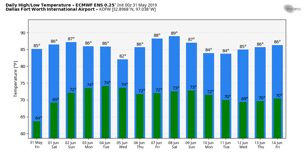 DROUGHT MONITOR: The new drought monitor data this morning shows drought conditions starting to creep back into parts of south and southwest Texas. Most of the state is drought free as a result of the severe weather and rain over the course of the last two months. 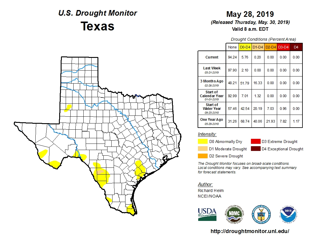 ON THIS DAY IN 2013: A massive EF3 tornado occured over the rural areas just outside of Oklahoma City. This was the widest tornado in recorded history, and was a part of a multi-day tornado outbreak. The tornado touched down southwest of El Reno as it rapidly grew in size and became more violent as it track through central Canadian county. Since the tornado remained over mostly open terrain, it did not impact many structures. However, measurements from mobile radars found 301 mph winds inside of the tornado, the second highest observed wind speeds on Earth, with the May 3rd, 1999 Bridge Creek, Moore tornado only exceeding that number by a margin.
This tornado is also known for killing four storm chasers, the first known deaths in the history of storm chasing. Although the tornado tracked through open terrain, many chasers were caught off guard with the size and movement of the tornado. Near the vicinity of Highway 81, scientist and engineer Dr. Tim Samaras, with his son Paul Samaras and research partner Carl Young, died in the tornado. Paul and Young were ejected from their Chevrolet Cobalt by the tornado's vortex, while Tim still had his seatbelt in the passenger seat. |
Archives
March 2023
Categories |
 RSS Feed
