
|
MOSTLY CLOUDY TODAY - Despite widespread cloud cover across the region, temperatures are in the low 50s to upper 40s this morning which is actually above our average low of 39. Today will be cool and a little wet with showers and rain increasing by the afternoon hours in advance of a potent storm system from the west. Highs will be in the mid 50s later today. FRIDAY AND THE WEEKEND - A cold, soaking rain is expected tomorrow as a surface low moves eastward across South Texas. No severe storms and probably no thunder. Just an all-day rain with temperatures holding in the low 40s over North Texas. Rain amounts of 3-5 inches are likely across the region. Sunday will be mostly dry after the storm system passes with highs reaching the mid 40s. SNOW? FLURRIES? - As the surface low begins to move eastward Saturday and colder air is pulled down into North Texas, there is an increasing risk of some snow/flurries across the North and Northwest part of the state Saturday evening into Monday morning. Based on forecast thermal and moisture profiles, there is a chance that this could put some impacts on travel Saturday night into the day on Sunday. Any rain that is still on the ground at that point would most likely freeze as soon as we hit below freezing. Any additional sleet/snow would cause more concerns for travel, especially for our north and western counties. But of course, this is still a few more days away and things could always change as the system gets closer. We will have our "first call" snow map released later this evening. The significant snow from the system will be mainly to the north and west of North Texas in a broad zone from the Texas Panhandle to Virginia and North Carolina. Some of the heaviest snow from this event is expected to fall in the southern Appalachians. Winter Storm Watches are already in effect for parts of the Texas Panhandle, Central Oklahoma, and areas into Missouri and Arkansas. 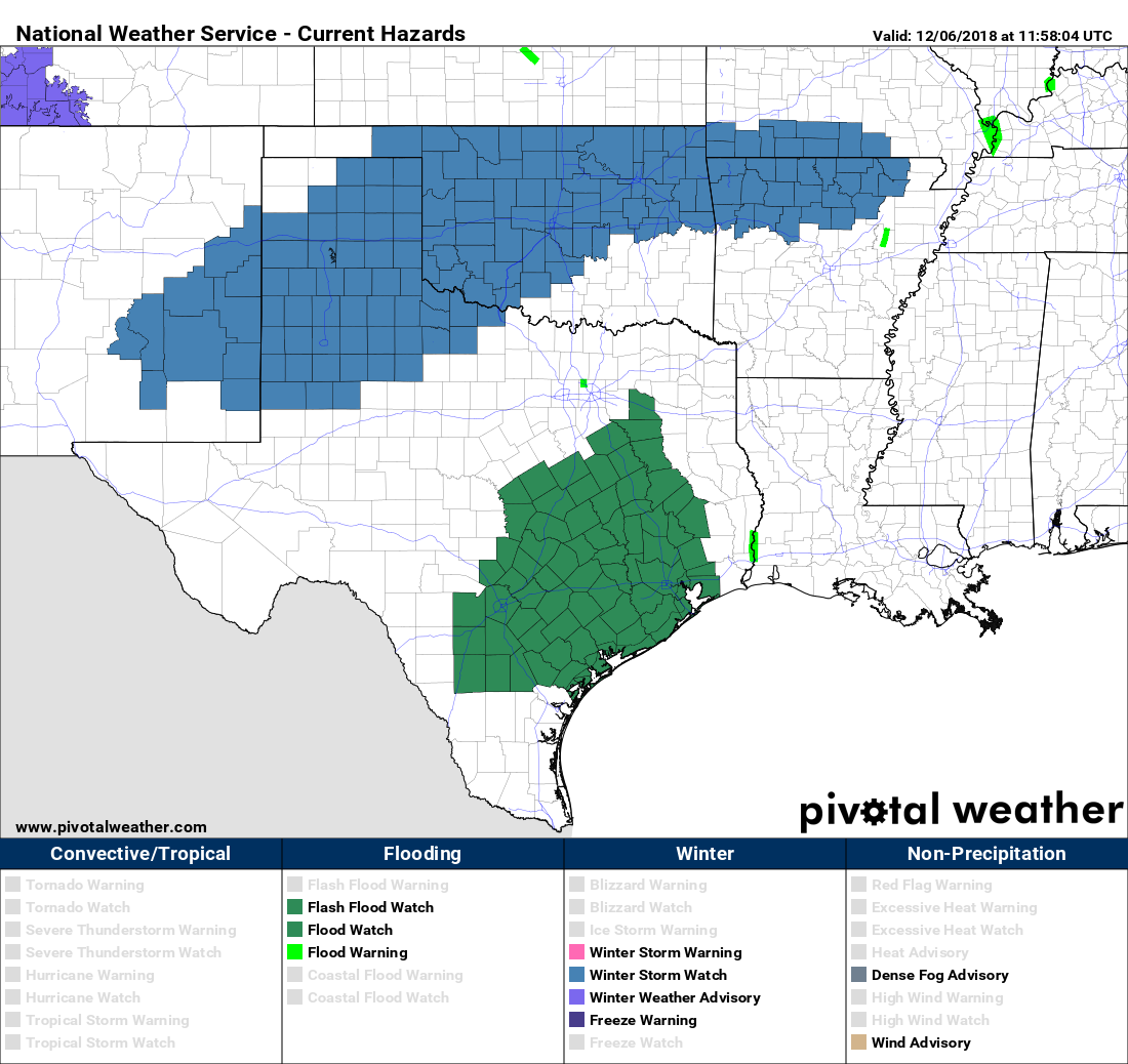 NEXT WEEK - Monday and Tuesday look dry with a slow warming trend, then rain and maybe a few thunderstorms should arrive Wednesday afternoon with a new system developing here, followed another shot of cold air. See the Texas Weather Discussion Video for more details. 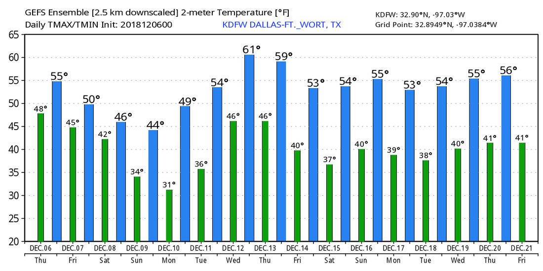 |
Archives
March 2023
Categories |
 RSS Feed
