
|
RADAR CHECK - Rain and thunderstorms continue to move to the east and northeast towards DFW this morning...  A cold front is due in here later this morning, which means that widespread rain and thunderstorms will persist throughout most of the morning and afternoon. Be sure you prepare by taking an umbrella to work or school as you head out this morning. Be careful for wet spots on roadways too. Most of North Texas is in the low 70s this morning, but with the cold front coming through, temperatures will go the wrong way today. We will start in the low 70s, and fall to the mid 60s during the afternoon. Don't expect much sunshine if you don't see rainfall. Rain amounts should stay in the 1/2-1 inch range. THE WEEKEND - Once the cold front moves through, we immediately warm back up on Saturday with highs in the low 80s with sunshine in full force. We stay pleasant during the weekend with highs in the mid 80s with overnight lows in the low 60s under a fair sky. NEXT WEEK - Looks like the week full of EOC's and AP testing will be mostly dry and mild with afternoon highs in the upper 80s under a sunny sky. There is a chance that some places could see 90 for the first time this season, but that's way too far out to predict. See the Texas Weather Discussion Video for more details. 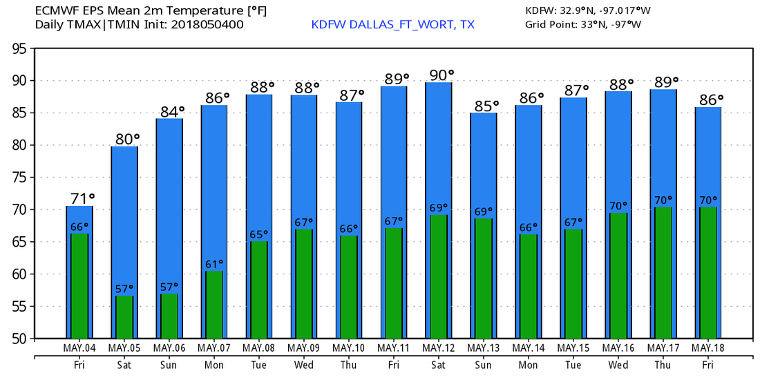 |
Archives
March 2023
Categories |
 RSS Feed
