
|
Cold Start - Temperatures are in the mid to upper 30s across North Texas, warmer than yesterday, where we were in the 20s. Due to cold air advection from a cold front pushing through this morning, most of us should struggle to get out of the 30s today, so you might want to grab a jacket and an umbrella as you head out. The sky will be mostly cloudy today. Today, rain is expected for all of north Texas this afternoon and evening. Thunderstorms is likely this evening, with a few turning marginally severe producing severe hail at times. This is where the SPC has introduced a 'marginal' risk for severe storms for areas generally to the south of DFW... 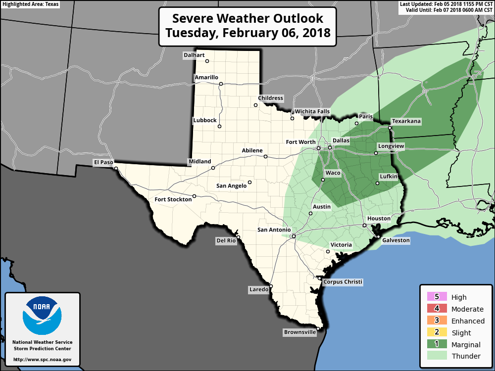 Later in the evening, some of the rain could turn into a freezing rain/light sleet mix as the preexisting freezing rain pushes to the southwest. However, freezing rain is most likely for areas to the north and west of DFW, where a Winter Weather Advisory has been issued... 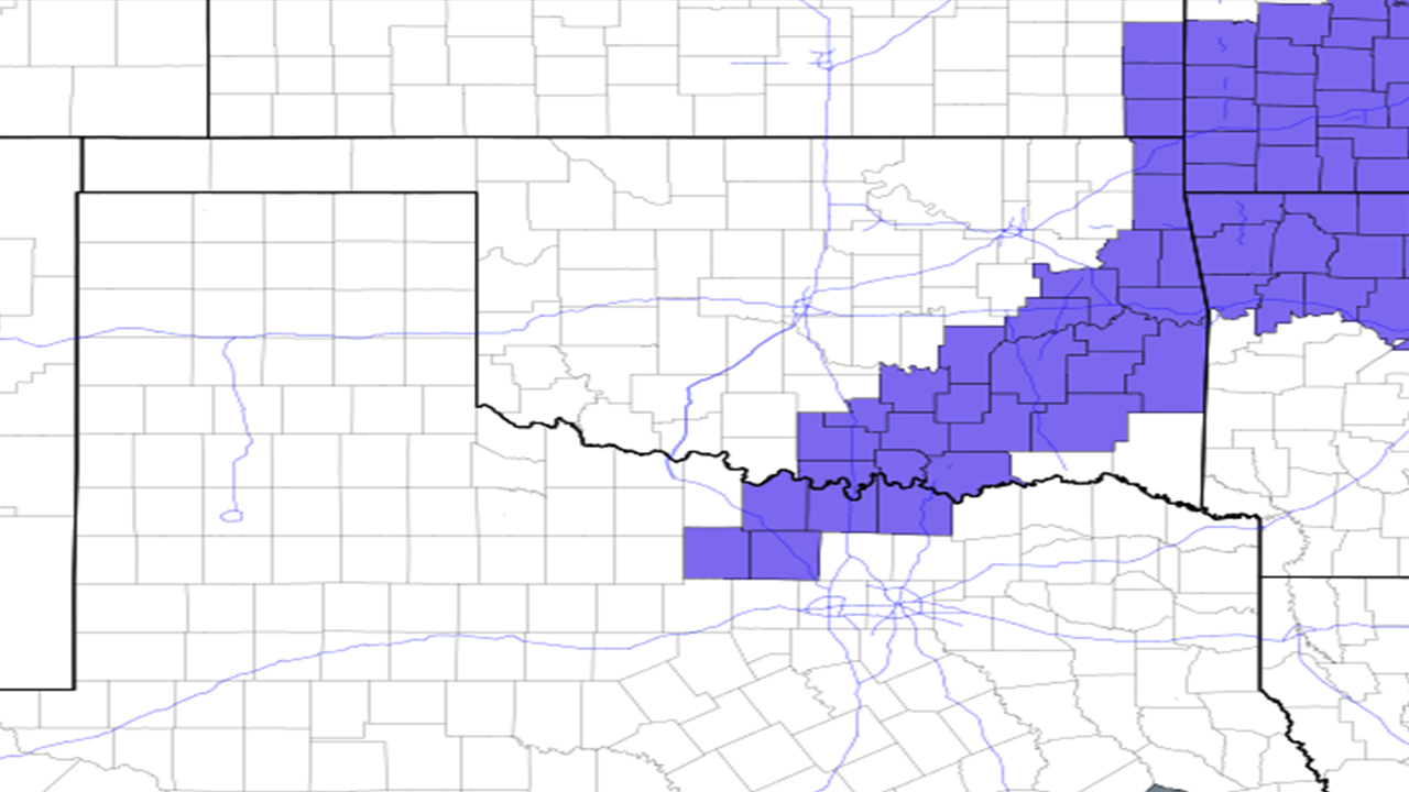 Just know that I would not be surprised if the Winter Weather Advisory expands to include Parker and Palo Pinto counties, and areas to the south. Timing - From noon to 2PM, showers will be possible to the southeast, with freezing rain likely falling in the Wichita Falls area. From 2P to 4P, rain starts to become more widespread as the main front pushes to the north. And from 4P to 10P, this is where rain is most likely going to be widespread over most of North Texas. Freezing rain will also be a possibility as well, and could start impacting DFW at around 6P or later IF freezing rain makes it to DFW. Impact - Though no flooding issues is expected from this system, freezing rain remains very possible this evening and tonight. If freezing rain falls, light ice accumulations will be possible on mostly bridges and overpasses, which may lead to hazardous travel in some spots. Additionally, severe hail will be possible from a few marginally severe storms, which may lead to minimal hail damage where it falls. So the bottom line is, don't worry about a big hail storm or major ice problems, just be prepared in case freezing rain makes it to DFW. Rest of the Week - Sun will start to peak by Wednesday, with mostly sunny conditions on Thursday. We will warm up after today, with highs in the mid 60s by Friday. Weekend - Our next chance of rain will start Saturday morning with mostly cloudy conditions. Highs will be in the low 60s on Saturday, with a cold front coming through on Sunday, dropping the high to the mid 40s the next day. Next Week - Seems like our next rain chance will start right on Monday with a few showers, then rain appears possible for most of next week. It will be a muggy week if this verifies. See the Texas Weather Discussion Video for more details. 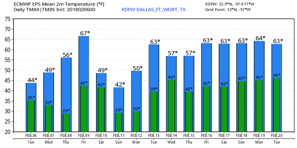 |
Archives
March 2023
Categories |
 RSS Feed
