
|
**No Texas Weather Discussion Video this morning due to planning** Radar Check - Really not much to say looking at the radar, other than scattered showers about, mainly to the east of I-35. 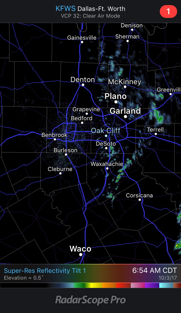 We should see more of these increase throughout the day, especially with the surface front coming through. The best chances of rain for DFW will come after 4:30 and end after 10:00. But in reality, you should prepare to see some rain anytime of the day. 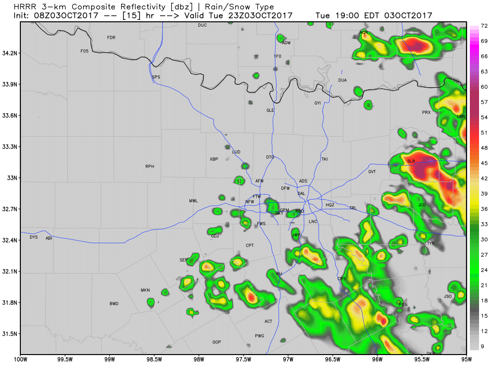 I still think the higher chances of rain will remain to the east of I-35, but please note that this model will NOT reflect actual conditions. Scattered to perhaps numerous showers and storms will be likely for all of North Texas today. Some storms may be strong to perhaps briefly severe. Otherwise, the high should be in the low to mid 80s, with ample cloud cover during the morning/afternoon hours. Tomorrow - The potential for scattered showers and storms still exists, mainly in the morning hours. Yes, there will be a possiblility, but it shouldn't be as widespread as today. The high should reside in the mid to upper 80s with clouds deteriorating. Thursday and Friday - We trend drier heading towards the weekend, with rain looking less and less likely in the coming days. Highs should remain in the upper 80s, which is a great look for high school football games. The Weekend - Not much change. We could see a few showers and storms on Saturday, but otherwise, most locations will stay dry with highs in the upper 80s. Next Week - After Monday, cooler air will be featured with a strong cold front coming through with highs dropping into the low 70s and lows reaching into the 50s. 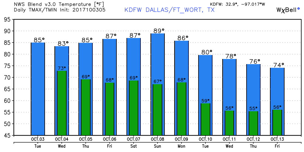 Tropics - All eyes will be on the Gulf of Mexico and the Caribbean Sea where development will be possible in coming days. While the formation of a tropical cyclone is looking more likely with time, it remains unknown whether or not this becomes a tropical storm or depression. For now, the main threat will be heavy rain for parts of the Gulf of Mexico and the southeast U.S. Coast. 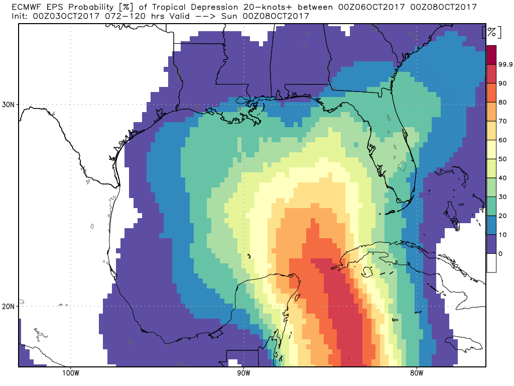 |
Archives
March 2023
Categories |
 RSS Feed
