
|
Quiet Morning - Surprisingly, we are starting this morning quiet with no showers and storms about and with temperatures in the low to mid 70s, as usual. Although some locations could see scattered showers and storms, expect most locations to be dry today with highs in the low to mid 80s. We should also stay mostly dry tomorrow with mostly cloudy conditions again with highs in the mid 80s, staying below average for this time of the year. Midweek - This week's weather will all largely depend on how Tropical Storm Harvey behaves. It has already came through many locations in southeast Texas (including Houston), and caused catastrophic and life-threatening flooding in some densely populated areas. This will continue to pour heavy rain over that region until the latter half of the week due to virtually no steering currents. When it finally decides to move on Thursday, we could experience its effects. We should stay cloudy for most of of the week with occasional scattered tropical downpours at times. We can't really say what time it is going to rain yet because the threat really lasts all day, but scattered showers and storms will be possible all throughout, especially during the latter half of the week. Weekend - After the remnants of Harvey moves well to our northeast, we are left with drier air creeping back in which will create more sunshine than clouds. Mostly all locations in north Texas should enjoy sunny skies with highs in the upper 80s. Next Week - Another disturbance comes through the area, which will also pose another risk for a few showers and storms early next week. Details are not clear now, but highs should still stick around in the lower 90s to upper 80s next week, still staying below average. 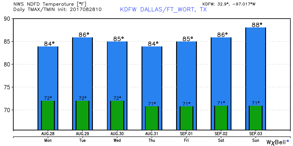 Harvey - Tropical Storm Harvey has caused unprecedented flooding and major damage in area like Houston and Galveston this weekend. The flooding threat is still expected to be an issue for that area until Wednesday or Thursday, when the system finally starts to move. Some spots have already received two or three feet of rain in the last 48 hours or so. Most rivers in the region are in the major flood stage. If the same areas receive an additional two feet of rain, that will beat any record for the most amount of rain in Texas from a tropical storm/hurricane. This system will move back into the Gulf, potentially making third landfall before it goes anywhere, creating a worse-case scenario in terms of flooding. 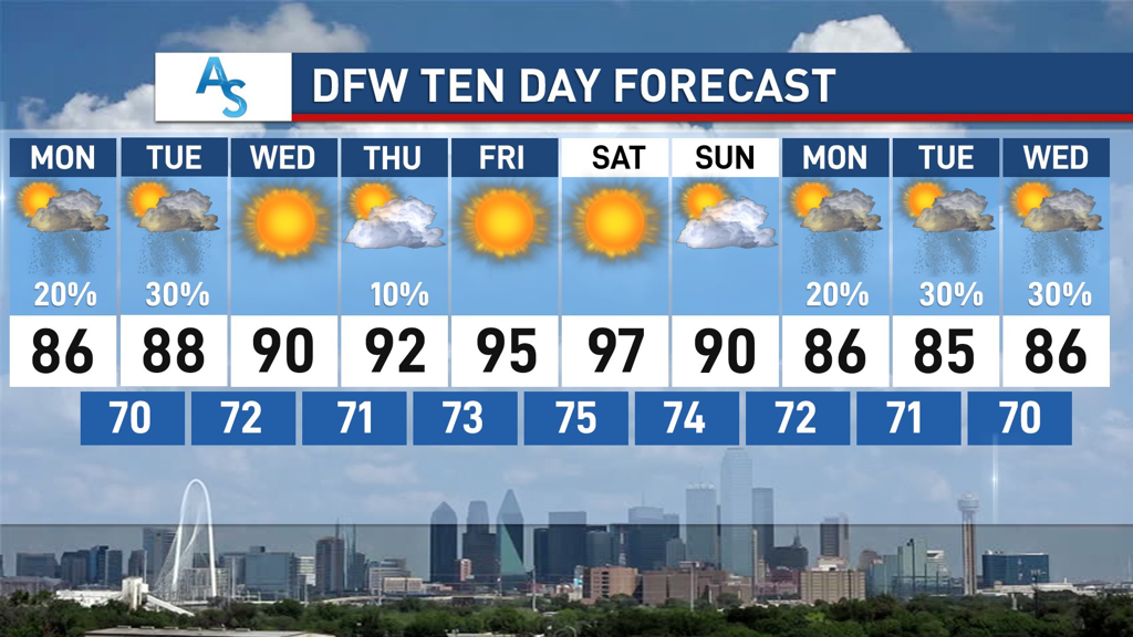 The center of circulation is expected to move north starting Thursday, as a tropical depression. The risk for heavy rain and isolated tornadoes will continue to the north and east of the circulation. 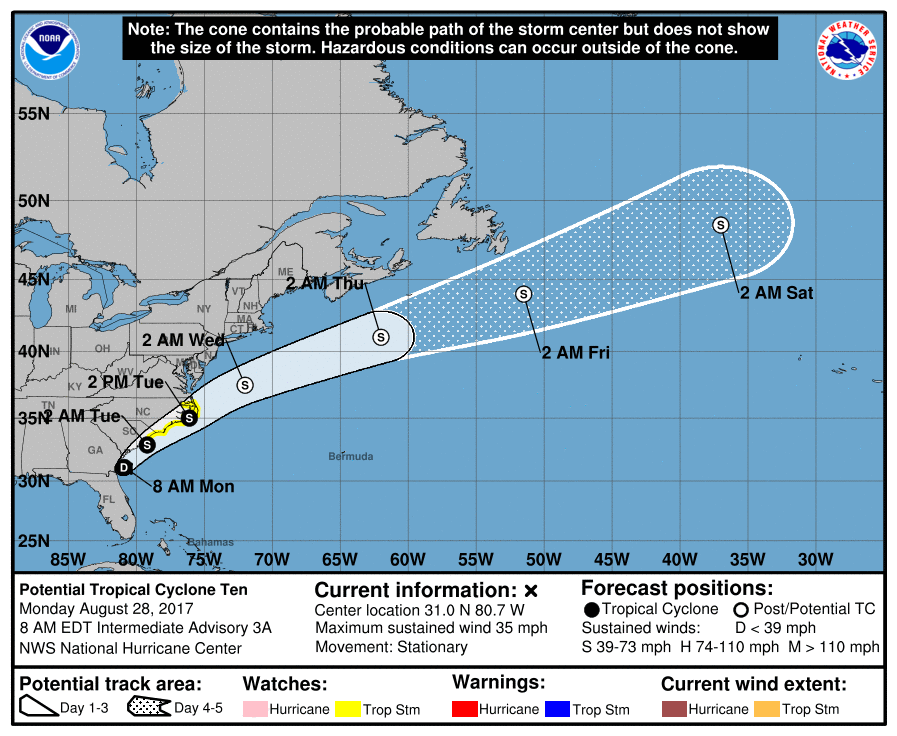 Potential Tropical Cyclone Ten is just off the coast of Jacksonville, Florida, and is expected to become tropical storm Irma during the next 24 hours. This will skirt the coast of the Carolinas, and then track over open water over the Atlantic afterwards. No impact to the U.S.
There is another wave that is just off of the African coast, that has a fair chance of developing. If it develops, it's name will be 'Jose'. We currently do not know where this system may end up. See the Texas Weather Discussion Video for more details. |
Archives
March 2023
Categories |
 RSS Feed
