
|
Dry Through The Weekend - The easiest part of this blog update involves today through the weekend. Expect dry weather for North Texas this weekend with a good supply of sunshine with highs in the upper 80s. We will continue to have mild mornings, with lows in the 70s in most spots. Tropical Depression 16 - The weather for the weekend for the Southeast part of the U.S will be greatly determined by how this system behaves, which is now skirting the coast of Central America. Here are the important points... *The depression is still expected to become Tropical Storm Nate later today once it moves off the Central America coast. *NHC has adjusted the track to the west overnight, now suggesting landfall will come across Southeast Louisiana, and then South Mississippi Sunday morning. But, don’t focus on the exact forecast track, especially at the longer ranges, since the average NHC track errors are about 175 and 225 statute miles at days 4 and 5, respectively. More changes are very possible. 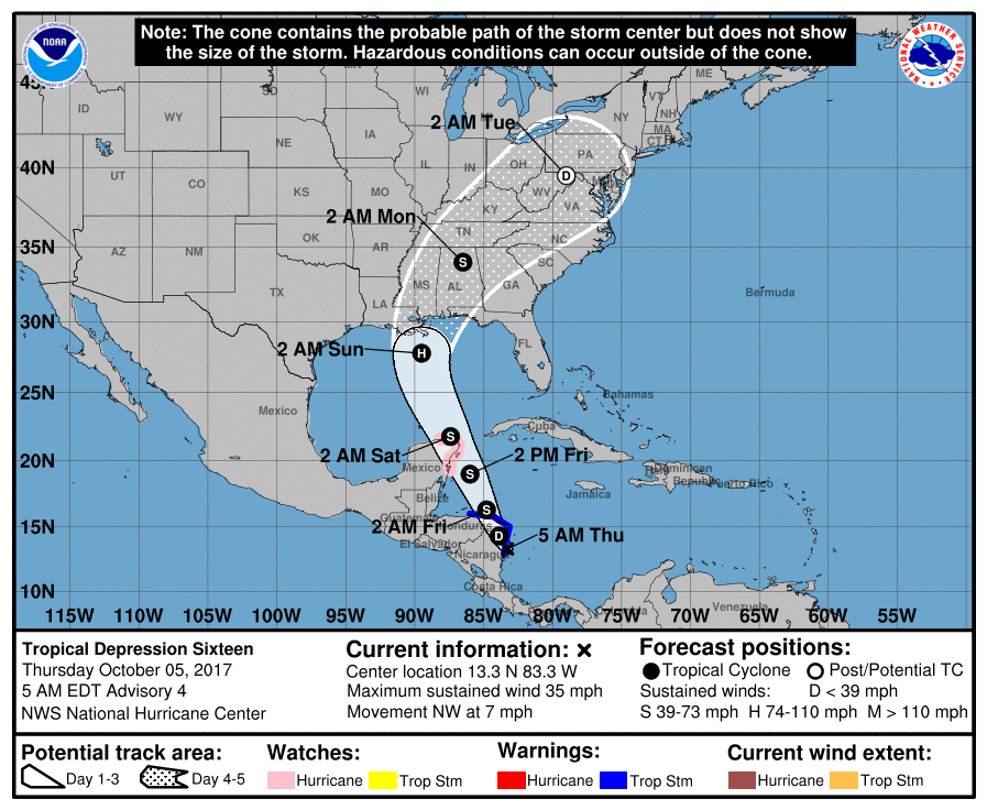 *The European global model shifted to the west on the 00Z run, in better agreement with the GFS and other tropical models. But, there is considerable disagreement concerning the timing of landfall; the Euro is much slower, showing the system moving into the Central Gulf Coast Sunday evening. On the other hand, the North American Mesoscale (NAM) model shows landfall late Saturday afternoon. The bottom line is that uncertainty remains in the forecast. *NHC suggests that “Nate” will be a category one hurricane at the time of landfall, but the system will encounter cooler water near the coast, some westerly shear, and also some dry air. The last two runs of the GFS shows only a weak tropical depression or storm moving up into the Gulf Coast, and the NAM is in fairly good agreement. So, there is a chance this doesn’t reach hurricane strength. But, there is only marginal skill in forecasting the intensity of a tropical cyclone four days in advance. *We note SPC has a “marginal risk” of severe weather defined for the Central Gulf Coast Saturday; a few isolated tornadoes are possible there. 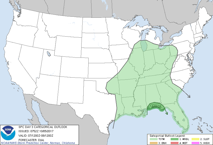 *It is too early to know if there will be a tornado threat inland Saturday night and Sunday. It depends on the strength and structure of the tropical system.
*If you have a beach trip planned this weekend, I would still hold off on changing plans until later today. But, it looks fairly certain that the weekend will be wet and windy for places like Gulf Shores, Pensacola Beach, Destin, and Panama City Beach. Conditions there improve Monday. Next Week - Dry, warm air should continue to linger across the state on Monday. Then, cooler, moist air should filter our region by Tuesday, where highs should drop to the mid 70s in most spots. See the Texas Weather Discussion Video for more details. |
Archives
March 2023
Categories |
 RSS Feed
