
|
Cold Start - Temperatures are in the upper 30s to mid 40s range for most of North Texas due to the cold air advection from the cold front. Luckily, today will be an absolutely pleasant day with abundant sunshine with highs in the mid 60s. The Weekend - Same deal tomorrow - chilly nights, pleasant days ahead. We project a high of around 68 on Saturday with some places touching 70. We could see a mix of sun and clouds during the day. We will need to mention the chance of isolated showers and thunderstorms during the afternoon and evening hours on Sunday. Some of those storms could turn marginally severe with the possibility of large hail with the isolated severe storms. The SPC has a marginal risk for severe storms defined for much of the southern and central plains... 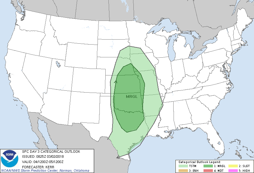 Most rain amounts should stay below 1/10th of an inch, and afternoon highs will be in the low 70s. Next Week - For the first time in a while, next week will be a completely dry week with very little to no rain expected. Expect cool nights and pleasant days ahead with afternoon highs in the mid 60s and morning lows in the low to mid 40s. See the Texas Weather Discussion Video for more details. 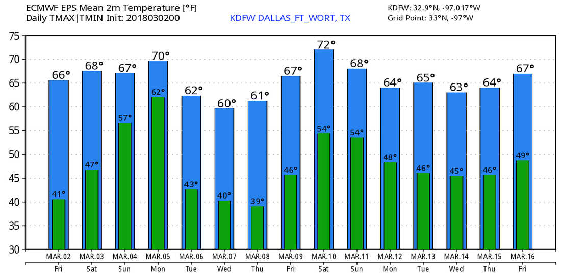 On This Day in 2012 - A deadly tornado outbreak occurred over a large section of the Southern United States into the Ohio Valley region. The storms resulted in 41 tornado-related fatalities, 22 of which occurred in Kentucky. Tornado-related deaths also occurred in Alabama, Indiana, and Ohio. The outbreak was the second deadliest in early March for the U.S. since official records began in 1950. This was a "High Risk" Day issued by the Storm Prediction Center.
|
Archives
March 2023
Categories |
 RSS Feed
