
|
COOL MORNING - Temperatures are in the upper 60s across the board this morning, which is a clear indication that fall is here, given that we haven't seen lows this cool in quite some time. High cloud coverage will persist throughout the day in North Texas, and afternoon highs will struggle to get out of the 70s as a result. We can't rule out a passing shower or thunderstorm in a few places. We could see some scattered showers and thunderstorms tomorrow before the afternoon, mainly for areas near Dallas and to the east of I-35. Sunshine within breaks in the clouds is possible each day, but afternoon highs will still be in the low 80s tomorrow as we have a few thunderstorms near Dallas eastward. WEDNESDAY THROUGH FRIDAY - We start to see clouds start to clear out, so we will mention a mix of sun and clouds starting Wednesday and Thursday with afternoon highs warming up to the middle to upper 80s. Areal coverage of scattered showers and thunderstorms will increase Friday, but the best chance of one spot getting wet is only in the 30 percent category for now. Just like Wednesday and Thursday, highs will stay in the upper 80s. THE WEEKEND - We start to warm back to average temperatures for the weekend, with highs around 88-92° each day. Any showers and thunderstorms for the weekend will be confined to a minimum. A mix of sun and clouds is expected Saturday and Sunday. NEXT WEEK - It looks like most of next week will be filled with a mix of sun and clouds in the sky. Afternoon highs will continue to be in the upper 80s, still right about average for mid-September. 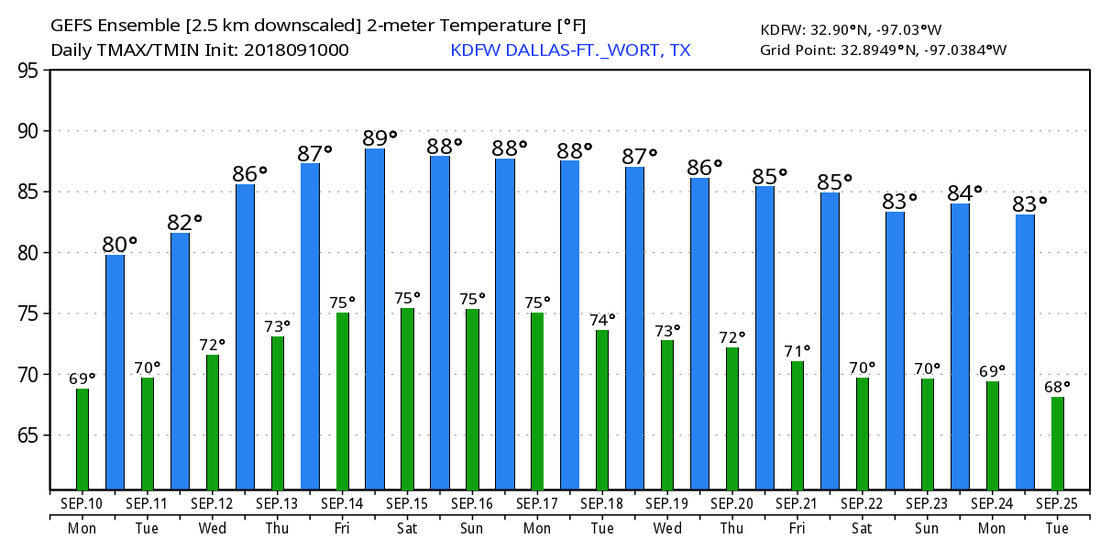 TROPICS - There are three active hurricanes in the Atlantic Basin; Issac, Helene, and Florence. The last time we had three hurricanes in the Atlantic Basin was last year when Irma, Jose, and Katia were still around. This is to be expected since we are in the climatological peak of hurricane season. 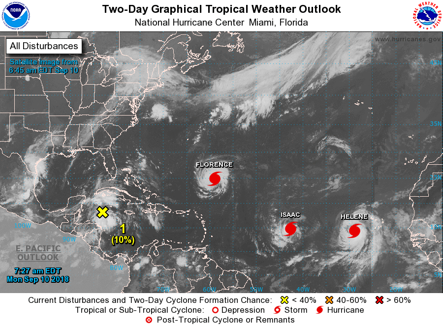 HELENE - Helene is a minimal hurricane just off of the African Coast with 80 mph sustained winds. The NHC anticipates this cyclone gaining latitude and moving north, away from the U.S. ISAAC - Isaac is another hurricane in the Atlantic which is moving due-west. It is expected to impact the Cabo Verde Islands as a minimal hurricane/high-end tropical storm. It remains to be seen if this moves towards the Gulf of Mexico or turns north out to sea. It’s way too far out. FLORENCE - Florence is still a high end category two hurricane with 105 max. sustained winds. This is expected to intensify to a major hurricane later today, further intensifying into a category four and maintaining its strength while landfalling near the Carolina Border. 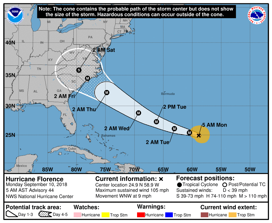 Hurricane Warnings and Watches will soon be issued for areas in and around the cone. Evacuations for the Carolinas and Virigina and other areas around the coast should begin today.
Another main impact from Florence will be heavy rain once this system landfalls and meanders over the region. This would mean some places would see about 1-3 feet of rain. It is imperative that you know the post-landfall effects of this system. See the Texas Weather Discussion Video for more details. |
Archives
March 2023
Categories |
 RSS Feed
