
|
Today we continue to start the day with (sort of) fall-like temperatures in the 60s with some cooler pockets reaching towards the 50s. Don't get too caught in this, as we are expected to warm to the mid to upper 90s during the latter half of the week as ridging in the upper-levels gets involved. But enjoy highs being in the mid 80s today while you can with abundant sunshine. Mid-Week - As ridging gets involved and Irma dissipates, we should continue on a gradual warming trend before peaking during Friday, where highs are expected to be somewhere between 93 and 97. We should also see a few clouds here and there as well. Thursday and Friday also looks great for high school football, as always. :) The Weekend - Not much change. We continue to stay in ridging, which will create mostly sunny and hot conditions. Highs will continue to range between 93 and 96 degrees with lows in the middle 70s. Next Week - Very little change. We continue to stay dry for virtually all of next week. The one chance that we might see some precipitation would be next Tuesday, but due to ridging in the upper-levels, most locations will continue to stay dry. Highs will be in the low 90s. Irma - Hurricane Irma (now a category one storm) made landfall yesterday near Key West at 9:10 PM EDT. This is the first time in U.S. history that two category four hurricanes made landfall in the continental U.S. in the same year, and let's keep it that way. At 4:00 AM CDT, Irma was located near Crystal River, with maximum sustained winds of 75 mph. This storm will continue to move to the north-northwest at 18 mph weakening to a tropical storm later today, before becoming post-tropical cyclone by Wednesday night. 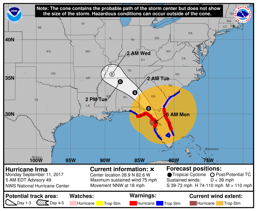 Those that are to the northeast of the circulation will still have to deal with an isolated tornado threat. Those of you that are in Alabama (which is experiencing some of the storm's effects) will have no tornado threat. Again, this storm should become post tropical-cyclone by Wednesday night. Jose - The other Hurricane that is located in the Atlantic is located a few hundred miles north of the Dominican Republic... 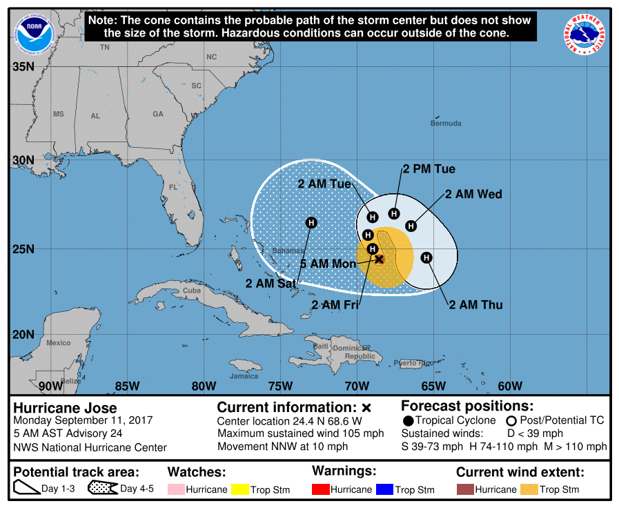 This storm is expected to make a U-turn into the open Atlantic, staying in open water, or just off of the East Coast, with some uncertainty involved. See the Texas Weather Discussion Video for more details.
|
Archives
March 2023
Categories |
 RSS Feed
