
|
Freezing Start - Temperatures are in the mid to upper 20s across the board this morning, with some of the urban places touching the low 30s; a classic February morning. Most of the ice on the roads from yesterday's winter event has already melted, so most of the roads will be fine. We will warm to the mid 40s today with sunshine out in full force. Look for a very similar day tomorrow with highs in the low 50s. However, a few showers will be possible during the evening hours as moisture begins to increase. The rest of the day should be mostly sunny. Wednesday through Friday - Wednesday should feature a rainy morning but pleasant day with highs in the low 60s, after starting the morning off in the upper 40s. Thursday will be a very dry day with afternoon highs in the mid to upper 70s, with some places touching 80, some even flirting with record highs. A cold front comes through Friday morning, which will cause afternoon highs to stick in the upper 40s. Rain will also be possible in advance of that front, but it remains known whether or not we see winter weather return during the afternoon. The Weekend - After seeing a few showers go through Saturday morning, look for mostly dry conditions with highs in the mid to upper 50s and lows in the 40s. Most of the weekend will be dry. Next Week and Beyond - The very beginning of the week looks dry with highs touching the mid 60s, then rain will return mostly during the latter half of the week, but too early to pinpoint any specific start/stop times. Notice how I've said 'rain' more than usual in this post, that's because we will have chances of rain this week, and even more chances next week. In fact, the CPC (Climate Prediction Center), shows that we will see more precipitation than average through the six to ten day period, which will definitely help with some of the drought problems. See the Texas Weather Discussion Video for more details. 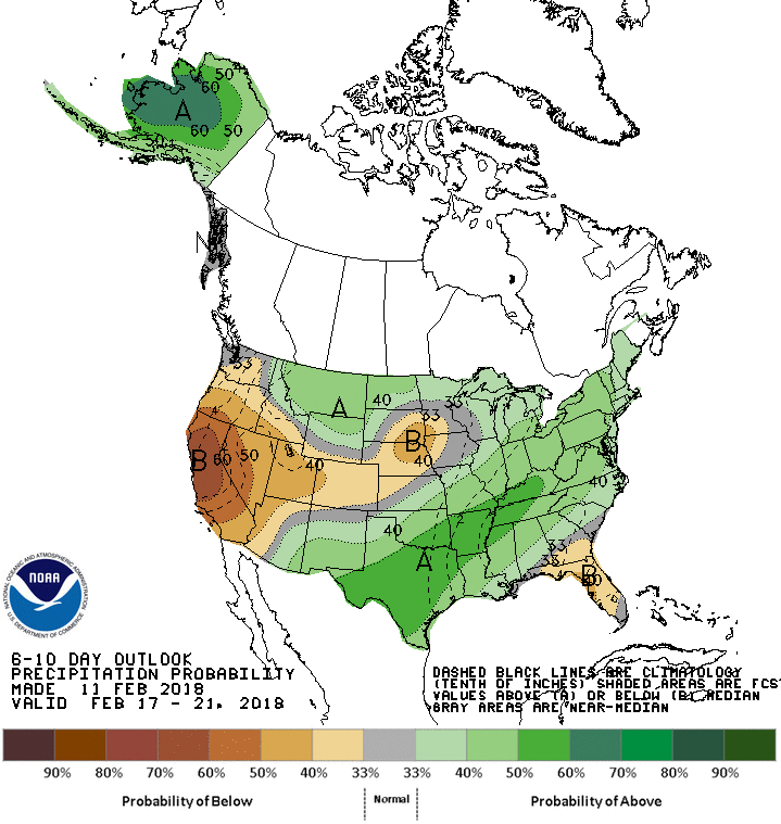 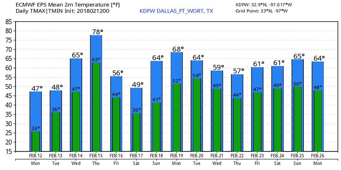 |
Archives
March 2023
Categories |
 RSS Feed
