
|
DRIER AIR STILL IN PLACE: After an unsettled period of wet weather Friday night through Saturday afternoon, drier air is still in North Texas today. The sky will feature partly to mostly sunny skies with a high in the low 80s, which is actually where are seasonal averages are at. The average high for DFW for May 13 is 83°. Tonight will remain dry and fair with many places ending up in the low 60s again. The day will feature a mix of sun and clouds with rain showers possible for our southwestern counties. The high will remain in the low 80s. REST OF THE WEEK: Not much change. Each day will feature mostly sunny skies and breezy conditions with afternoon highs in the mid 80s. We will see a notable increase in humidity each day. THE WEEKEND: Another storm system is due in here on Saturday, and severe storms will be possible on that day. The SPC has already issued a risk of severe weather for Central Texas extending into Southern Kansas. This includes all of the North-Central Texas area. 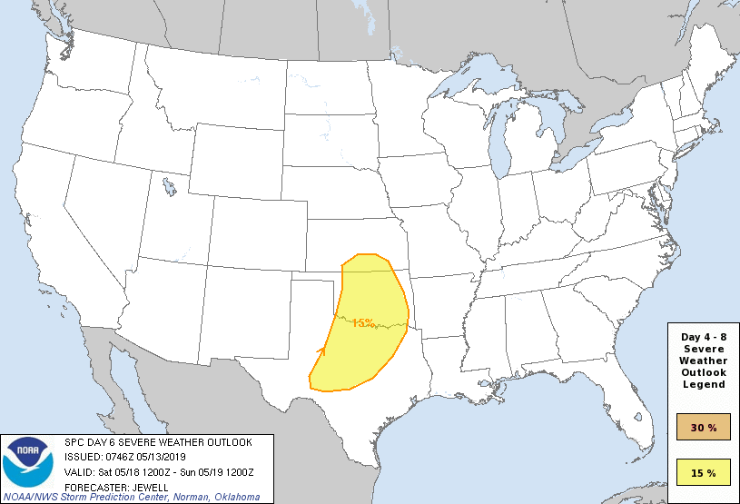 There is still significant model spread concerning the storm mode during the afternoon and evening. At this point, is it far too early to pinpoint any specific threats, timing, and placement of the storms. This just serves as a heads-up going into the weekend. Then we clear the state of any rain on Sunday. We will stay mostly sunny with highs in the mid 80s on both days. NEXT WEEK: The beginning of next week looks tranquil with afternoon highs in the mid 80s. No signs of any hot 90° for the time being. See the Texas Weather Discussion Video for more details. 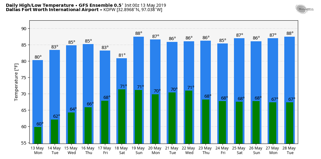 |
Archives
March 2023
Categories |
 RSS Feed
