
|
The Texas Weather Discussion Video is a detailed weather discussion that goes far beyond what is normally shown in a traditional TV setting! From Donovan Neal and ApexStorm - Dallas/Fort-Worth. ACTIVE WEATHER AHEAD - A dynamic storm system will bring multiple chances of severe weather from the southern Plains through much of the Deep South this afternoon, evening, and through parts of Saturday morning. The SPC has defined a moderate risk of severe storms (4/5) for the lower Mississippi River Valley, with an Enhanced Risk (3/5) surrounding it.  Closer to home, we have the standard "slight" risk (2/5) of severe weather for most of the metroplex, with the enhanced risk in the northeastern corner of the state for this afternoon and evening... 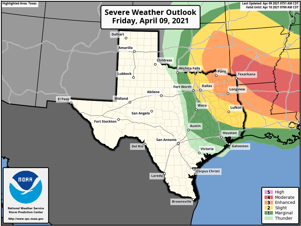 TIMING - Keep in mind that the threat for severe storms today remains very conditional. The cap, which is the warm layer just above the surface, is known for keeping North Texas safe from major severe weather events when they are forecast. If storms had the best chance to break the cap, they would do it from around the 3:00-9:00p hours. THREATS - Any storm that develops will remain isolated. That being said, most places will stay dry this evening. However, said storms would be capable of producing hailstones greater than two inches, and maybe an isolated tornado or two, especially to the east of US 75. RAIN - Rain amounts are expected to stay fairly light, with many locations getting nothing at all, while some places will receive downpours from the isolated storms Just make sure you have a way of getting warnings this afternoon and evening as very large hail will be a concern with any severe thunderstorm that develops in the metroplex during the PM hours. The sky becomes mostly sunny tomorrow as a dry slot moves into the state... the high will be in the mid 70s. SUNDAY AND NEXT WEEK - Sunday and Monday will feature a mix of sun and clouds with dry weather on both days. Highs will stay pretty close to the low 80s with fair nights. A few showers and storms are likely Tuesday through Thursday, with severe weather possible on Friday. See the Texas Weather Discussion Video for maps, graphics, and more details. 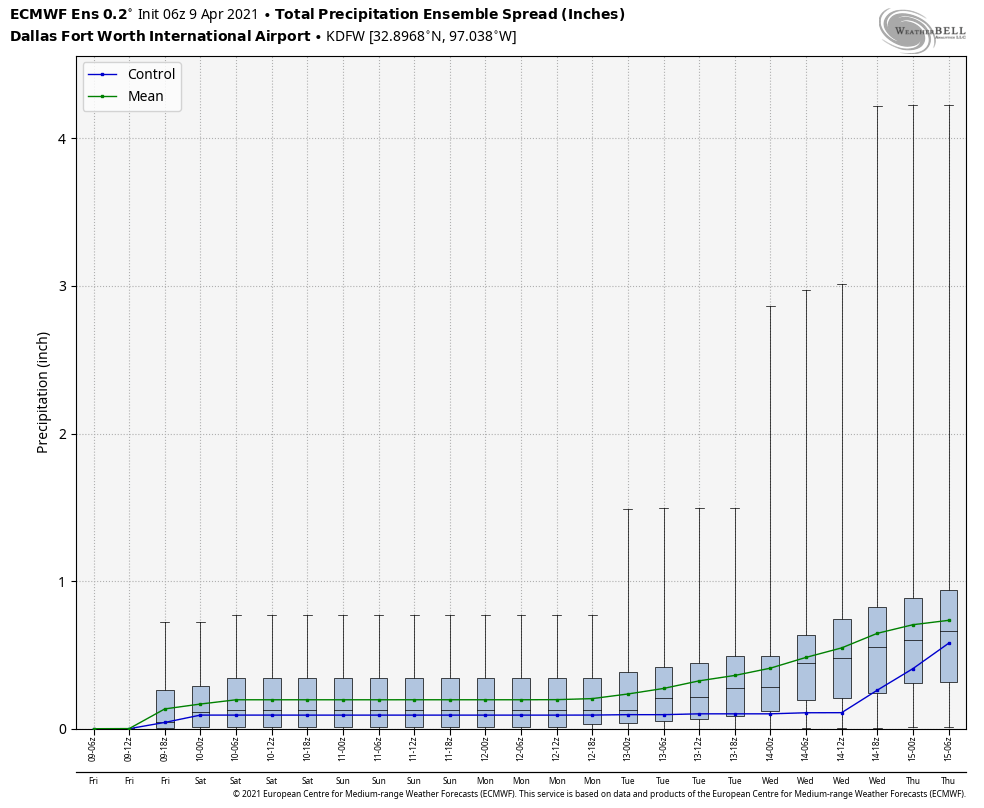 ON THIS DATE IN 1947 - An estimated F5 tornado struck Woodward, Oklahoma during the late evening killing 95 persons and causing six million dollars damage. The tornado, one to two miles in width, and traveling at a speed of 50 mph, killed a total of 167 persons along its 221-mile path from Texas into Kansas, injured 980 others, and caused nearly ten million dollars damage.
CONNECT - You can find me on most of the major social networks.... ApexStorm Weather Text Messaging System Be sure to join the text message remind and follow my twitter for weather updates throughout the day... enjoy the weekend! |
Archives
March 2023
Categories |
 RSS Feed
