
|
Sub-Mild Morning - That's something we haven't said in quite some time. Temperatures are in the upper 60s, with many places in the 70s this morning, about 18 degrees above the average low for late March. We will continue to remain cloudy, but highs will remain in the low 80s. tl:dr - An active weather pattern will set up through Thursday, with severe weather and heavy rainfall expected during that time. Due to troughing in the southwest, with a slow-moving upper-low, a stalled front at the surface, and ridging to the east of us, moisture will surge in to the big state, which will result in heavy rain and flooding in some spots becoming likely on Tuesday and Wednesday. Today, we will deal with the severe weather threat in West Texas before we get to the heavy rain part. The SPC has defined a risk for severe weather for most of West Texas, with the standard "slight" risk extending from San Angelo all the way to the north of the Oklahoma City metro... 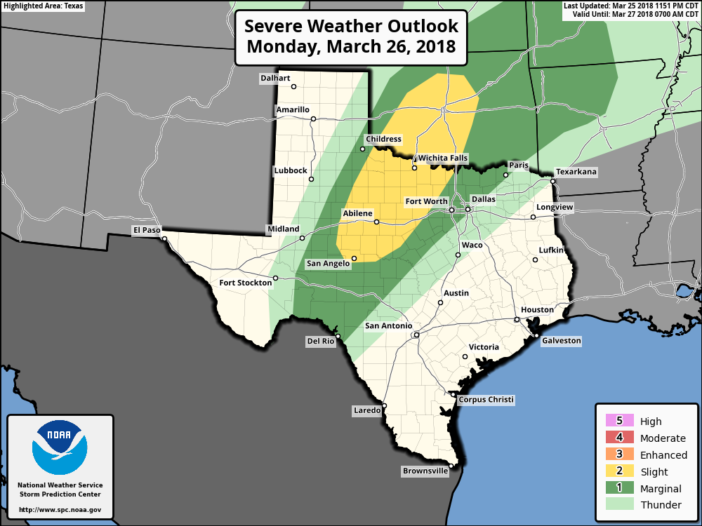 The one thing that we can guarantee is that the storm coverage this week will be much higher than the lone supercell near Wichita Falls yesterday. Multiple rounds of thunderstorms appear likely. Timing - An initial batch of possibly severe storms could develop after 1PM in West Texas. Since these storms may be more discrete in nature, they will be capable of mainly large hail and a couple of tornadoes. Our second round of thunderstorms roll in here after 4PM. Still to the west of the DFW metro, these storms will be capable of mainly large hail and damaging winds, though an isolated tornado cannot be ruled out. During the overnight hours, scattered showers begin to overspread North Texas. From there, we will mention a chance of showers and storms throughout the day on Tuesday. It will not rain all day, but rain will be possible at times. Then, numerous showers and thunderstorms overspread the region during the pre-dawn hours on Wednesday, which will set up for a wet morning commute. From there, we will mention the possibility of scattered showers and thunderstorms at times throughout the day, before all of the activity pushes off to the east. From there, we should be mostly dry and pleasant on Thursday and Friday with highs in the low 70s. Rain amounts will be in the 2-4 inch rain in most spots this week. The Weekend - We will stay dry during the Easter weekend with afternoon highs in the mid to upper 70s with lots of sunshine. Next Week - For the beginning of April, we will stay comfortable and variable with afternoon highs in the low to mid 70s with a mix of sun and clouds. No sign of any significant severe weather for at least the next ten days. See the Texas Weather Discussion Video for more details. 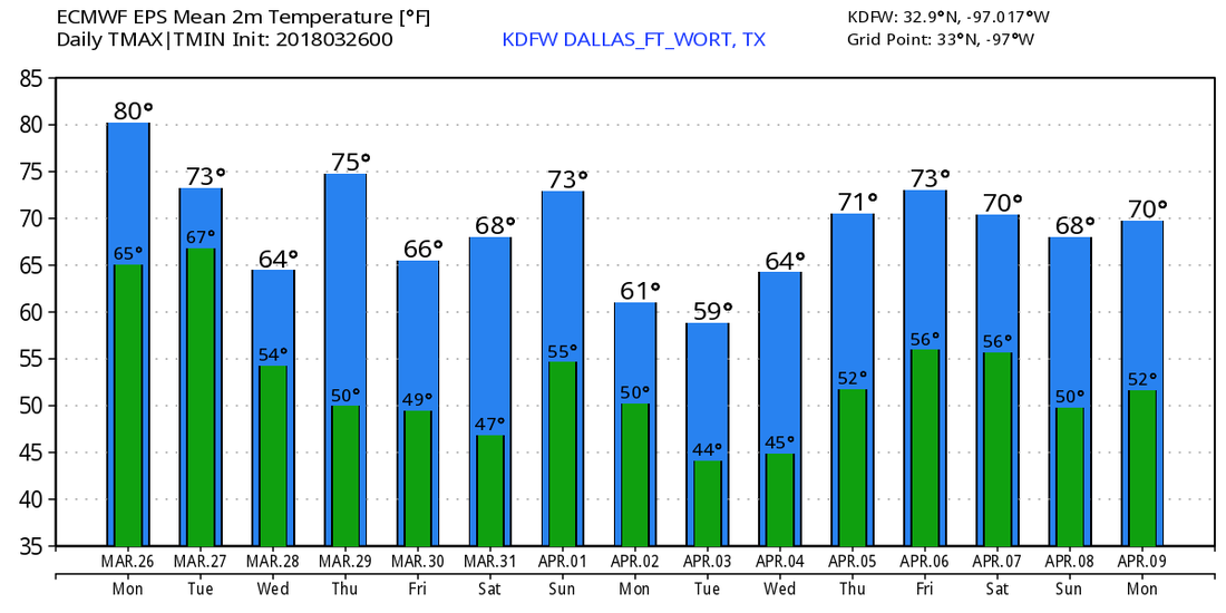 |
Archives
March 2023
Categories |
 RSS Feed
