
|
*no Texas Weather Discussion Video this morning* CHILLY MORNING - Temperatures are mostly in the mid 40s across the great region right now, which is still a few degrees cooler than yesterday. Clouds and fog will affect the morning commute, but we could see some sun peak during the day. A couple of showers will be possible mainly during the evening, and the best chance of one spot getting wet is in the 40-50 percent bracket. Some rain may persist overnight. Today's high will be at or close to 70°. THE WEEKEND - After starting the day basically at the freezing mark, we turn sharply cold starting Saturday with the coldest air of the season thus far. If we still have some moisture by the morning hours, I wouldn't be surprised if we see some flurries by early morning. The arctic cold front Friday evening will send temperatures plummeting into the mid 30s by mid-morning. But we will see a slight recovery into the very low 40s by the afternoon. We should clear into sun by the afternoon. It will also be windy with a northwest wind of 25mph, with gusts to 30mph likely. However, wind chills will be in the 20s, so it will definitely feel much colder. After a hard freeze overnight, Sunday should be mostly sunny with highs in the mid 40s. Although the wind will not be as strong, wind chills in the 20s are still very well possible. NEXT WEEK - At this point, next week features mostly a mix of sun and clouds with highs mostly in the mid 40s - mid 50s range by the afternoon. 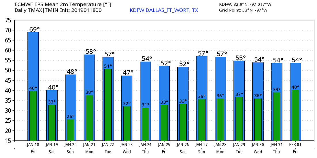 |
Archives
March 2023
Categories |
 RSS Feed
