
|
Radar Check - A few storms are still in progress this morning for areas to the east of DFW... 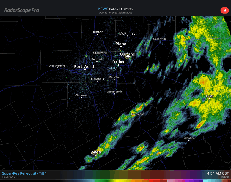 Once the activity tapers off this morning, the rest of the region should dry out and we should reach the mid 60s this afternoon with a mix of sun and clouds. Happy Meteorological Spring - March 1st marks the beginning of Meteorological Spring here in the US. This is different than the regular astrological spring season, which typically begins later in the month. We are starting to warm up, as average temperature climb to 69 this month, 77 in April, and 84 in May. We will start to see more rain, despite this February being the wettest February on record for DFW. With the beginning of Meteorological Spring, that usually marks the beginning of the spring tornado season. On average, Texas usually sees about 11 tornadoes this month. That number quickly jumps to 28 in April, and 44 in May. The tornado season in Texas usually peaks at around mid April to late May, before things get quiet again in June. So expect to see an increase in severe weather going forward. Make sure that you visit the Severe Weather Preparedness tab on the website for more details to keep you and your family safe from the storms. Friday and the Weekend - Not much change. We will continue to remain dry with highs in the mid 60s with a mix of sun and clouds. We will continue to forecast cool nights and pleasant days ahead. Sunday will be mostly cloudy with a chance for a few showers during the afternoon and evening hours. Highs should be in the low 70s. Next Week - Next week will be a mostly rain-free week with highs in the low to mid 60s with lots of sunshine. Once again, we will continue to forecast cool nights and pleasant days ahead. No signs of any major severe weather issues, or any brutally cold snaps at this time. See the Texas Weather Discussion Video for more details. 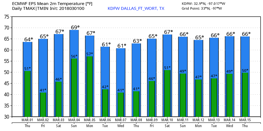 |
Archives
March 2023
Categories |
 RSS Feed
